The only ticket you need for this day costs €20, and it buys you an hour with 700-year-old mosaics. Everything else is free or close to it: the greatest mosque Sinan built in Istanbul, a working patriarchate, an iron church shipped down the Danube, and a commuter ferry along the Golden Horn charged on the same card as the tram.
The route runs from Süleymaniye on the Third Hill, down to the water, west along the shore through Fener and Balat, and up to the Chora (Kariye) by the old land walls. It is about 6–7 km if you walk all of it, less if you let the T5 tram or the Haliç ferry take a stretch. Start early, avoid Friday, and wear shoes you can take off ten times.
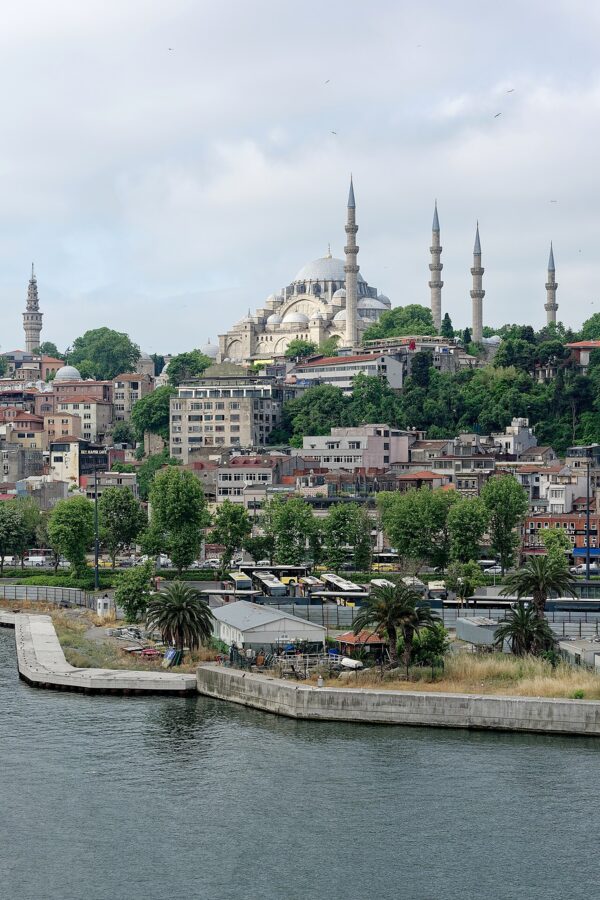

The two great buildings at either end belong to two different empires, built about 230 years apart, and the shore between them is where Istanbul kept the people it did not put on postcards: Greek bankers, Jewish refugees from Spain, Bulgarian clergy, boatmen and factory hands. You read the city’s story in about six hours, at walking pace.



Contents
The day at a glance
The walk in order, with what each stop costs, assuming a 09:00 start on any weekday but Friday:
| Stop | Time to allow | Cost (late 2026) | Note |
|---|---|---|---|
| Süleymaniye Mosque, tombs and terrace | 1.5–2 hours | Free | Closed to sightseeing around each prayer |
| Walk or T5 tram to Fener | 15 minutes by tram, 40 on foot | 46.20 TL on the Istanbulkart | Tram from Küçükpazar, Cibali or Eminönü |
| Ecumenical Patriarchate, Fener | 30 minutes | Free | Security check at the gate |
| Bulgarian St. Stephen Church | 20 minutes | No ticket | On the shore road between Fener and Balat |
| Balat streets and lunch | 1.5 hours | Lunch from a few hundred lira | Quietest before 11:00 |
| Chora (Kariye Mosque) | 1–1.5 hours | €20 for foreign visitors | Closed to tourists on Fridays |
| Land walls and Tekfur Sarayı | 30–45 minutes | Free outside | Five minutes’ walk from the Chora |
| Ferry or tram back | 20–60 minutes | 46.20–76.90 TL | Ferry from Balat or Ayvansaray; T4 from Edirnekapı |
You can run it in reverse: the Chora opens at 09:00, the Süleymaniye terrace is best in late afternoon light, and the walk down from Kariye to Balat is kinder than the walk up. I’d still start at Süleymaniye, because a mosque at 09:00 on a weekday is nearly empty, and you get it the way Sinan’s patron never did: with no crowd and no court.
Süleymaniye Mosque
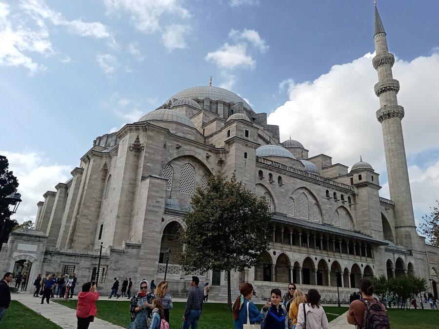

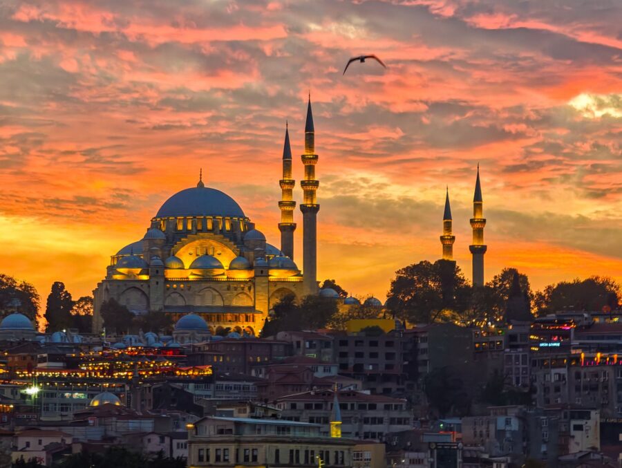
Süleymaniye is the largest Ottoman mosque in Istanbul and the one that gives the old city its skyline from the water. Süleyman I, whom Europe called the Magnificent and his own people the Lawgiver (Kanuni), ordered it at the height of his reign. His chief architect, Mimar Sinan, began it in 1550 and opened it in 1557; the Turkish ministry’s own pages give 1551–1558, so expect both dates on signs.
Entry is free, there is no ticket desk and nobody will try to sell you anything at the main gate. That alone makes it the best-value great building in the city.
Sinan, Süleyman and the hill
Sinan came into the sultan’s service as a conscripted Christian boy from Anatolia, trained as a military engineer and became chief architect in 1538. He is credited with hundreds of buildings, but he called Süleymaniye his journeyman’s work. His masterpiece, in his own telling, was the Selimiye in Edirne, finished when he was in his eighties.
The site was a decision in itself. Earlier imperial mosques sat on a main road, beside a barracks or in a residential district; this one went on the crest of the Third Hill, partly on the grounds of the Old Palace, where it could be seen from Galata, the Bosphorus and every ship entering the harbor. The mosque was meant to be looked at from outside the city as much as prayed in from within it.
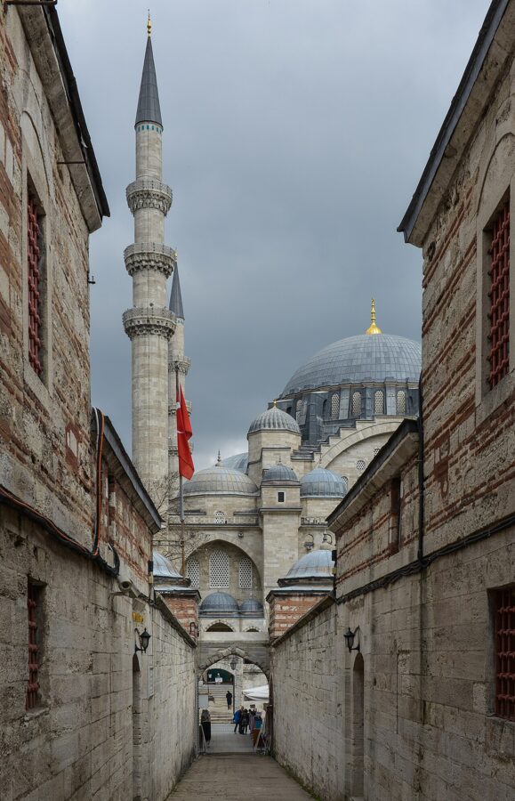

Sinan’s memoirs, dictated late in life to his friend the poet Sai Çelebi, tell the best story about the building. When the dome was closed, rivals told the sultan that Sinan had left the scaffolding up to hide cracks and had lost his mind. Süleyman stormed into the workshop and demanded a date; Sinan, shaking, said two months. Two months later Süleyman handed him the key at the opening and asked him to open the doors with a prayer.
The account books for the last five and a half years of the work survive almost complete. The historian Ömer Lütfi Barkan counted more than 2.6 million workdays in them, and 3,523 named craftsmen, about half with Christian names and half with Muslim ones. Most of the labor was paid; about two-fifths came from conscripted boys, and a small share from the sultan’s galley slaves.
How the külliye worked
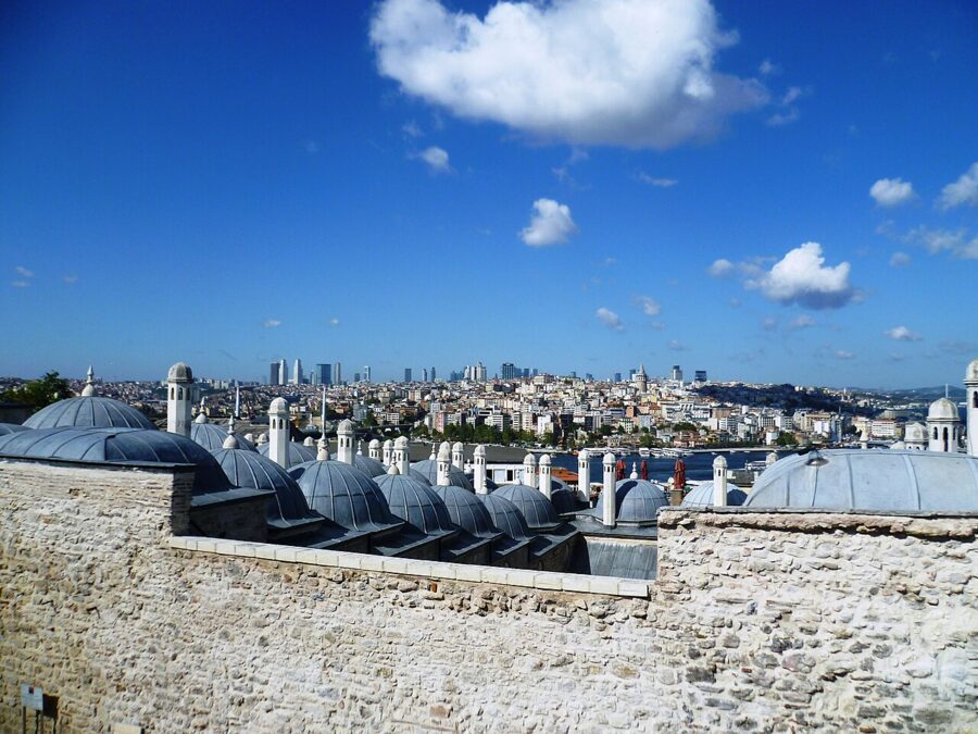

The mosque was only the center of the complex the Ottomans called an imaret and historians now call a külliye. Around its walled garden Sinan set four colleges of law and theology, a college for the study of the Prophet’s sayings that ranked above every other school in the empire, a medical school, a hospital, a primary school, a guesthouse for travelers, a kitchen that fed students, guests and the poor, and a bath. Shops ran along the street under the colleges.
It was a single endowment (vakıf), and its foundation deed spelled out who was paid to do what, down to the two men employed to recite the Quran at the tombs. The bath and the shops earned rent; villages, farms, mills and ports elsewhere in the empire paid for the rest. The free soup and the free hospital were the point of the whole thing.
Walk around the outside before you go in. The streets around the garden meet at right angles, the way Sinan laid them out, and the old kitchen, hospital and colleges still line them, most now used as libraries, schools and offices. The two colleges on the west side became the Süleymaniye Library, a research library for manuscripts, so treat it as a building to look at from the lane rather than a sight to tour.
Inside the prayer hall
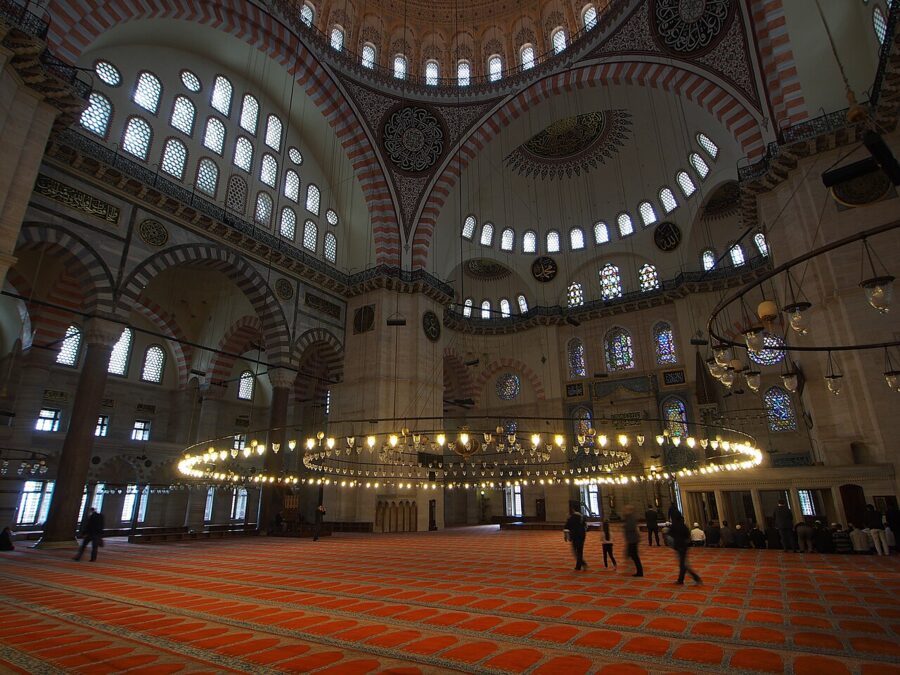

The plan answers Hagia Sophia: a central dome flanked by half domes on the entrance and prayer axis, with the side bays tucked under arcades. Sinan’s version is lighter and less mysterious. The dome rises 53 m from the floor and is about 27 m across (sources give between 26.5 and 27.25 m), and the hall is lit by more than 200 windows.
Four granite columns, each about 9 m tall, carry the arches on either side. Sinan’s memoirs and other sources of the time say where they came from: one from Alexandria, one from Baalbek in Lebanon, one from Kıztaşı in Istanbul and one from the grounds of Topkapı Palace. Sinan compared them to the four caliphs who followed the Prophet.
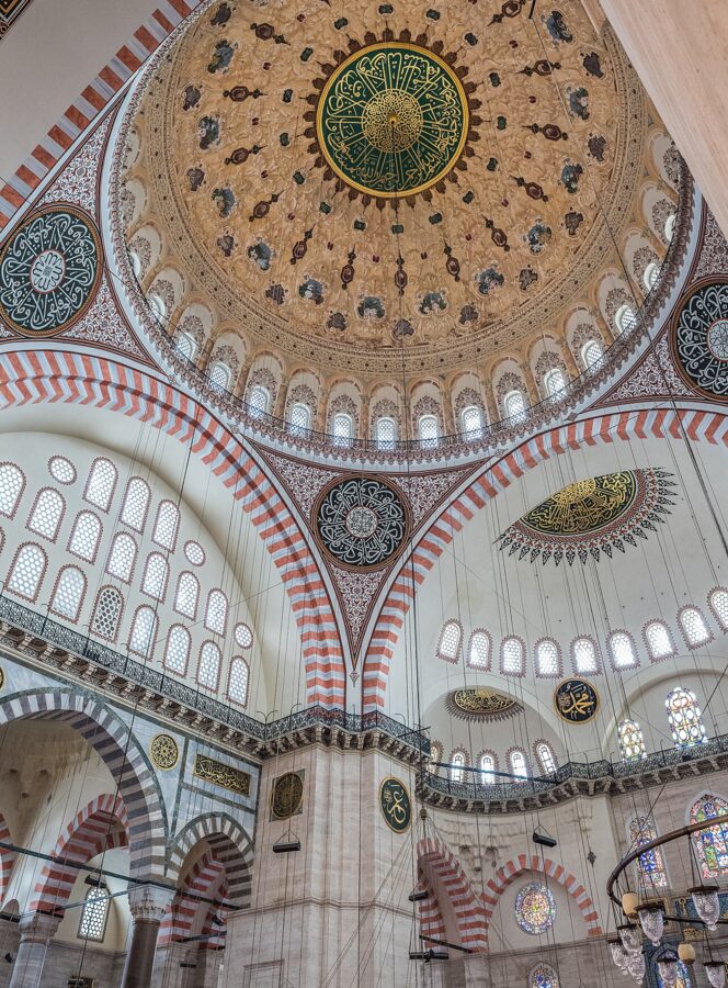
Look for the few places Sinan did allow color. The stained glass around the prayer niche (mihrab) was made by a glazier the 17th-century traveler Evliya Çelebi called İbrahim the Drunk. Inside the hall, Iznik tiles appear only around the mihrab and on some windows. The foundation deed explains the restraint: if decoration were a requirement of faith, it says, the walls could have been covered in rubies and pearls.
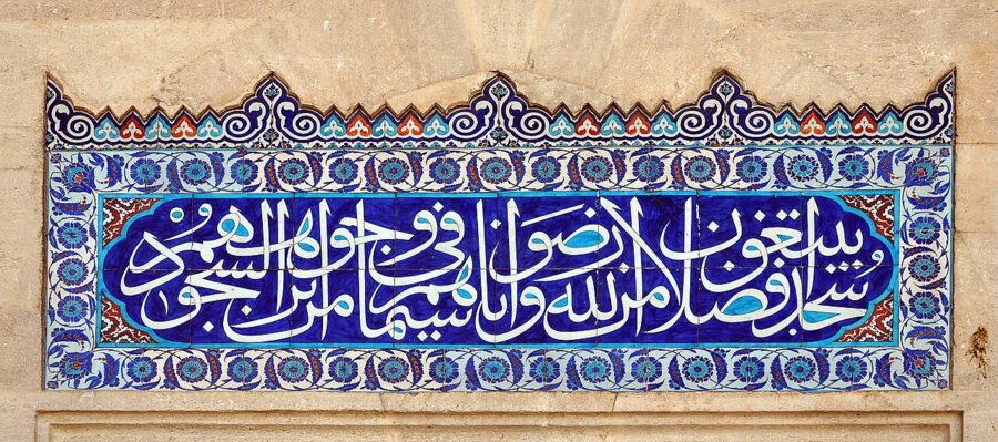

The courtyard in front has a marble floor, a fountain and 28 domed arcades on columns, some of them probably taken from the ruins around the old Hippodrome. The verses over the side gates invite the faithful into paradise, and that is how the courtyard was meant to be read: as a garden before the house of prayer.
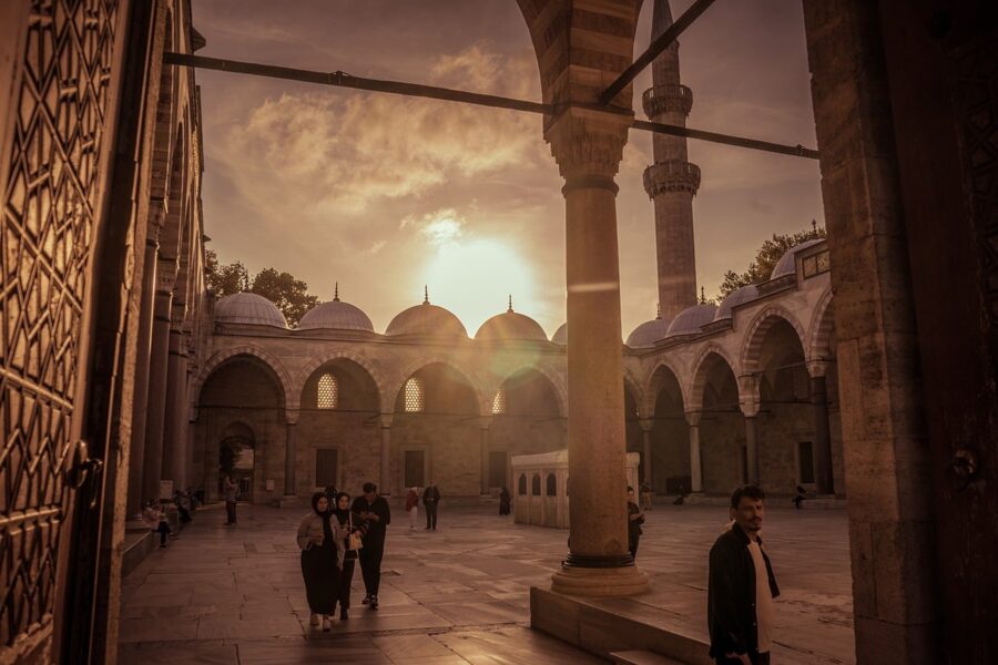
Four minarets stand at the corners of the courtyard, with ten balconies between them. The usual explanation, repeated on the Turkish ministry’s site, is that Süleyman was the fourth sultan since the conquest of Istanbul and the tenth of his dynasty. It may be a story told after the fact, but it is a good one.
The tombs of Süleyman and Hürrem
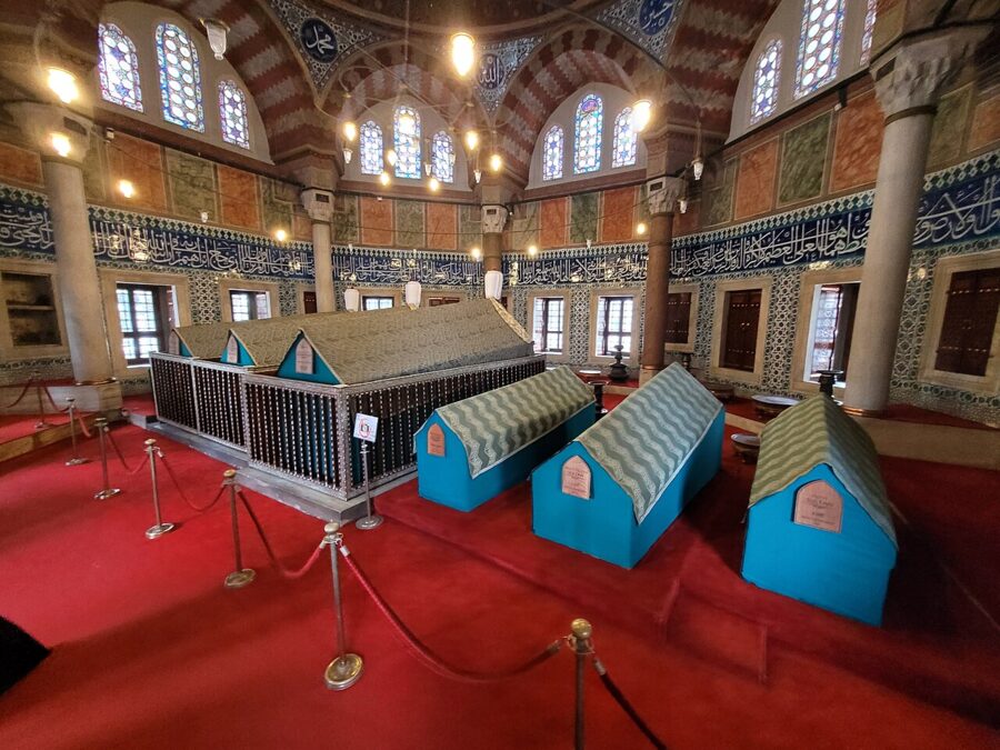

Behind the prayer niche, in the walled cemetery, stand two domed tombs. Süleyman’s is the large octagon with a portico around it, built after his death on campaign in Hungary in 1566. The historian Gülru Necipoğlu, whose book The Age of Sinan is the standard work on the architect, reads it as a deliberate echo of the Dome of the Rock in Jerusalem, built for a sultan who liked being called the Solomon of his age.
The smaller tomb belongs to Hürrem Sultan, the woman Europe called Roxelana: captured as a girl, taken into the palace and freed and married by Süleyman, against every custom of the dynasty. She died in 1558, a year after the mosque opened, and was buried first. Her tomb’s walls are covered in Iznik tiles of flowers and trees, the brightest room in the whole complex.
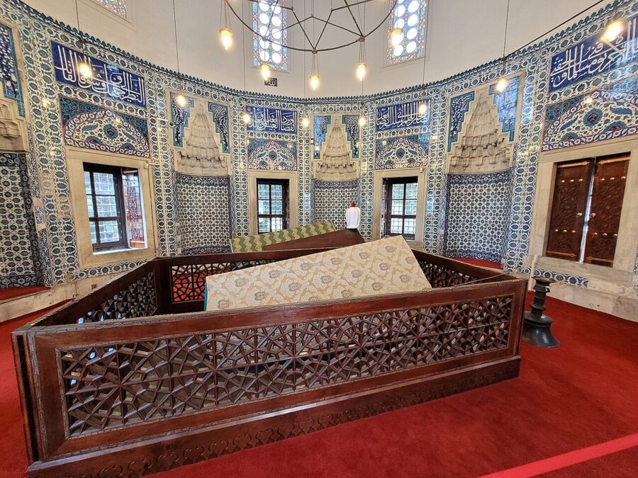

Neither tomb sells tickets, though you may find a donation box. Take your shoes off at the door, keep your voice down and do not photograph people who are praying at the cenotaphs, which some do.
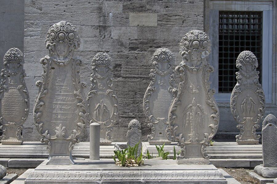

The terrace view and Sinan’s own tomb
From the garden on the north side, the low wall looks over the college domes to the Golden Horn, Galata and the Bosphorus. Evliya Çelebi said you could see the palace, Üsküdar, Beşiktaş, Galata and the ships setting sail from here, and you still can. It is free; Galata Tower charges foreigners €30 for a view that does not include Galata Tower.
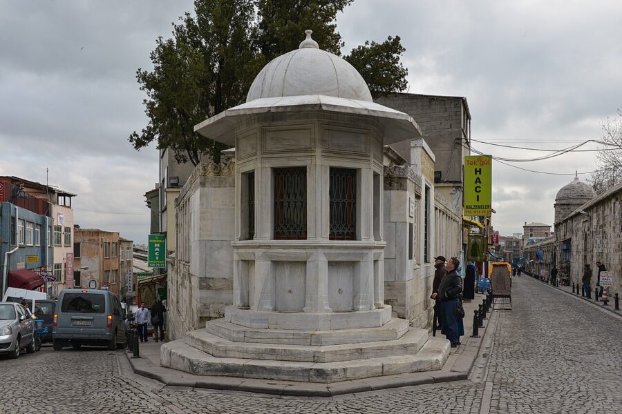

Before you head down, walk to the northern corner of the complex, where Mimar Sinan Caddesi meets Fetva Yokuşu. Sinan’s tomb is a modest open canopy with a fountain built into the wall, on the plot beside the house where he lived while he built the mosque. He died in 1588 and is buried in sight of the dome that made his name.
Visiting Süleymaniye: hours, prayers and dress
- Getting there. T1 tram to Beyazıt-Kapalıçarşı, then about 10 minutes on foot past the Istanbul University gate; or walk up from Eminönü through the market streets, about 15–20 minutes uphill.
- Hours. The mosque is open to sightseers every day outside prayer times, and no ticket or booking exists. Visits stop for about half an hour around each of the five daily prayers, and for longer at the Friday noon prayer, when the building fills.
- Friday. Avoid late morning to mid-afternoon on Fridays. Mornings before about 11:00 are fine.
- Dress. Shoulders and knees covered for everyone; women cover their hair. Carry your own scarf rather than relying on a loaner at the door.
- Shoes. Off at the door and carried with you; a light bag helps. Socks without holes help your dignity more than anything else on this list.
- Ramadan and holidays. Prayer crowds are larger and gaps between prayers shorter, especially in the evening; go in the morning.
Prayer times shift through the year with the sun. Check the day’s times on a prayer-times app or the board at the door before you plan the rest of the walk around them.
The streets around Süleymaniye
The neighborhood around the mosque is one of the few in the old city where wooden Ottoman houses still stand next to the stone colleges, some restored, some propped up and leaning. Walk the lanes on the west and north sides before you go down to the water; they are steep, quiet and lived in.
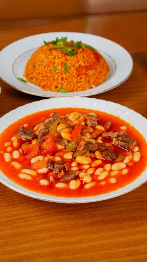
The street along the mosque’s west wall, Prof. Dr. Sıddık Sami Onar Caddesi, was once known as the Tiryakiler Çarşısı, the addicts’ market, after the coffee houses (and, by most accounts, opium sellers) that kept shop under the colleges. Today the same arcades are filled with restaurants serving kuru fasulye, white beans stewed in tomato with a little meat, eaten with buttery rice (pilav) and pickles. Several of them claim to be the original; all of them are cheap by Istanbul standards, and the lunchtime crowd of office workers and students is the best guide to which is busy that week.
West of the mosque lies Vefa, a working neighborhood of stone houses, small mosques and the old Byzantine church now known as the Vefa Kilise Mosque. Vefa is also the home of Istanbul’s boza tradition: a thick, faintly sour drink of fermented millet, served cold with cinnamon and roasted chickpeas on top, and drunk in the cold months.
From Süleymaniye, the quickest way down to the water is north through the lanes that drop to the Golden Horn shore near the Haliç Metro Bridge, about 700 m. At the bottom is the T5 tram stop at Küçükpazar.
The Golden Horn
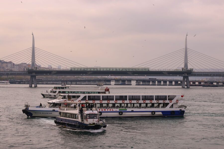
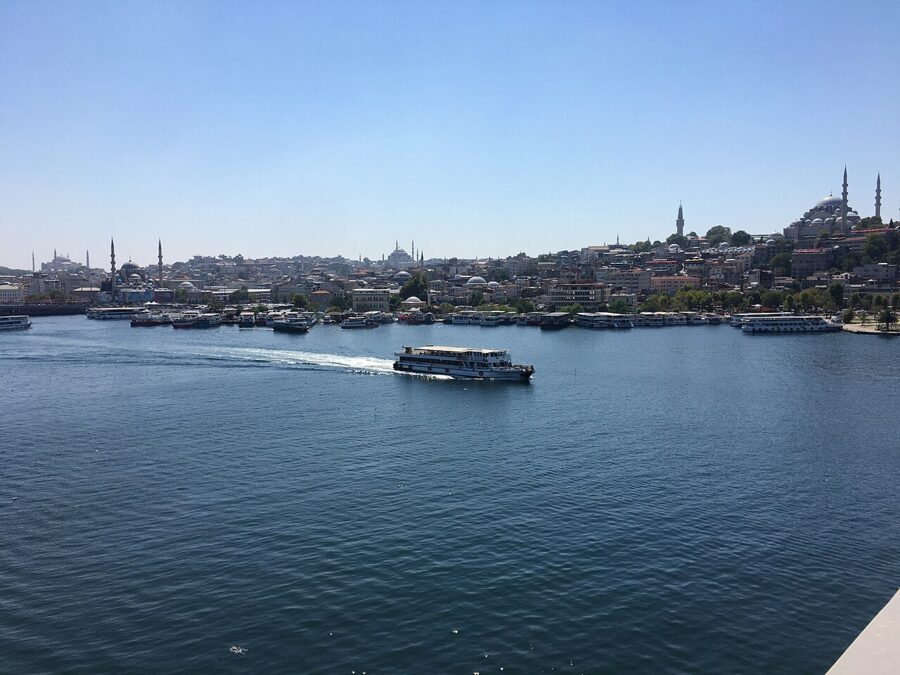
The Golden Horn is a drowned river valley, about 7.5 km long and at most 750 m wide, where two streams run into the Bosphorus. The Greeks called it Chrysokeras, the Golden Horn; the Turkish name, Haliç, simply means estuary. Nobody agrees on the gold: the harbor’s wealth and the color of the water at sunset are the usual guesses.
For a thousand years it was the city’s harbor and its weak point. The Byzantines stretched a chain across its mouth from the city walls to Galata. In 1204 Venetian ships broke it during the Fourth Crusade, and in 1453 Mehmed II went round it, hauling his ships overland on greased logs behind Galata and launching them into the Horn behind the defenders’ backs.
The Ottomans built their imperial shipyard on the north shore at Kasımpaşa in the 15th century, and ships were still being built along that shore in the 20th. By the 1970s the shores were lined with factories, warehouses and slaughterhouses, and the water was famous for its smell. The cleanup began under mayor Bedrettin Dalan in the 1980s, when much of the shoreline industry was cleared and replaced by the parks and roads you walk along now, and continued in the 1990s. The water is cleaner, the fishermen are back, and the shore road is pleasant on foot.
The Haliç ferry
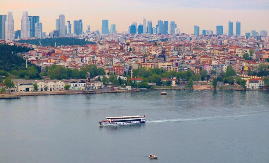
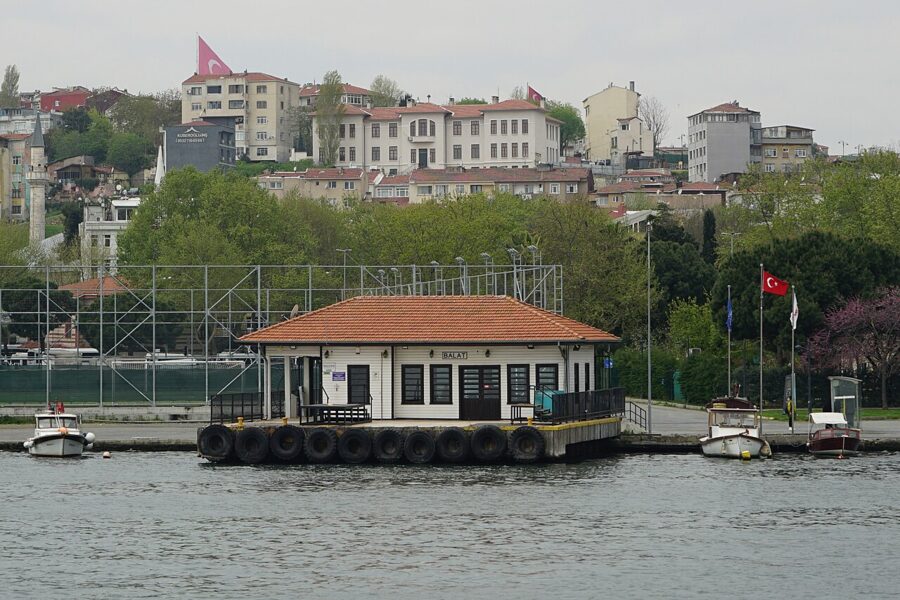
Şehir Hatları, the city ferry company, runs the Haliç line from Üsküdar across the Bosphorus to Karaköy, then up the Horn via Kasımpaşa, Fener, Balat, Hasköy, Ayvansaray and Sütlüce to Eyüpsultan. The whole run takes about 55 minutes. It is a commuter boat, not a cruise, and it is the cheapest way to see the Golden Horn from the water.

On the winter 2026–27 timetable, which runs from 7 September 2026 to 27 June 2027, the boats were roughly hourly in each direction:
| Direction | Weekdays and Saturdays | Sundays and holidays | Journey |
|---|---|---|---|
| Karaköy to Fener and Balat | Leaves Karaköy at :45 past the hour from 07:45 to 15:45, then 16:55, 17:55, 18:55, 20:00 | From 10:45, with an extra evening boat | 15 minutes to Fener, 20 to Balat |
| Balat to Karaköy and Üsküdar | Leaves Balat at :50 past the hour from 07:50 to 15:50, then 17:00, 18:00, 19:00, 20:05 | From 10:50, last boat 21:05 | 20 minutes to Karaköy, 35 to Üsküdar |
You pay by tapping the Istanbulkart at the pier gate. The listing for the line gave a full fare of 76.90 TL in autumn 2026, against 46.20 TL for a tram ride, so the ferry is the one leg of the day that costs more than the tram. The timetable changes twice a year and the boats stop in strong southwesterly winds, so check the board at the pier.
The T5 tram along the shore
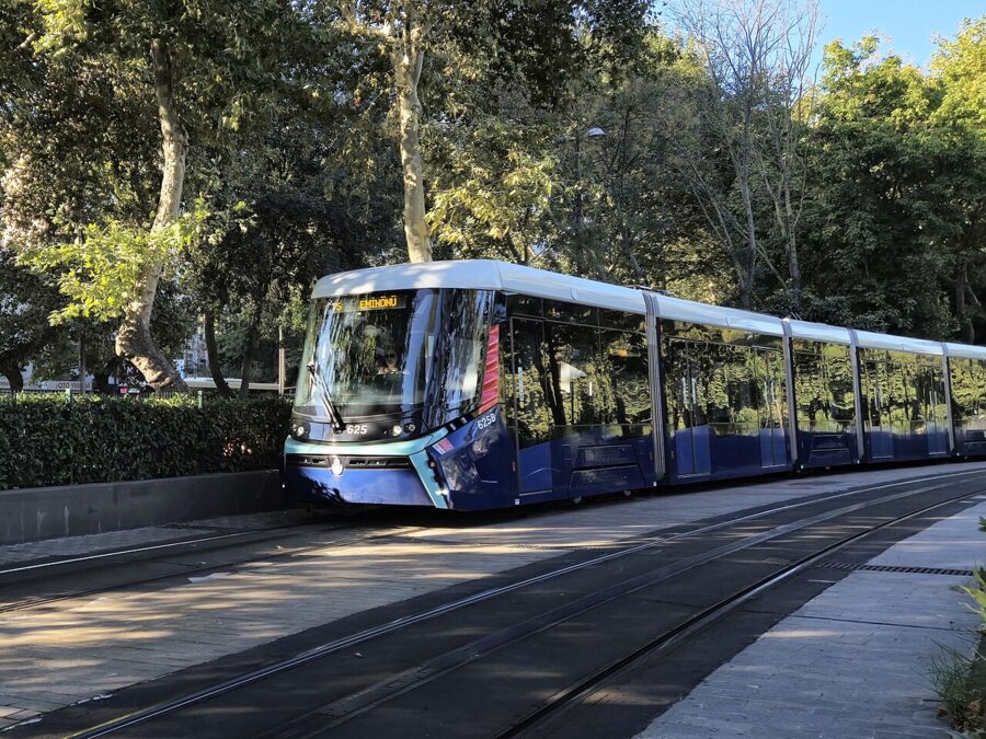

The T5 tram runs along the southern shore of the Golden Horn from Eminönü through Küçükpazar, Cibali, Fener, Balat and Ayvansaray, then on to Eyüpsultan and Alibeyköy. The first section opened in 2021 and it reached Eminönü in August 2023. It costs a standard ride on the Istanbulkart, 46.20 TL on the tariff in force since 20 July 2026, and it is the fastest way to skip the 2 km of shore road between Küçükpazar and Fener if your feet need the rest.
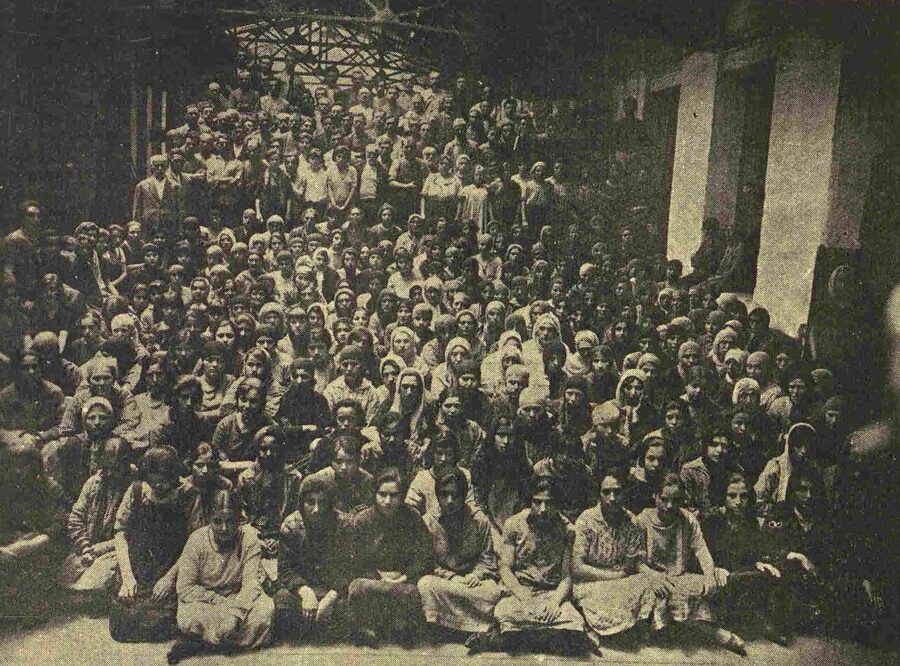
On foot, the shore path from the Haliç Metro Bridge to Fener is flat and mostly through parks. Past Cibali you go by the old tobacco factory of 1884, now part of Kadir Has University, which was one of the city’s big employers of women.
Fener: the Patriarchate and the Red School
Fener (Phanar in Greek) was the Greek Orthodox quarter of Ottoman Istanbul. The wealthy Greek families who lived here, the Phanariots, served the sultans as interpreters, diplomats and governors of the Danube principalities, and their houses climbed the hill behind the Patriarchate. Most of the Greek community left in the 20th century; a few thousand remain in the whole city.
The Ecumenical Patriarchate
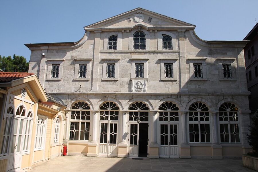

The Ecumenical Patriarchate of Constantinople, the senior see of Orthodox Christianity, has had its seat here since about 1600, when it moved into the former convent of St. George. The church was rebuilt several times after fires, most recently after a fire in 1941, with restoration finished in 1991. Inside are the patriarchal throne, mosaic icons and relics of Saints Gregory the Theologian and John Chrysostom, some of them returned from Rome by Pope John Paul II in 2004.
The main gate of the compound has stayed shut since 1821, when Sultan Mahmud II had Patriarch Gregory V hanged from its lintel at the start of the Greek War of Independence. Visitors use the side entrance. The church is open to the public daily, about 08:00–16:30, with a security check at the gate; dress as you would for a mosque, and keep quiet during services, which are frequent on feast days.
St. Mary of the Mongols
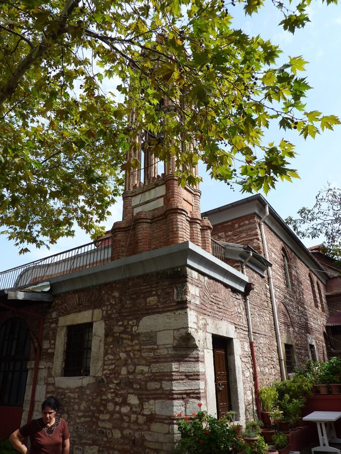

A short, steep climb above the Patriarchate, on Tevkii Cafer Mektebi Sokak, is the small church of St. Mary of the Mongols. Maria Palaiologina, a daughter of Emperor Michael VIII who had been married off to the Mongol Ilkhan Abaqa, rebuilt it around 1281 after she returned home a widow. Turks call it Kanlı Kilise, the Bloody Church, after the fighting around it on the day the city fell in 1453.
It is usually described as the only Byzantine church in the city never turned into a mosque, kept in Greek hands by decrees of Mehmed II and Bayezid II. Opening is irregular. Ring the bell at the gate; if nobody answers, the wall and the view are still worth the climb.
The Phanar Greek Orthodox College
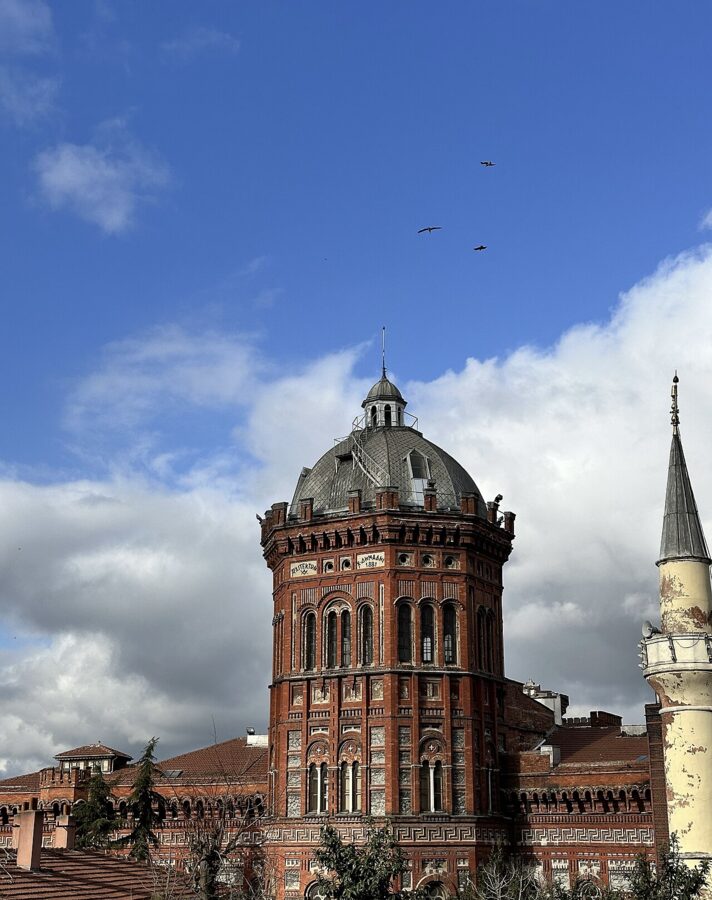
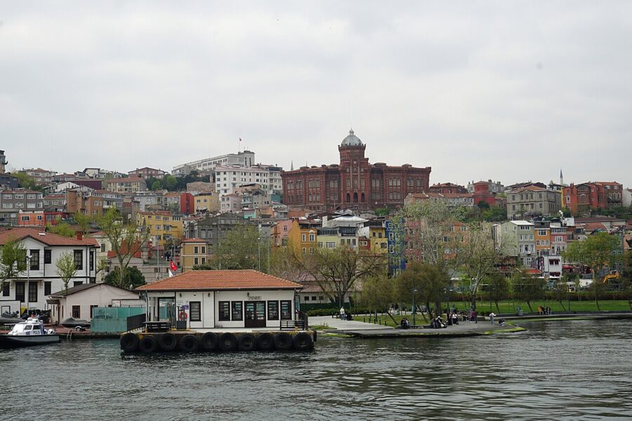
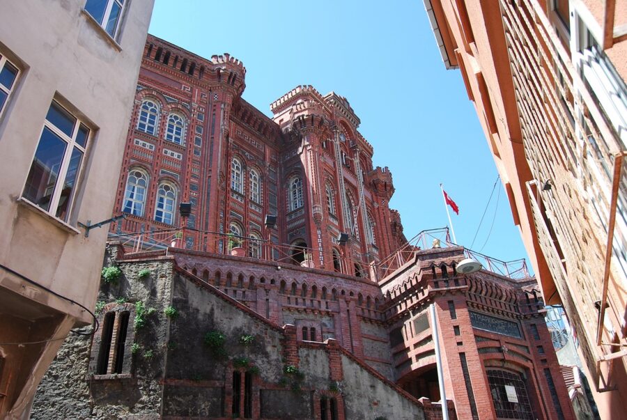
The red-brick castle on the ridge is a school, the Phanar Greek Orthodox College, known locally as the Red School or the Red Castle. Its roots go back to the 15th century, when the first patriarch after the conquest, Gennadios Scholarios, reorganized it; the present building went up in 1881–1883 to designs by the architect Konstantinos Dimadis, paid for by the banker Georgios Zarifis. In October 2025 the education ministry ordered it emptied within 90 days over earthquake-safety rules, and the cost of strengthening it was put at more than €10 million, so do not count on seeing students on the steps.
The Bulgarian St. Stephen Church
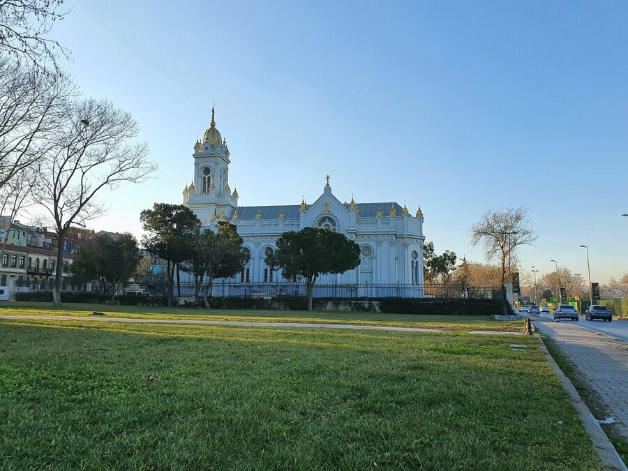

On the shore road between Fener and Balat, in a garden by the water, stands the strangest church in the city. The Bulgarian St. Stephen Church is made of prefabricated cast iron: about 500 tonnes of parts cast in Vienna by the firm of R. Ph. Waagner in 1893–1896, shipped down the Danube and across the Black Sea, and assembled on a design by the Istanbul Armenian architect Hovsep Aznavur. It was consecrated in September 1898.
The site matters more than the metal. In 1870 Sultan Abdülaziz recognized a separate Bulgarian church, the Exarchate, free of the Greek Patriarchate up the road; the decree was first read out in the wooden church that stood here before. A seven-year restoration funded by Turkey and Bulgaria ended in January 2018.
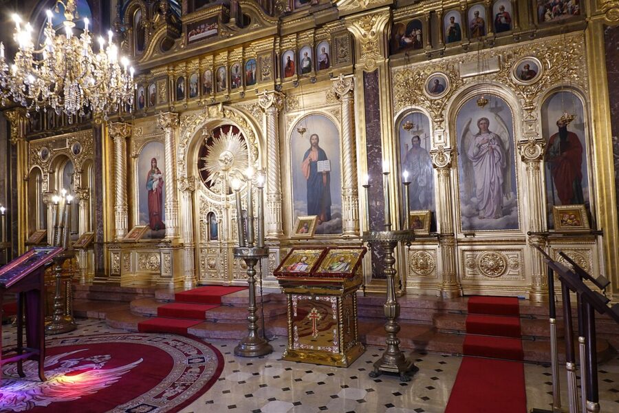

The church is a working parish. When the gate is open you can go in; cover your shoulders, keep your voice down and do not photograph during a service.
Balat
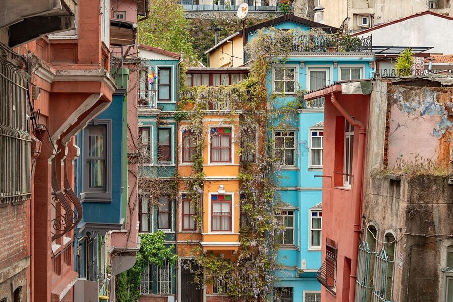

Balat begins where Fener ends, around the iron church, and runs west to the end of the old sea walls at Ayvansaray. Its name probably comes from the Greek palation, after the Byzantine palace of Blachernae on the hill above. From the late 15th century it was the main Jewish quarter of the city, settled by refugees from Spain and Portugal whom Bayezid II took in after 1492; at its peak it had 18 synagogues.
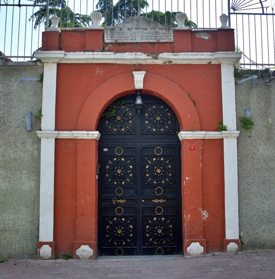
Three remain in use. The Ahrida Synagogue, founded in the 15th century by Jews from Ohrid in present-day North Macedonia, is the oldest; it was here in 1666 that the messianic claimant Sabbatai Zevi preached to his followers. Istanbul’s synagogues admit visitors by prior arrangement rather than on a walk-in basis, so treat Ahrida’s gate as the view, and keep your camera off any security staff.

Through the 20th century the Jewish, Greek and Armenian families moved out, to newer districts or abroad, and migrants from the Black Sea coast and eastern Anatolia moved in. The old houses decayed. Restoration programs from the late 1990s onward, the largest of them funded by the European Union, rebuilt some streets and set off arguments about who the renovated houses were for.
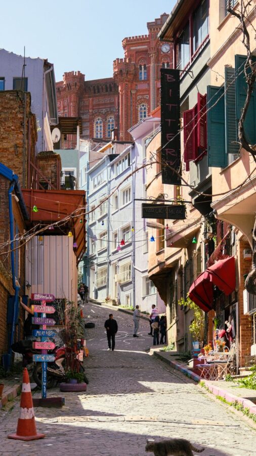
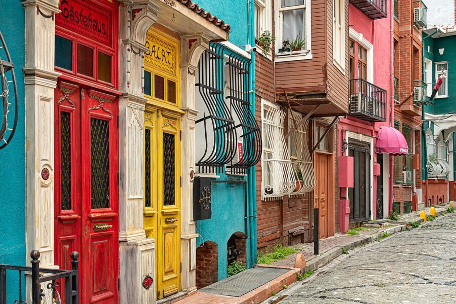
In the 2020s Balat became one of the most photographed neighborhoods in Istanbul. Ground floors have turned into cafes, antique shops and guesthouses, and the color you see on social media is partly paint applied for the camera. Behind it the neighborhood is still poor and still residential, with laundry over the street and children playing on the steps.
Seeing Balat without being a nuisance
- Photograph the street, not the people. Ask before taking anyone’s picture, and take no for an answer.
- Do not sit on doorsteps or climb house steps for a photo, and do not block doorways or the narrow lanes with a tripod.
- Dress for a conservative neighborhood. Shorts and vests draw looks here that they would not in Kadıköy.
- Buy something. A tea, a simit or lunch in a small local place puts money in the neighborhood rather than into the backdrop.
Eating in Fener and Balat
The shore road and the lanes behind it have simit sellers, tea houses and small lokantas with trays of stews and vegetables in olive oil, plus a growing number of brunch cafes aimed at the photo crowd. The lokantas charge old-city prices; the decorated cafes on the most photographed corners charge more for less. I would eat where the plates sit on a steam table and the customers are local.
Lira prices moved fast through 2026, so treat any figure you read as a rough guide and look for the price list on the wall, which lokantas are required to display. If a cafe menu has no prices, ask before you order.

The Chora (Kariye Mosque)
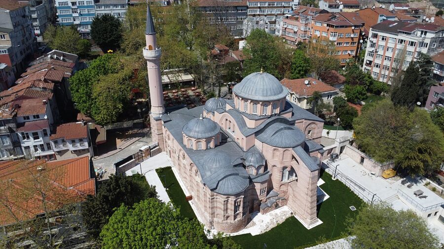
From Balat, walk uphill to the southwest, about 1.2 km and 20 minutes through residential lanes, to the Kariye Mosque, the former Church of the Holy Saviour in Chora. It holds the finest surviving cycle of late Byzantine mosaics and frescoes anywhere. It was a museum for most of the 20th century; since 2020 it has been a mosque again, and since August 2024 foreign visitors pay to see it.
A church outside the walls
Chora means something like “in the country”: the first monastery here stood outside Constantine’s city walls, before the Theodosian walls of the 5th century took it inside. The name stuck, and the mosaic makers played with it. Over the door Christ is labeled “the land (chora) of the living”, and the Virgin “the dwelling place (chora) of the uncontainable”.
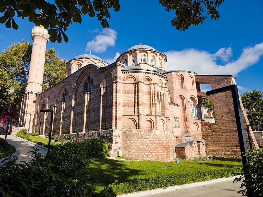
The building you see is mostly the work of one man. Theodore Metochites was the chief minister of Emperor Andronikos II, a scholar, astronomer and poet, and one of the richest men in the empire. Between about 1315 and 1321 he rebuilt the monastery church (some sources give 1310–1317 for the decoration), adding the outer porch, the funerary chapel and the mosaics and frescoes that cover them.
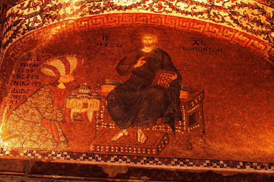

It did not end well for him. When Andronikos II was overthrown by his grandson in 1328, Metochites lost his office and his fortune and was exiled. He was allowed back to end his days as a monk in his own monastery and died there in 1332. He is the man in the enormous hat in the dedication mosaic.
After the conquest the church stayed in Christian use for about half a century. Around 1511 Atik Ali Pasha, grand vizier to Bayezid II, converted it to a mosque. Islam does not allow figural images in a place of prayer, so the mosaics were plastered or covered over, and a minaret replaced the bell tower.
From mosque to museum and back
In 1945 the Turkish government designated the building a museum. From 1948 to 1958 a team from the Byzantine Institute of America and Dumbarton Oaks, led by Thomas Whittemore and then Paul Underwood, took the plaster off and conserved what lay under it. The Kariye Museum opened in 1958 and became one of the most visited sites in the city. Much of what is known about the building’s construction comes from that work and from later study by architectural historians, above all Robert Ousterhout.
In 2019 Turkey’s highest administrative court annulled the 1945 decision, and on 21 August 2020 a presidential decree handed the building to the Directorate of Religious Affairs as a mosque. It then closed for restoration for nearly four years and reopened for worship on 6 May 2024. The mosaics are still there, and most of them can be seen.
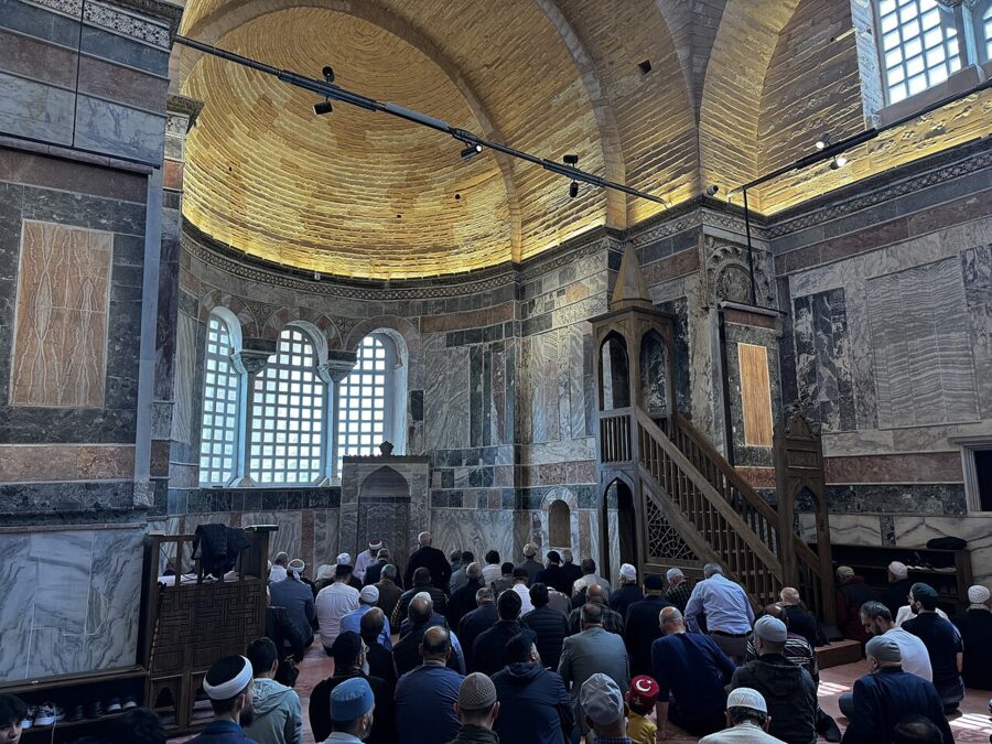

What you can see now
The building has four parts: the outer narthex (porch), the inner narthex, the main hall (naos) and the side chapel (parekklesion). The visitor route takes in all of them, but the main hall is now a prayer space, and its few figural mosaics may be curtained while it is in use.
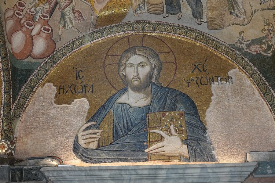

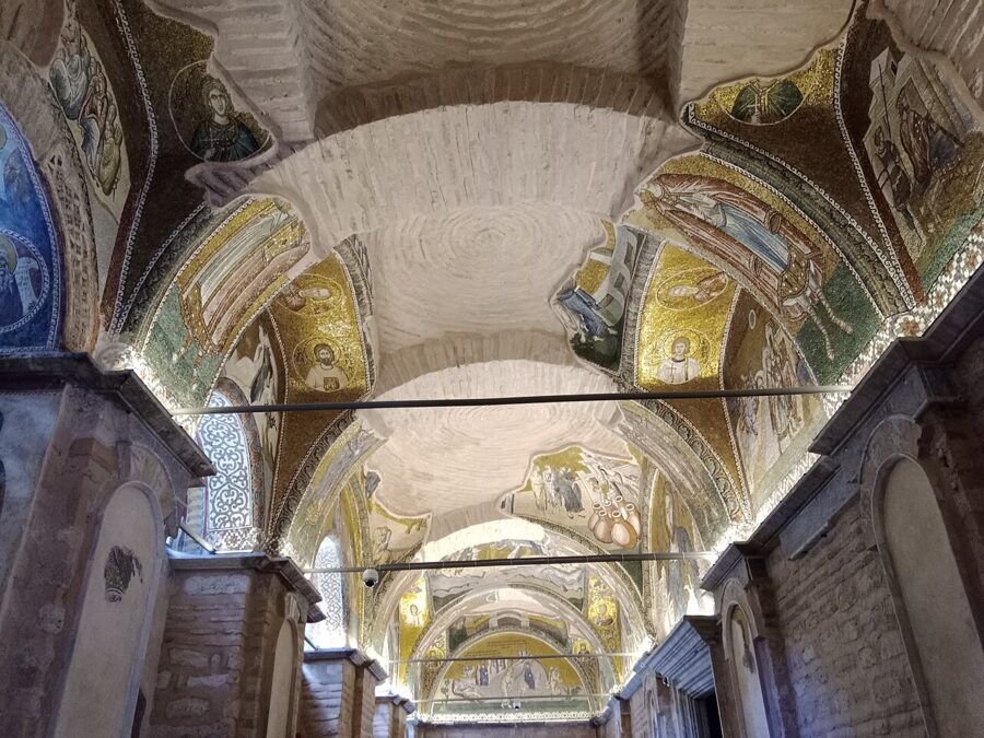
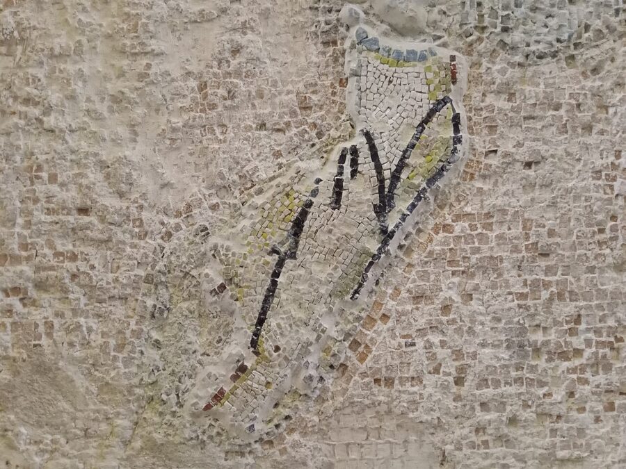
The outer narthex has the infancy and ministry of Christ: the journey to Bethlehem, the Nativity, the Massacre of the Innocents, the Wedding at Cana and the healings, running across the vaults. Many panels are damaged, which makes the surviving faces more striking.
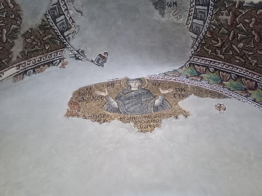

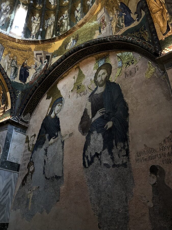
The inner narthex tells the life of the Virgin from the apocryphal Gospel of James: the Annunciation to her mother Anna, her first steps, her presentation in the Temple and her being fed by an angel. Its two domes hold the genealogy of Christ. On the east wall is the huge Deesis, Christ and his mother, with the small kneeling figures of a Komnenian prince, Isaac, and a nun called Melane at their feet.

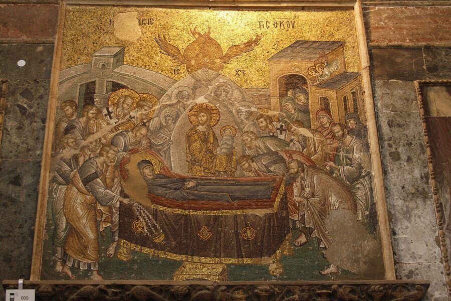
The main hall holds the Dormition of the Virgin over the entrance door, with the young Christ holding his mother’s soul as a swaddled child, and panels of Christ and the Virgin on either side of the old sanctuary. This is where the mosque’s mihrab and carpets are, and where you are most likely to find curtains.

The parekklesion
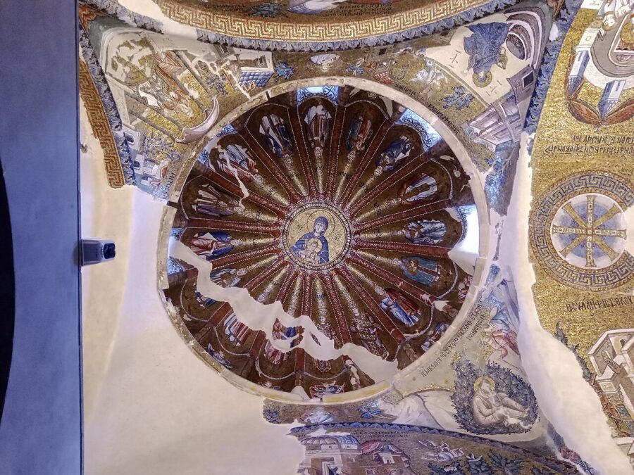

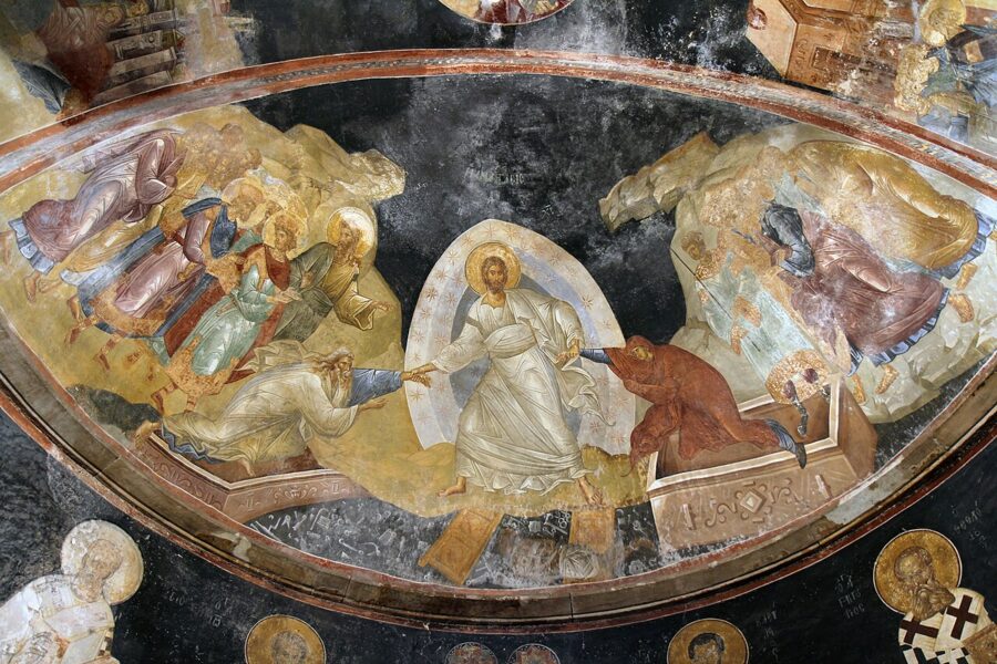
The side chapel is painted, not mosaic, and it may be the best room in Istanbul. It was a funerary chapel, and its theme is death and what comes after it. The vault holds the Last Judgment, with the scroll of heaven rolled up by an angel; the dome has the Virgin and Child with a ring of angels; the walls carry Old Testament scenes read as prophecies of the Virgin.

In the apse is the Anastasis, the Resurrection in the Byzantine form: Christ in white, standing on the broken gates of hell, pulling Adam and Eve out of their tombs by the wrists. It is one of the great paintings of the Middle Ages, and the reason to pay the €20.

Tickets, hours and the Friday rule
- Price. €20 for foreign visitors, paid at the booth at the entrance, from 19 August 2024 under a decision of the Directorate General of Foundations (Vakıflar). Turkish citizens and those entering to pray do not pay. The Museum Pass is not valid. Check the board: euro prices at state-run sites are usually revised each January.
- Extras. At the 2024 launch the booth also sold headphones for €5, a body covering for €3 and a headscarf for €1.50. Bring your own scarf and long trousers or skirt.
- Days and hours. Open to visitors six days a week, 09:00–18:00 according to the 2024 announcement. Fridays are for worship only.
- Prayers. Tourist visits pause 15 minutes before each call to prayer and resume 15 minutes after the prayer.
- Time. An hour is enough for most people; two if you want to read every panel.
Go early or late, when the tour groups are elsewhere; the narthexes are narrow, and one group of 30 under the genealogy domes fills them.
The land walls and Tekfur Sarayı
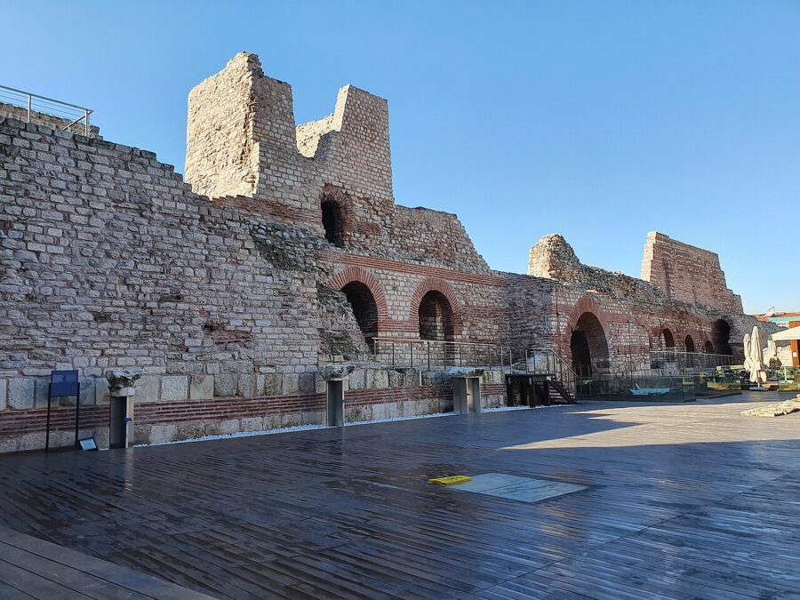

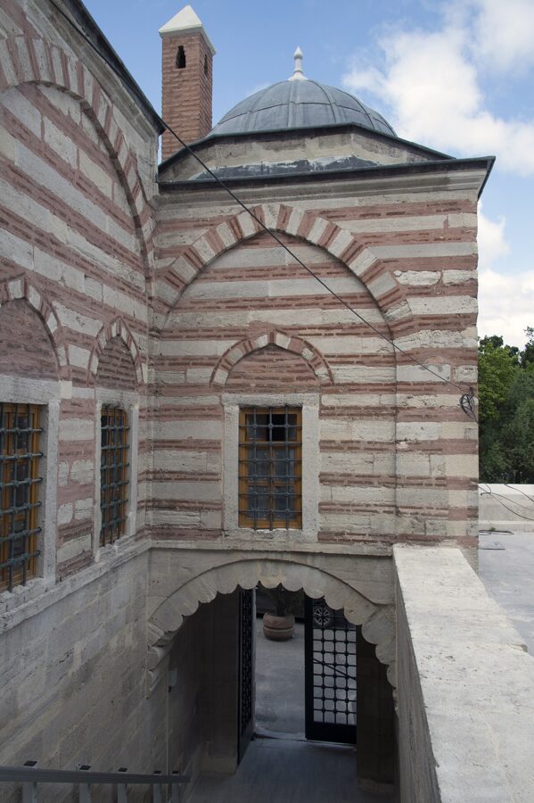
Five minutes north of the Chora, against the line of the land walls, stands the shell of the Palace of the Porphyrogenitus, which Turks call Tekfur Sarayı, the Palace of the Lord. It was part of the Blachernae palace complex, where the late Byzantine emperors lived, and probably dates from the late 13th or early 14th century. The name comes from Constantine, a son of Michael VIII “born in the purple”, meaning born to a reigning emperor.
After the conquest the building had a run of odd lives: a menagerie for the sultan’s animals, then from 1719 a workshop where potters from Iznik made tiles for about 15 years, then a glass factory. The city restored it and opened it as a museum. I could not confirm current opening hours or prices for the museum, so treat it as an outside view unless the gate is open when you arrive.
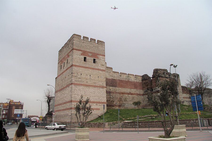

The Theodosian land walls were built in the early 5th century and held the city against every attacker for a thousand years, until the Ottoman cannon of 1453. The gate nearest the Chora is Edirnekapı, the Adrianople Gate, through which Mehmed II is traditionally said to have entered the city on 29 May 1453. Just inside it stands the Mihrimah Sultan Mosque, built by Sinan for Süleyman’s daughter, which closes the circle on the day nicely.

Walk the inside of the walls only in daylight and stay on the streets. Some stretches are overgrown and empty, and they are not the place for a sunset stroll on your own.
Walking route, food and getting back
Distances are approximate and measured along streets:
- Beyazıt tram stop to Süleymaniye Mosque: 700 m, 10 minutes.
- Süleymaniye to the Golden Horn shore at Küçükpazar: 700 m, 10–15 minutes downhill. Take the T5 tram from here to Fener, or walk on.
- Küçükpazar to Fener along the shore: about 2 km, 30–40 minutes, mostly through parks.
- Fener to the Bulgarian St. Stephen Church: 400 m, 5 minutes along the shore road.
- St. Stephen’s into Balat: 500 m, then as long as you like in the lanes.
- Balat to the Chora: about 1.2 km uphill, 20 minutes.
- Chora to Tekfur Sarayı: 500 m, 5–10 minutes.
- Tekfur Sarayı down to Ayvansaray pier and tram stop: 800 m, 10–15 minutes downhill.
That makes about 6–7 km on foot, with two serious climbs: up to Süleymaniye at the start and up from Balat to the Chora. If you take the tram from Küçükpazar to Fener, cut 2 km.
Where to eat along the way
- Breakfast: a simit and tea from a street seller near Beyazıt before you go in.
- Lunch: beans and rice on the west side of Süleymaniye if you want to eat early, or a lokanta in Balat if you want to eat at 13:00.
- Afternoon: tea in a Balat tea house before the climb to the Chora.
Getting back
You have three good ways back to the old city or the hostels around Karaköy and Galata:
- Haliç ferry from Ayvansaray or Balat. The best way to end the day: back down the Golden Horn to Karaköy in about 30 minutes from Ayvansaray, or on to Üsküdar on the Asian shore. Watch the last sailing, which was 19:55 from Ayvansaray on weekdays and Saturdays on the winter timetable.
- T5 tram from Ayvansaray or Balat to Eminönü. A standard fare on the Istanbulkart, and you can change to the T1 at Eminönü for Sultanahmet.
- T4 tram from Edirnekapı. If you finish at the Chora, the T4 runs from Edirnekapı, 10–15 minutes’ walk away, to Topkapı, where you change to the T1 for Sultanahmet; allow just under an hour.
If this is your first visit to Istanbul, give this walk its own day, not an afternoon squeezed between Topkapı and the Grand Bazaar. On a longer Turkey itinerary it is the day that shows you the city’s Greek, Jewish, Bulgarian and Ottoman layers in one line on the map, and it costs a single museum ticket.
Before you go
- Do not do it on a Friday. The Chora is closed to visitors and Süleymaniye is full at midday.
- Load the Istanbulkart with at least 200 TL before you start: one tram ride, one ferry and a margin.
- Carry euros or a card for the Chora, lira in cash for tea, simit and the bean restaurants.
The last ferry from Balat toward Karaköy leaves a little after 20:00 on weekdays. Be on the pier ten minutes early, stand at the back of the boat, and watch Süleymaniye rise out of the dark ahead of you.