The stone heads on top of Mount Nemrut have been lying on the ground for the best part of two thousand years, and they still keep a timetable. One row looks east and gets the sunrise, the other looks west and gets the sunset, and almost every decision about a budget trip here follows from which of the two you want to be sitting in front of.
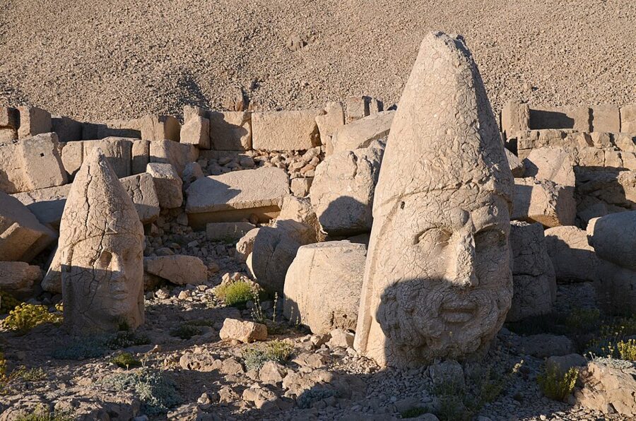

Nemrut Dağı is a 2,150 m summit in Adıyaman province, in south-eastern Turkey, with a man-made peak. Antiochus I, king of the small Hellenistic kingdom of Commagene in the first century BC, had his tomb sanctuary built here: a cone of loose stone chips piled over the summit, with terraces of colossal seated gods and kings on three sides. The bodies still sit on their thrones; the heads, each taller than you, have tumbled to the ground in front of them.
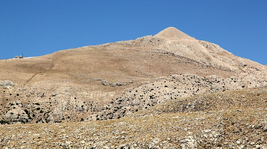

There are two bases on the southern side. Kahta is a small town 43 km from the summit with the bus station, the cheap hotels and the minibus operators; Karadut is a village about 12 km below the top with a few pensions and the shortest pre-dawn drive. On the north side, Malatya is a big city with an airport, a long drive from the summit and less useful without a car. The summit road is normally open from about April until the first heavy snow at the end of the year: in 2026 it reopened in early April, after road crews had cleared snowdrifts and a landslide near Karadut.

No public bus goes to the top. That leaves two real options: a seat in a local minibus tour from Kahta (or Karadut), which is how most independent travelers do it, or a hire car from Adıyaman or Malatya airport. I’d take the minibus for the summit itself and only rent a car if you want to linger over the Commagene sites below it or carry on to Şanlıurfa at your own pace. Şanlıurfa, with Balıklıgöl’s sacred carp and the Neolithic enclosures of Göbekli Tepe, is two to three hours south by bus and is where most people end this loop.
Contents
Minibus tour or on your own
The Kahta minibus is the budget default for a reason. The operators run sunrise and sunset trips through the season, they know the road in the dark, and the price is set per vehicle, so it drops sharply once the seats fill. A sunrise run leaves Kahta around 03:00 in summer, reaches the summit car park after an hour or more of winding climb, and comes back via the Commagene sites below the mountain by late morning. Sunset trips work the same way in reverse, leaving in the early afternoon, doing the lower sites first and coming down in the dark.
Prices are quoted for the whole minibus and the circuit you choose, and they move with fuel and with the season, so ask two or three operators in Kahta and agree the figure, the stops and the return time before you get in. Check four things: that the driver holds a tourism transport license, how many seats will be sold, whether the €10 summit ticket is included (it usually is not, and should not be used to justify a higher price), and what happens if fog or snow cancels the morning. Your guesthouse will make the call for you, which is easiest but not always cheapest.
Doing it yourself means a car. Adıyaman airport has the usual rental desks, the road via Kahta is paved all the way to the car park, and the last 12 km above Karadut are steep switchbacks with sharp hairpins. A car also lets you take the slower Arsameia road, stop at the Roman bridge when the light is right, and leave when you want. Taxis from Kahta or Karadut will do the summit and wait, at a price you agree in advance.
Some people walk up from Karadut. It is about 12 km uphill on the road, which is fine in daylight in June and miserable in the dark in October. I wouldn’t plan on hitching: before dawn the only traffic is tour minibuses that are already full.
| Base | To the summit | How you get up | Good for |
|---|---|---|---|
| Kahta | 43 km, 1–1.5 hours | Minibus tour, taxi, hire car | Cheapest beds, bus links, the Commagene circuit |
| Karadut | about 12 km, 30–40 minutes | Pension transfer, taxi, on foot | Sunrise without a 02:30 alarm |
| Adıyaman city | 87 km direct, 77 km by the Arsameia road | Hire car from the airport, or bus to Kahta first | Flights |
| Malatya (north side) | a long mountain drive through Pütürge district | Hire car or organized tour only | Flights, if you are coming from the north |
The summit: Antiochus I and his mountain
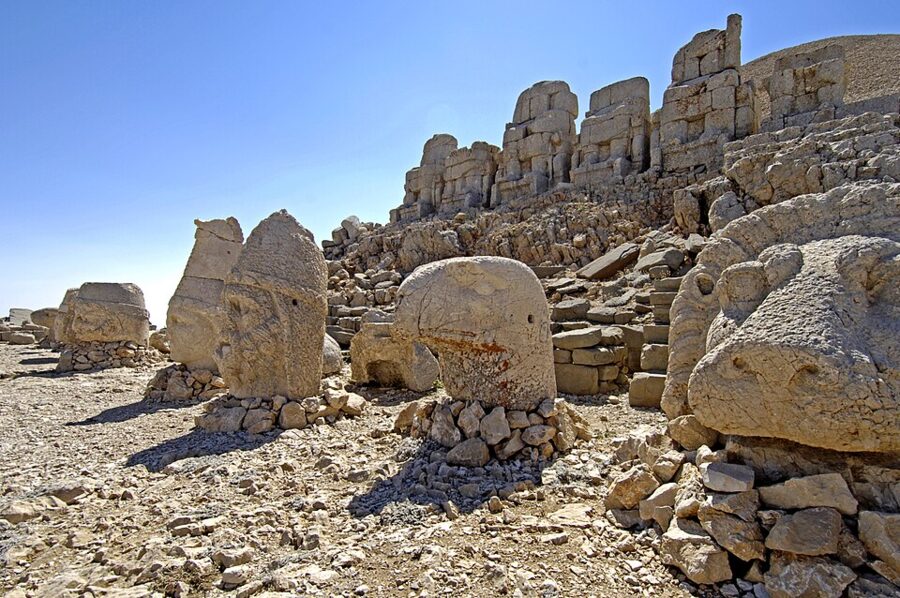

Commagene was a narrow kingdom on the upper Euphrates, squeezed between Rome and Parthia after Alexander’s empire broke up. Antiochus I, who ruled from about 69 to 34 BC (UNESCO’s dates; others give 70 to 31 BC), claimed descent from the Persian king Darius on his father’s side and from Alexander’s successors on his mother’s. He built that double ancestry into a religion of his own, and Nemrut was its showpiece.
The gods on the terraces are hybrids: Zeus merged with the Persian Oromasdes (Ahura Mazda), Herakles with Artagnes, Apollo with Mithras and Helios. Next to them sits Antiochus himself, as an equal. The tumulus over everything is 145 m across and about 50 m high today; UNESCO estimates it once stood around 60 m, and has lost height to weather, to careless digging in the past and to people climbing on it, so stay on the marked paths.
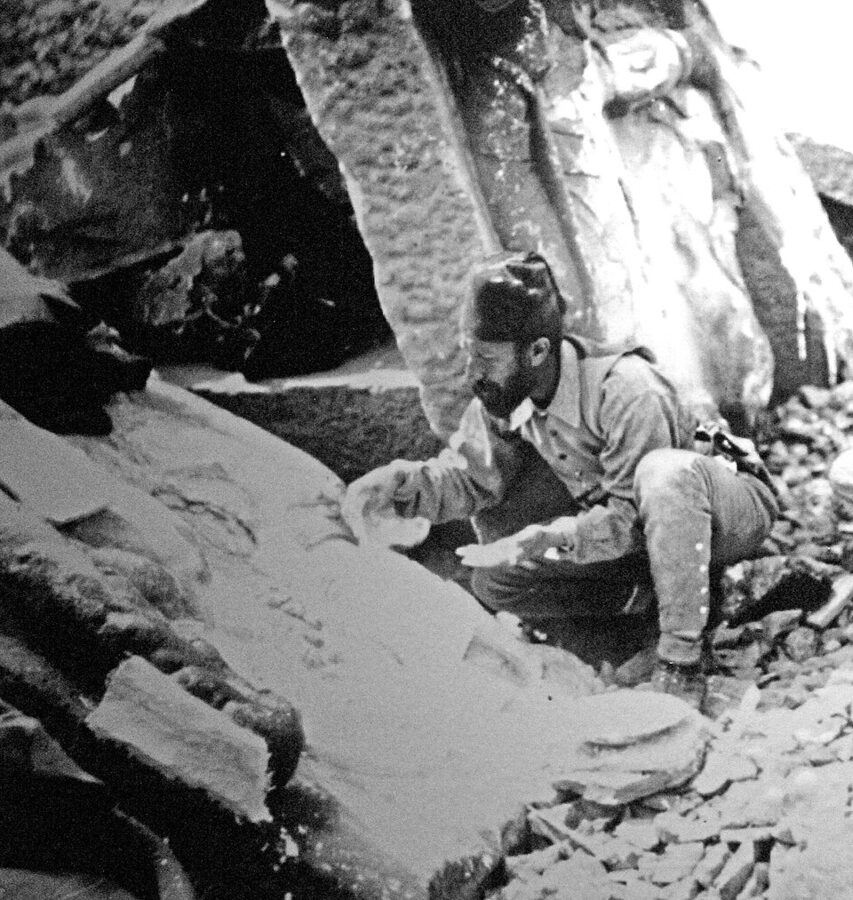
Nobody has found the tomb. The American archaeologist Theresa Goell spent seasons from the 1950s into the 1970s trying to reach a burial chamber, and the mound defeated her, because loose chips slide back into any tunnel. Whether Antiochus lies inside it is still an open question.
The walk up from the car park
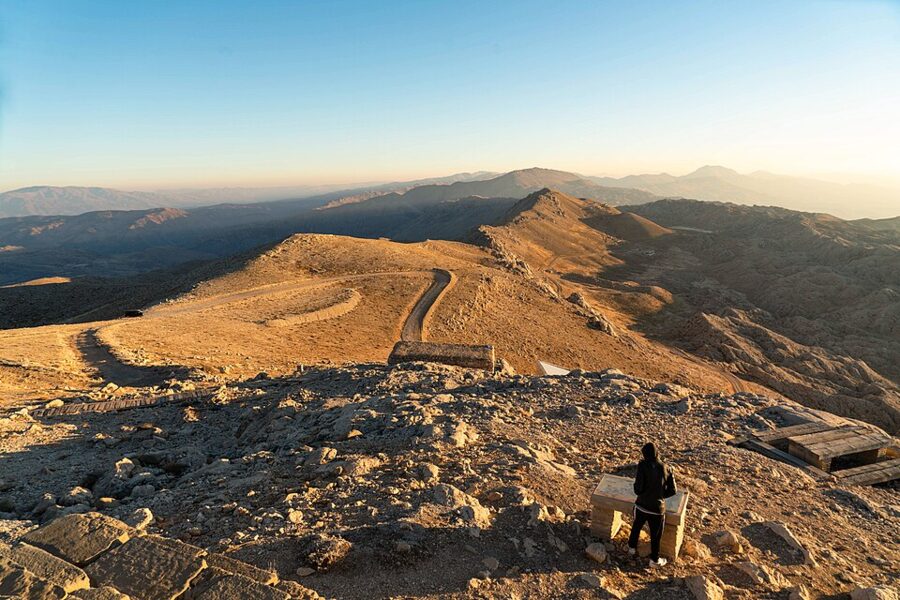
The road ends at a car park and visitor building on a saddle below the cone. From there a path of stone steps and gravel climbs about 600 to 700 m to the east terrace, which takes most people 15 to 20 minutes with stops for breath at this height. The loop round the tumulus, east terrace, north terrace, west terrace and back down, is about 1.6 km.
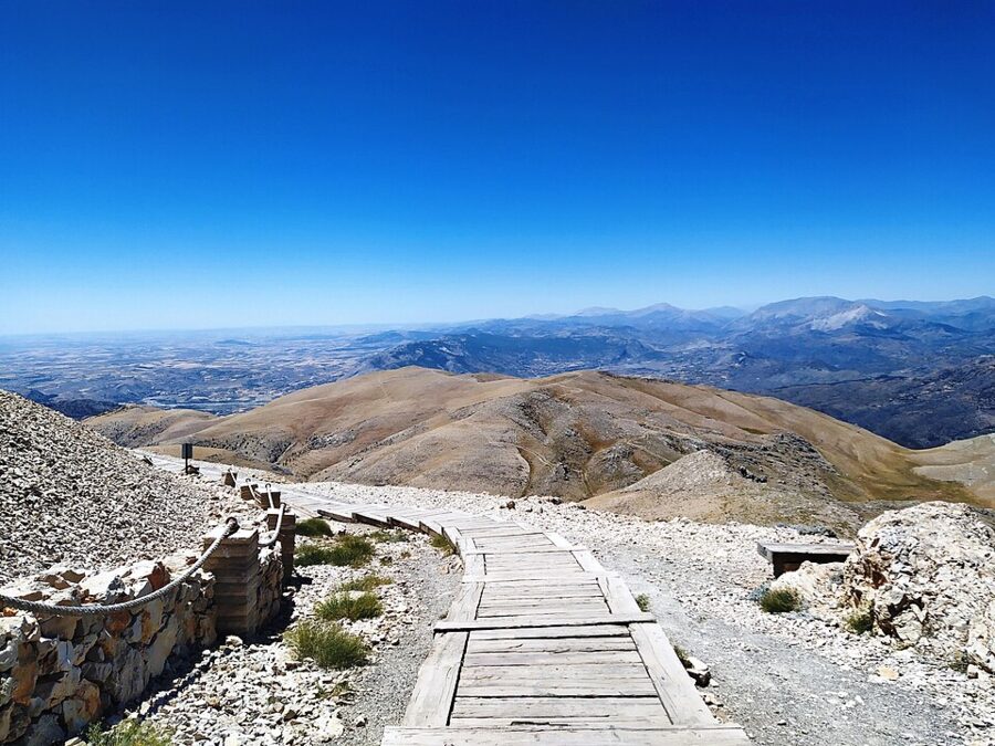

There is nothing to buy on the summit itself. Carry water and something to eat, and leave everything else in the minibus. There are no railings on the terraces and the drop on the outer edges is real, so keep away from the rim when the wind is gusting.
The east terrace
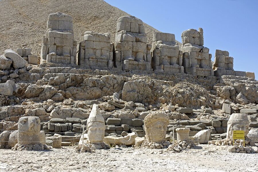

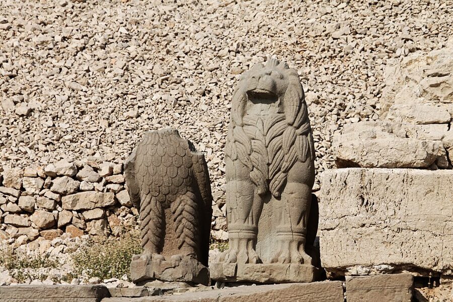
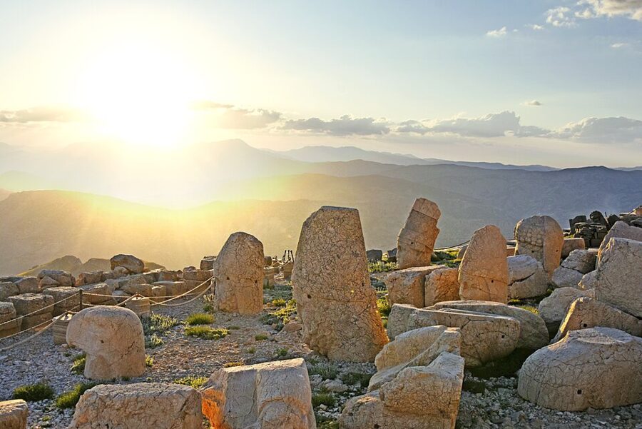
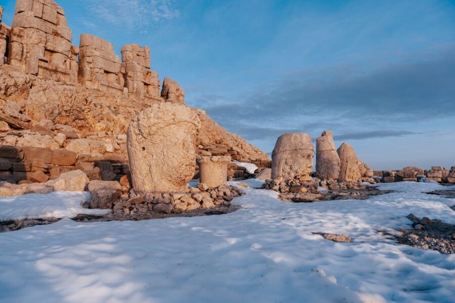
The east terrace is the better preserved of the two. The headless statues sit in a line on their thrones with a guardian lion and eagle at each end, and their heads lie on the terrace below, set more or less upright in front of the bodies they fell from. The Ministry of Culture’s order, left to right as you face them, is Antiochus, the goddess Commagene, Zeus-Oromasdes in the middle, Apollo-Mithras and Herakles-Artagnes.
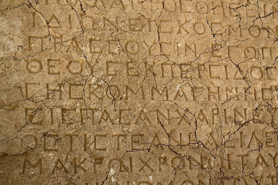
Walk behind the thrones. Carved into the backs of the bases is the Nomos, the long Greek inscription in which Antiochus lays down the rules of his cult: the feast days, the priests, the music and the meals to be served to the people at his monuments. The Ministry counts 223 lines; other sources give 234 or 237, depending on how the damaged sections are read. Along the terrace edges stand the remains of relief slabs showing his Persian and Macedonian ancestors.

The west terrace and the lion horoscope
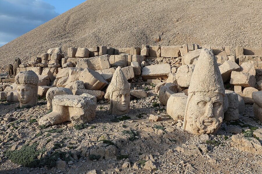

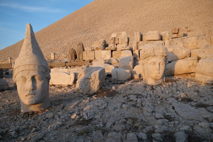
The west terrace mirrors the east one, but the statues have fared worse: the thrones have collapsed and the heads lie in a looser group. What this side has instead is the reliefs. A series of slabs shows Antiochus shaking hands with the gods one by one, a scene called a dexiosis, and the gesture is the whole point of the cult: a king as the gods’ equal partner.
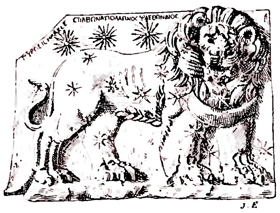
The most famous slab is the lion horoscope, a lion covered in stars with a crescent moon on its chest and three planets labeled in Greek above its back. The Ministry reads it as the sky on 7 July 62 BC and ties that date to Antiochus’s reign; astronomers and historians still argue over the reading, so treat the exact day as a good guess. Either way, it is one of the oldest known horoscopes cut in stone.

Conservators have been working on the heads since 2022, injecting nano-lime into hairline cracks to keep water out before it freezes. In 2025 they treated the Antiochus and eagle heads on both terraces, and in August 2026 they were working on the Commagene and Zeus heads on the west terrace. If you find scaffolding or a fenced-off head, that is why.
The north terrace
Between the two main terraces runs the north terrace, a ceremonial road about 180 m long lined with plain pedestals and stelae that were never finished. Most people walk straight along it to the next viewpoint. It is the quietest part of the summit, and the only side where you see how the mound sits against the mountains behind it.
Sunrise or sunset
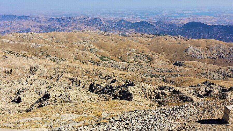

Sunrise is the classic, and it is the colder, quieter and harder option. You walk up in the dark, wait on the east terrace in the wind, and the light comes across the plain and hits the faces head-on. Sunset is easier: you walk up in daylight, see the east terrace first, then sit on the west side as the sun goes down behind the heads. In summer the sunset crowd is large enough that Turkish television ran pieces on it in August 2026.
I’d pick sunset unless you are sleeping in Karadut. It costs you no sleep, you see the path you are walking on, and if cloud spoils the evening you can still come back up at dawn. If you are only here for one go and the forecast is clear, sunrise is the one people remember.

Cold and wind at 2,150 m
The summit is cold even when Kahta is not. At dawn in midsummer it can sit not far above freezing, the wind is constant, and it snowed hard enough on 5 May 2026 to stop traffic on the Malatya side and turn cars back on the Adıyaman road. Bring a warm jacket, a hat that will not blow away, gloves for a sunrise and shoes with grip; sandals and the gravel do not mix.
The altitude figure itself is a small argument. The Ministry of Culture gives 2,150 m, while provincial officials and news reports often quote 2,206 m for the summit. Either way, take the walk up slowly if you came straight from the coast.
The ticket and hours in 2026
Mount Nemrut is a Ministry of Culture archaeological site, and in November 2026 its ticket costs €10, paid at the gate near the car park. The Ministry lists it as open every day; its November hours are 05:30 to 16:50, with a note that opening and closing times move with sunrise and sunset, so they stretch at both ends in summer. Children under 8 go free.
The site is busy. Officials reported about 350,000 people in 2025 and were aiming for 420,000 in 2026, which means a summer sunset is shared with hundreds of others. Come in September or early October for clear air and smaller crowds; the summit was still open in mid-November 2026.
When the summit road is open
The road from Karadut to the summit is the constraint, not the site. Snow closes it every winter, and the Highways Directorate (Karayolları) cuts it open again in spring. In early April 2026 drifts on the last 4 km were up to 3 m deep, and a 30 m section near Karadut had collapsed in a landslide; crews set to work on both, and officials said tours would restart the following week.
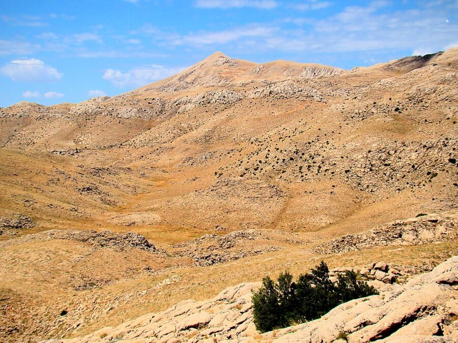

From April to June the road can still close for a day or two after late snow, as it did in May 2026. July and August are reliable but hot and busy below, and crowded on top. September and October are the best months, with clear air and cooler valleys. From November it becomes a question of weather: the site may be listed as open while the road is snowed in, so ask in Kahta before you book a minibus.
- April to mid-June: road usually open, cold summit, occasional snow closures.
- Late June to August: long days, hot in Kahta and Şanlıurfa, the biggest crowds at sunset.
- September to October: the best balance of weather, light and crowds.
- November to March: snow decides; expect closures of the road from Karadut.
The Commagene circuit below the mountain
Most tours come back down by a second road, past four sites that between them explain the summit: a royal summer palace, a medieval castle, a Roman bridge and a tomb for the royal women. All four sit within about 25 km of Kahta, and a taxi or tour will do them in two or three hours.
Arsameia
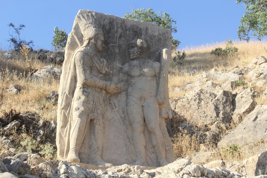
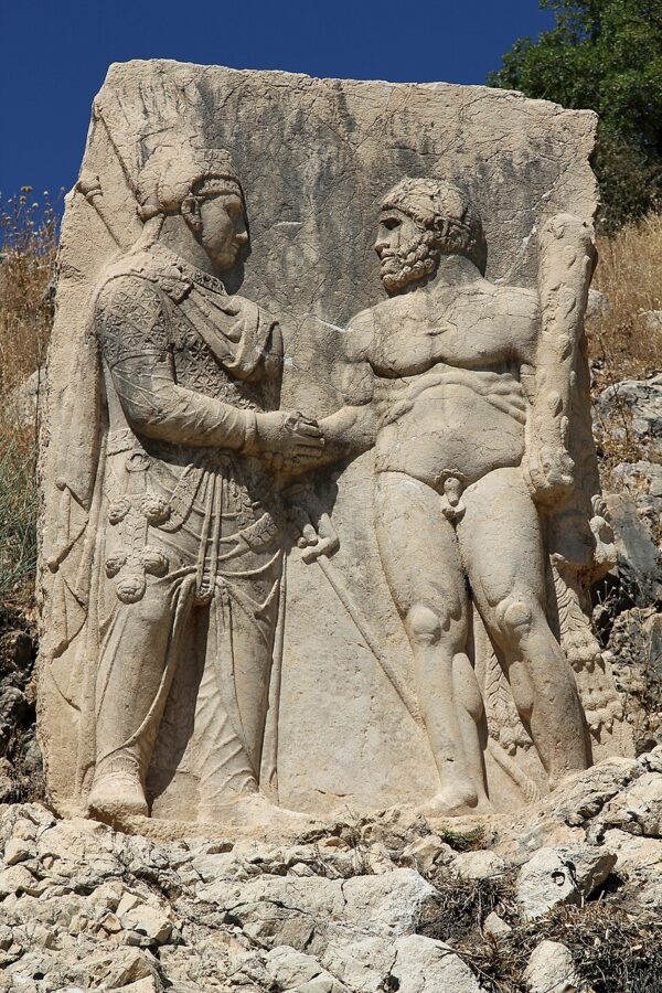
Arsameia on the Nymphaios was Commagene’s summer capital, on a hill above the Kahta stream. Antiochus built a sanctuary here for his father, Mithridates I Kallinikos, and you follow the old ceremonial path up past relief slabs to the top. The best preserved shows a king shaking hands with Herakles, the same dexiosis scene as on Nemrut, in much better condition because it sits far lower, out of the worst of the frost and wind.
Below the relief is the longest Greek inscription in Anatolia, cut into the rock face, and beside it a stepped tunnel that runs 158 m into the hill for reasons nobody has explained. Entry is free, and the Ministry lists it as open every day from 08:00 to 17:30.

Yeni Kale
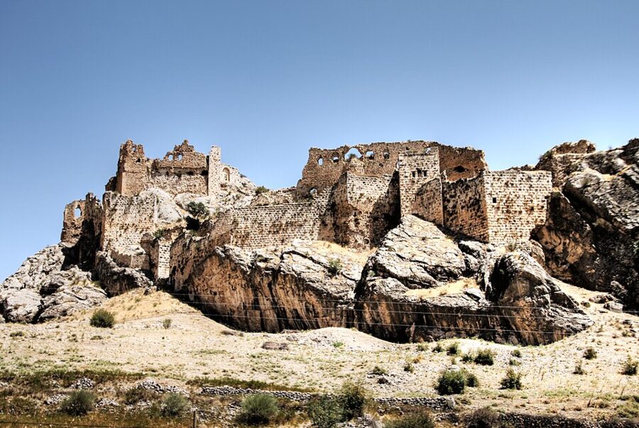

Across the gorge from Arsameia, Yeni Kale (“New Castle”) sits on a sharp ridge above the village of Kocahisar, the old Kahta. Its first walls may go back to Commagene, but what you see is mostly Mamluk, with inscriptions naming the sultan Qalawun over the gate, plus later Seljuk, Artuqid and Ottoman work. It was restored in 2012; entry is free and the listed hours are 08:00 to 19:00 daily.
The climb is short but steep, and the view down to the Seljuk bridge over the stream is the reason to do it. Allow 45 minutes.
The Cendere bridge
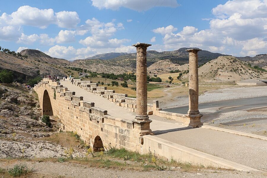

The Cendere bridge is a single Roman arch with a span of about 34 m, one of the widest the Romans built, made of 92 big blocks. A Latin inscription says four cities of Commagene put it up in honor of Septimius Severus, his wife Julia Domna and their sons Caracalla and Geta around AD 200. Traffic now uses a newer bridge alongside, so the Roman arch is for walking only, free and open at all hours.
Karakuş tumulus
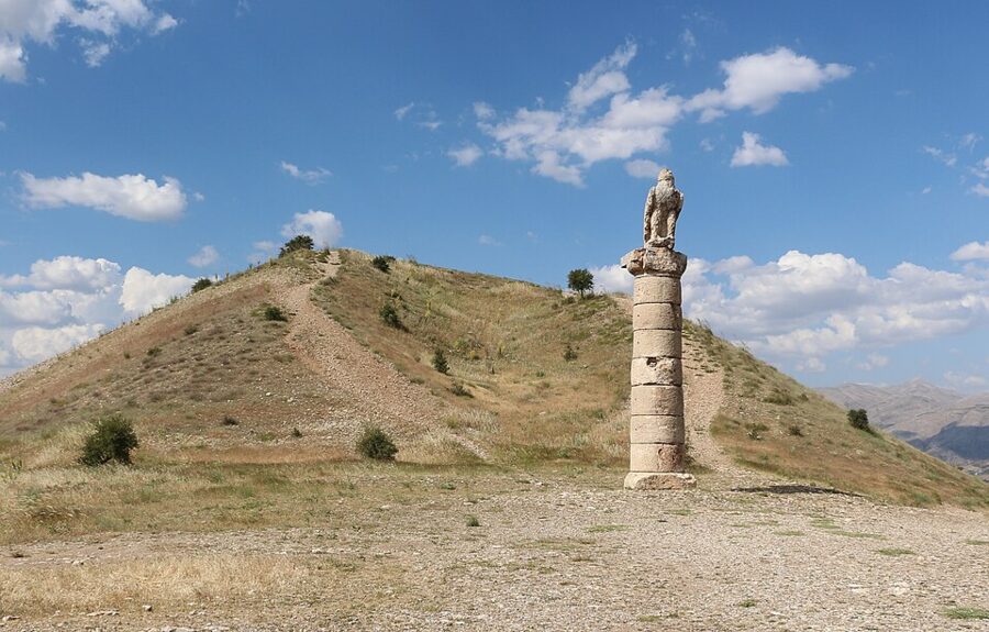

Karakuş is the burial mound Antiochus’s son, Mithridates II, built for the royal women: his mother Isias, his sisters Antiochis and Laodike and his niece Aka. Columns topped by an eagle, a lion and a relief stand around it. On 6 February 2023 the earthquake brought down the column carrying the relief of Mithridates shaking hands with Laodike; conservators re-erected it from its pieces and it reopened in July 2023.
From the top of the mound you can see the Atatürk Dam lake spreading across the plain to the south. The reservoir, finished in the early 1990s, drowned the valley of Samosata, the Commagene capital, and the small modern town of Samsat was rebuilt on higher ground.
Getting there and between the bases
This corner of Turkey is far from everything else on a first trip, and the arithmetic is simple: fly if you are short of days, take the night bus if you are short of money. Both work here the way they do everywhere in the country, so the general advice on getting around Turkey applies; what follows is specific to Kahta, Adıyaman and Şanlıurfa.
Flights
Adıyaman airport (ADF) is the closest to Nemrut, with flights from Istanbul on AJet, Pegasus and Turkish Airlines, about 90 minutes to 2 hours in the air. From the airport it is about 90 km to the summit via Kahta. Malatya airport serves the north side, and Şanlıurfa’s GAP airport (GNY), about two hours from Istanbul, is the one to use if you are starting or finishing in Şanlıurfa. A common budget shape is to fly into one and out of the other, and cover the middle by bus.
Night buses
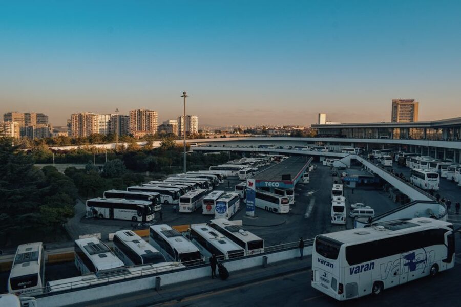
Kahta and Adıyaman are both on the national bus network. From Istanbul it is about 18 hours, with Metro Turizm, Adıyaman Ünal Turizm and Kamil Koç running from Esenler, Harem and the other city terminals. From Cappadocia, the usual base before the east, buses leave Nevşehir otogar for Kahta at 08:30, 22:18 and 23:59 and take 8.5 to 9 hours; if you are staying in Göreme, ask whether your ticket includes the free servis minibus to Nevşehir.
| Route | Lowest fare seen, November 2026 | Time | Operators |
|---|---|---|---|
| Istanbul to Kahta | 2,600 TL | about 18 hours | Metro Turizm, Adıyaman Ünal, Kamil Koç |
| Nevşehir to Kahta | 1,900 TL | 8.5–9 hours | Metro Turizm, Adıyaman Ünal |
| Malatya to Kahta | 500 TL | first bus 04:35, last 15:00 | Adıyaman Ünal, Kahta Petrol |
| Şanlıurfa to Adıyaman | 500 TL | 1.5–2 hours | Topçam, Öz Gülaras |
Lira fares move fast, so read these as 2026 ballpark figures, not promises. Holiday weeks sell out first and cost more, so check the bayram dates among the Turkish public holidays before you commit to a night bus around them.
Between Kahta, Adıyaman and Şanlıurfa
Adıyaman city and Kahta are about 35 km apart, half an hour by the frequent minibuses between the two bus stations. For Şanlıurfa, the simplest link is the intercity bus from Adıyaman, with morning and early-afternoon departures; the 09:30 from Şanlıurfa reaches Adıyaman at 11:30. Nothing scheduled goes up to the summit car park, and nothing public runs at sunrise hours.
The north approach from Malatya
Nemrut can also be reached from Malatya through the Pütürge district, on a mountain road that comes up the north side. In 2026 Malatya’s municipality was resurfacing a 14 km stretch between Nohutlu and Taşmış on that route. There is no public transport up this side and it is the first road to close with snow, so it only makes sense with a car or a tour from Malatya, or if Malatya is where your flight lands.
The 2023 earthquakes and what is open now
The earthquakes of 6 February 2023 hit this region hard. Adıyaman and Malatya were among the worst-affected cities, and both are still rebuilding: you will see empty lots, container shops and new blocks going up. None of that stops a trip, but it changes what you can see.
The summit itself was not damaged. The provincial museum directorate said in April 2023 that the heads and terraces came through intact, and the site has opened every season since. The Karakuş column that fell was re-erected the same summer. The Adıyaman Museum in the city is a different story: the Ministry still lists it as closed because of the earthquake, and a new archaeology museum was under construction in October 2026.
- Adıyaman city: the first phase of a rebuilt central bazaar, 172 shops, was nearing completion in April 2026, while a September 2026 report counted about 2,773 damaged buildings still waiting to be demolished.
- Malatya: the rebuilt central bazaar was handed over to shopkeepers in October and November 2026, and the coppersmiths’ bazaar (Bakırcılar Çarşısı) reopened in July 2026. The Yeni Cami mosque was due to reopen once its square was finished.
- Şanlıurfa: less damaged than its northern neighbors. Harran’s Ulu Cami was repaired and reopened in July 2024, though the Ministry still lists the wider Harran site as closed because of the earthquake.
For a bed in Adıyaman or Malatya, pick somewhere with recent reviews and photos from 2026, since plenty of hotels changed hands, moved or shut after the earthquakes.
Şanlıurfa
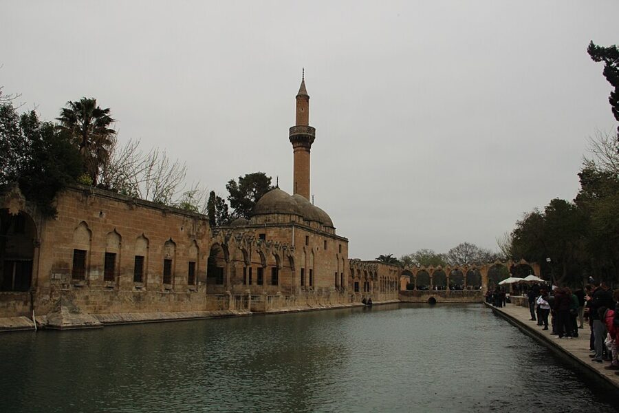
Şanlıurfa (Urfa to almost everyone) is the big, warm, devout city of this corner of Turkey, and after the cold of Nemrut it feels like another country. It is two to three hours south of Kahta by bus, usually with a change in Adıyaman. Give it at least two nights: one day for the old town and the museums, one for Göbekli Tepe and Harran.
Balıklıgöl and the sacred carp
The story behind Balıklıgöl is that the tyrant Nimrod threw the prophet Abraham into a fire here, God turned the fire into water and the logs into fish, and the carp in the pools are their descendants. They are not eaten, and the water is thick with them. Some historians link the sacred-fish pools to the much older cult of the Syrian goddess Atargatis; either way, people have been feeding fish here for a very long time.
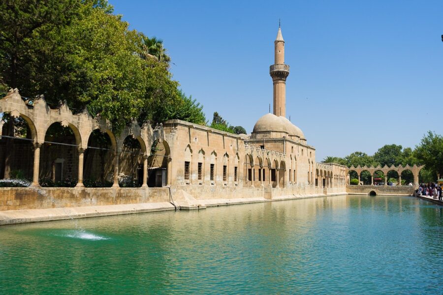
Two mosques stand on the water, the Halil-ür Rahman Mosque and the Rızvaniye Mosque, and the Mevlid-i Halil Mosque nearby is built around the cave where Abraham is said to have been born. Like all working mosques they close to visitors during the five daily prayers and for longer at Friday noon prayer. The cave has separate entrances for men and women; women cover their hair, everyone covers shoulders and knees, and shoes come off.
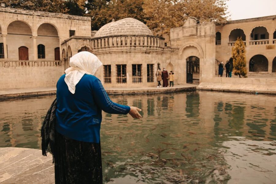
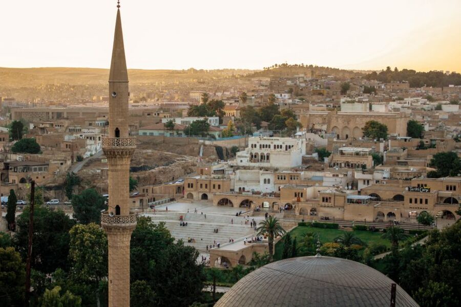
Above the pools rises the castle rock with its two Roman columns. Urfa Castle itself has been closed to visitors since 2018; excavation and a first stage of restoration were done by October 2026, and the governor says it will reopen after a second stage. You can still see the columns from the gardens below.
The bazaar and the hans
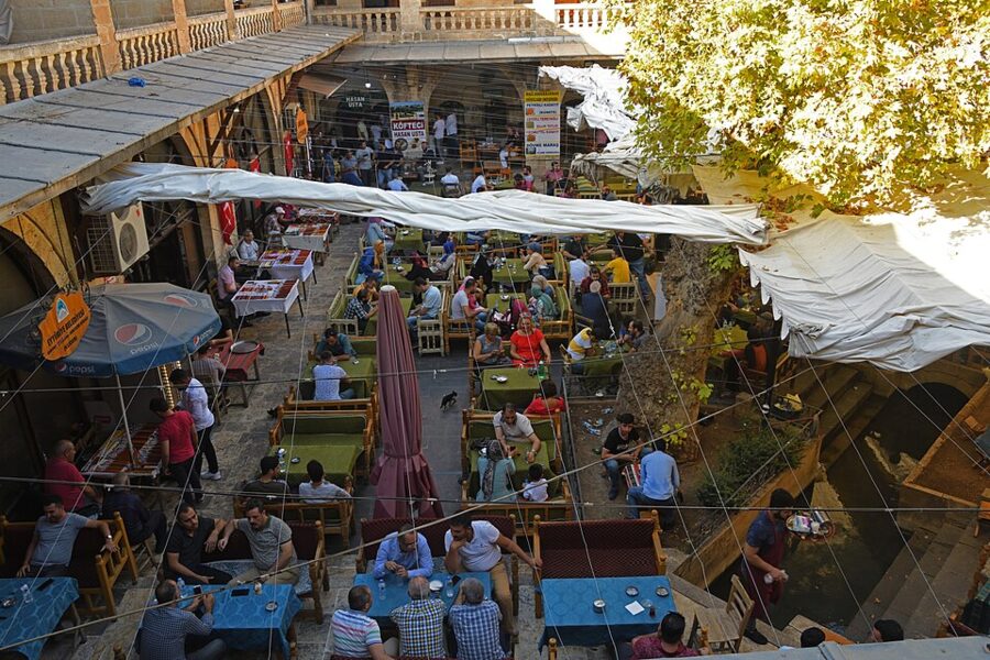

Şanlıurfa’s covered bazaar runs north of Balıklıgöl in a tangle of lanes, and it is a working market, not a show: copper, saddlery, spices, isot pepper and headscarves. It is smaller than Istanbul’s Grand Bazaar and hardly sells to tourists at all, which is the point. At its heart is the Gümrük Hanı, a two-story caravanserai with an arcaded courtyard; the notice at its door says it was built in the 1560s under Süleyman the Magnificent, though some historians date it much later.
Off the han run the Bedesten, where the valuable goods were once locked up, and the Sipahi Pazarı, the old textile market. Prices are fixed in most food and household shops; bargain politely only for carpets, copper and souvenirs.
The Archaeology Museum and the Mosaic Museum
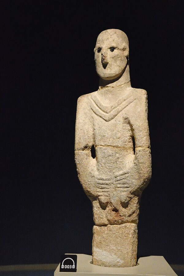

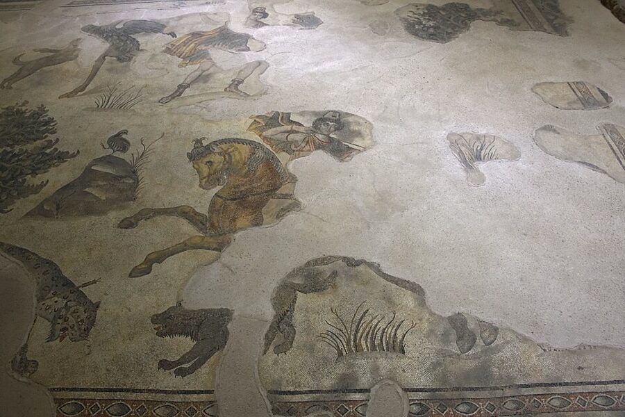
The Şanlıurfa Archaeology Museum is the largest museum building in Turkey and the place to start before you go to Göbekli Tepe. It holds the finds from the site, a full-size replica of one of the enclosures, and the Urfa Man, a statue made around 9000 BC. The Haleplibahçe Mosaic Museum, in the same park, is built over a Roman villa whose mosaics were left in place: hunting Amazons, the life of Achilles, and the goddess Ktisis holding a Roman foot rule.
The Ministry lists each museum at €10 in 2026, open every day from 08:30, with the last tickets around 17:00. Allow two hours for the archaeology museum and one for the mosaics, and go in the heat of the afternoon, when the old town is at its least pleasant.


Where to stay cheaply
Sleep near Balıklıgöl or along the main road north of it, where the cheapest hotels and the old-town guesthouses are. The restored stone mansions (konak) around the pools are lovely and cost more; the plain concrete hotels on the main road are cheaper and are a 10-minute walk from the same sights. Air conditioning is worth paying for between June and September, when afternoons often pass 40°C.
Eating in Urfa
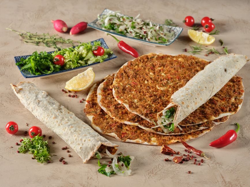
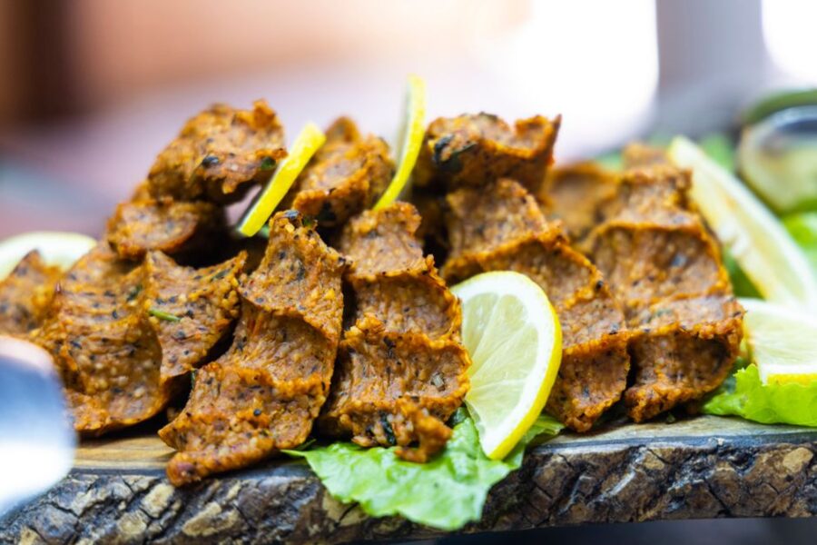
Urfa is a food city on a budget. Lahmacun here is thin and spiced with isot, the dark, smoky local pepper; ciğer kebabı (grilled liver) is eaten for breakfast as well as dinner; and çiğ köfte, the spicy bulgur paste wrapped in lettuce, comes from this part of Turkey. Many restaurants have a separate family room (aile salonu), which is where women and couples are usually seated.
Harran and its beehive houses
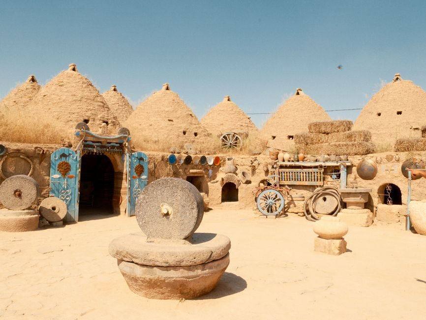
Harran is 44 km south-east of Şanlıurfa, on the flat plain toward the Syrian border, and it makes an easy half day. The beehive houses, built of mud brick with conical domes, are a regional style that goes back thousands of years, though the ones you see are mostly around two centuries old. Minibuses for Harran and Akçakale leave from the city’s southern minibus garage; a taxi there and back with waiting time is the easy alternative.
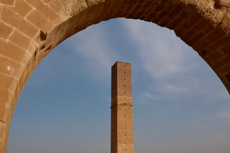
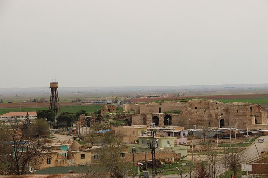
Harran was a holy city long before Islam, with a temple to the moon god Sin, and later an Umayyad capital. The Ulu Cami, one of the first great mosques in Anatolia, has walkways through its ruins since its 2024 reopening. The castle-palace was still under excavation in late 2025, with more than 80% of the digging done, and the Ministry’s listing for the wider site still reads closed because of the earthquake, so expect fences around the castle and the mound.
Göbekli Tepe
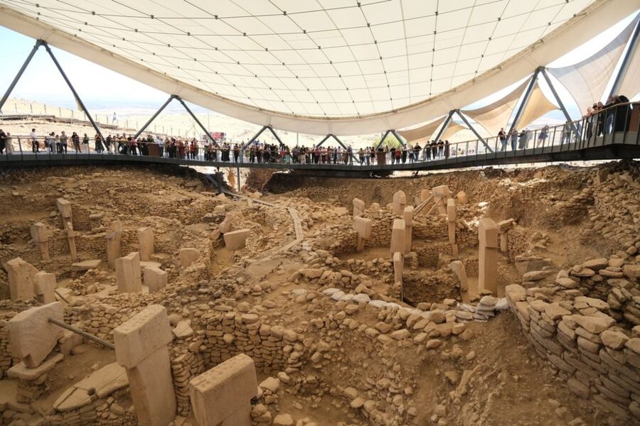
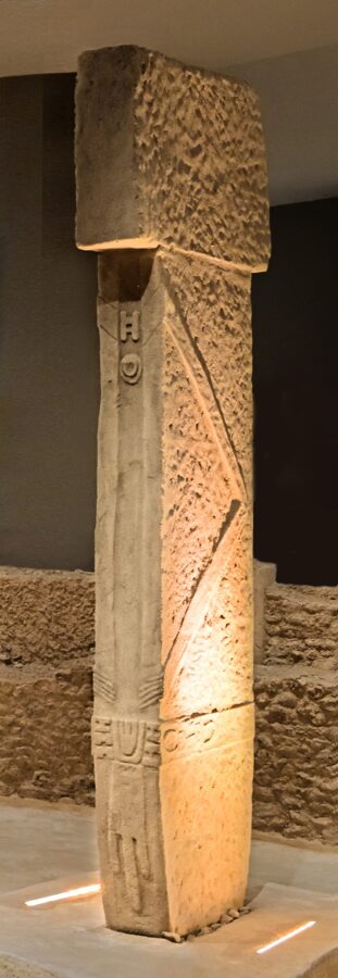
Göbekli Tepe, 15 km north-east of Şanlıurfa, is a group of round stone enclosures built by hunter-gatherers from around 9600 BC, before farming, pottery or towns. Their T-shaped pillars, some 5 m tall, are carved with foxes, boars, snakes, birds and scorpions, and some have arms and hands, which suggests they stand for people or spirits. The builders later filled the enclosures in on purpose, which is why they survived.
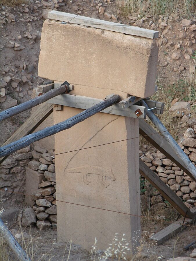

The site was first recorded in 1963 and dug seriously from 1995 by Klaus Schmidt of the German Archaeological Institute; UNESCO listed it in 2018. In 2026 the ticket is €20, which the Ministry says also covers Karahantepe. It is open every day from 08:30 to 17:30, with the last tickets at 17:00, and there is an audio guide.
Allow an hour and a half to two hours with the visitor center film. A municipal bus line from the Archaeology Museum serves the site with only a few departures a day, so ask at the museum desk for the current times or share a taxi, and agree the waiting time in advance. Go at opening time in summer; by midday the plain is baking and the walkway has no shade beyond the roof.
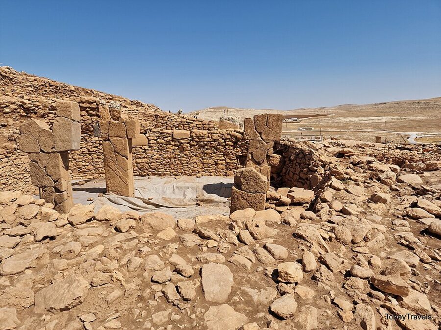
Karahantepe, 55 km east of the city in the Tek Tek hills, is the same kind of site with even stranger carvings, including a room of pillars with a carved human head. It was closed to the public in 2026 while a protective roof and visitor center were built, with the work due to finish by the end of the year.

Dress, Ramadan and manners in the south-east
This is the most conservative part of Turkey on the usual backpacker routes. In Şanlıurfa and Adıyaman, cover shoulders and knees in town and not just in mosques; women will feel more comfortable with long sleeves, and a scarf in the bag covers the mosques. Ask before you photograph people, and do not photograph women without a clear yes.
During Ramadan, which in 2027 runs from 8 February to 8 March, many family restaurants shut in daylight or serve behind curtains, and eating or smoking openly in the street is bad manners. The evenings are the best of it: the whole city eats together at the sunset meal (iftar) and stays out late. The bayram at the end fills every bus, so book ahead.
A budget for four days
The fixed costs are low. Here are the tickets and fares that matter, as quoted in November 2026.
| Item | 2026 price | Note |
|---|---|---|
| Mount Nemrut site | €10 | Paid at the gate; under 8 free |
| Arsameia, Yeni Kale | free | Daily, daytime hours |
| Cendere bridge, Karakuş tumulus | free | Open-air |
| Göbekli Tepe | €20 | Covers Karahantepe when it reopens |
| Şanlıurfa Archaeology Museum | €10 | Daily 08:30–17:30 |
| Haleplibahçe Mosaic Museum | €10 | Same park as the archaeology museum |
| Harran Ulu Cami | free | Castle and mound fenced during works |
| Nemrut minibus tour from Kahta | per vehicle | Agree the price and stops before you get in |
| Istanbul to Kahta bus | from 2,600 TL | About 18 hours |
| Şanlıurfa to Adıyaman bus | from 500 TL | 1.5–2 hours |
A sensible four days runs like this: arrive in Kahta by night bus or via Adıyaman airport; sunset on Nemrut with the circuit on day one; sunrise or a lie-in on day two, then the bus to Şanlıurfa; the old town and museums on day three; Göbekli Tepe in the morning and Harran in the afternoon on day four. In a longer Turkey itinerary, this loop fits best straight after Cappadocia, with a flight back west from Şanlıurfa.
Buy the bus seat out of Kahta for the day after your summit trip, not the morning of it. If the sunset turns out cloudy, the heads will still be facing east at dawn, and you will want to be there.