Every cemetery on the Gallipoli Peninsula is free to walk into, and there are a lot of them: 31 Commonwealth war cemeteries, a French one above Morto Bay, and Turkish memorials that between them carry the names of 59,408 Ottoman dead. What costs money is getting between them. No public transport runs into the battlefield, the sites are spread across the peninsula from Suvla Bay down to Cape Helles, and the cheapest way in is a 40 TL ferry ticket that only gets you as far as the far shore.

So the first decision is how you move. With a car, or a group to split a guide, you can see both ends of the peninsula in a day. On foot and by ferry you can still do the Anzac area properly, which is where most English-speaking travelers want to be, but the southern tip and the big Turkish memorial at Morto Bay are a long way from any bus.
This is also a place where behavior matters more than at most sights in Turkey. For Turkish visitors the peninsula is where the nation’s founding story begins; for Australians and New Zealanders it is where theirs does. Both sets of dead lie a few hundred meters apart, and the rules (no alcohol anywhere in the historic area, stay on the paths, keep your voice down) exist because people come here to grieve as well as to look.

Most people arrive on the classic Turkey itinerary, coming south from Istanbul by coach and staying a night or two in Çanakkale. Give the battlefields one full day, a second if you want the southern tip at a walking pace, and keep a morning for Troy.
Contents
The campaign in outline
In early 1915 Britain and France set out to force the Dardanelles with warships, knock the Ottoman Empire out of the war and open a sea route to Russia. The strait is narrow, its shores were lined with forts and batteries, and the channel was mined. Turkish historians date the campaign from 19 February 1915, the first naval bombardment, to 9 January 1916, when the last Allied soldier left.
18 March: the naval attack
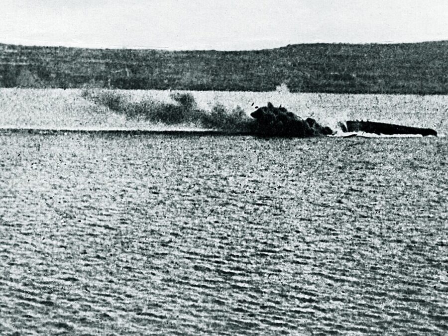
On 18 March an Allied fleet of 18 battleships pushed into the narrows. Ottoman gunners on both shores fired back all day, but the mines decided it: the French Bouvet and the British Irresistible and Ocean sank, and others were badly damaged. The fleet turned back, and the plan changed to landing an army to take the forts from behind. Turkey marks 18 March as its day of victory and remembrance, the day of the phrase Çanakkale geçilmez, “Çanakkale cannot be passed”.
25 April: the landings
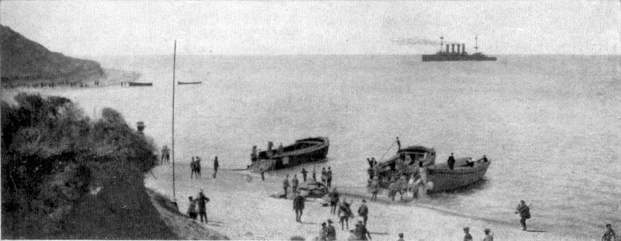
The British 29th Division landed at dawn on 25 April on five beaches around Cape Helles, at the southern tip, and lost heavily at V and W Beaches. Australians and New Zealanders came ashore further north near Ari Burnu, in the cove that took their name, and climbed into a maze of gullies. The Ottoman 27th and 57th Regiments, the latter thrown in by the 19th Division’s commander, a then little-known lieutenant colonel called Mustafa Kemal, stopped them short of the heights. French troops landed briefly on the Asian shore at Kumkale as a diversion and then joined the British at Helles.
Summer, August and the evacuation
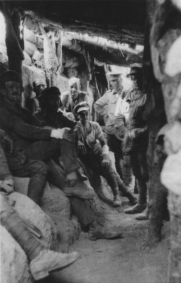
Neither side could break the other, and both dug in. At Helles the British and French attacked the village of Krithia (today’s Alçıtepe) three times by June and never took it. At Anzac a huge Ottoman night attack on 19 May failed with terrible losses, and a truce on 24 May let both sides bury the dead between the trenches. Summer brought flies, dysentery and typhoid, which sent tens of thousands of men to the hospital ships.
In August the Allies tried again. Australians attacked at Lone Pine on the 6th, the Light Horse charged at the Nek on the 7th, New Zealand and British troops took Chunuk Bair on the 8th while Gurkhas briefly reached neighboring Hill Q, and a fresh British corps landed at Suvla Bay, followed by the 10th (Irish) Division. Mustafa Kemal’s counterattack retook Chunuk Bair on 10 August, and the last big fighting, at Hill 60 and Scimitar Hill, petered out by the end of the month. In December the Allies slipped away from Anzac and Suvla over several nights, the last men leaving before dawn on 20 December; Helles followed on 8–9 January 1916.
Who fought, and what it cost
Casualty figures vary between sources, the Ottoman figure most of all. Edward Erickson’s study of the Ottoman army, Ordered to Die (2001), worked from the Ottoman archives and gives 56,643 Ottoman dead from all causes; older estimates run past 86,000. The table gives the commonly cited counts of dead.
| Force | Dead, roughly | Where they are remembered |
|---|---|---|
| Ottoman (Turkish, Arab and other soldiers) | 56,000–87,000 | Çanakkale Martyrs’ Memorial, 57th Regiment, dozens of smaller cemeteries |
| British, including Irish regiments | about 31,000 | Helles Memorial, Lancashire Landing, Twelve Tree Copse, Suvla |
| French and French colonial | about 9,800 killed or missing | French war cemetery, Morto Bay |
| Australian | about 8,700 | Lone Pine, the Anzac Cove cemeteries, the Nek |
| New Zealand | about 2,700–2,800 | Chunuk Bair, Hill 60, Twelve Tree Copse |
| Indian | about 1,350 | Helles Memorial, cemeteries at Anzac |
| Newfoundland | 49 | Suvla cemeteries, Helles Memorial |
Add the sick and wounded and each side counted roughly a quarter of a million casualties. For the Allies it was a defeat; for the Ottomans a victory that made Mustafa Kemal’s name, and he went on to found the Turkish Republic as Atatürk. If you read one book before you go, I’d make it Peter Hart’s Gallipoli (2011), with Erickson for the Ottoman side.
Kabatepe: where to start, tickets and rules
The whole battlefield is the Gallipoli Historical Site (Çanakkale Savaşları Gelibolu Tarihi Alanı), run by a directorate under the Ministry of Culture and Tourism. The area, the cemeteries and the memorials are free. You pay only at a handful of museums, and the main one sits at Kabatepe, the harbor on the west coast 8.5 km from the Eceabat ferry and the natural first stop.
The Çanakkale Destanı Tanıtım Merkezi
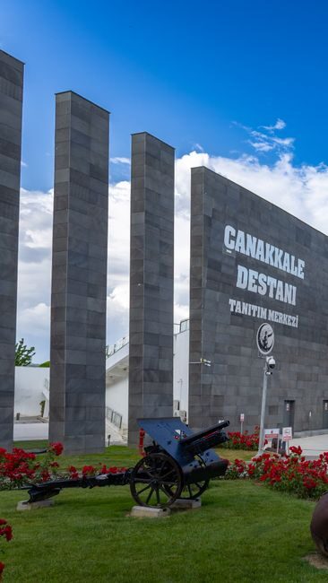
This visitor center opened in June 2012 around 11 simulation halls that took groups of up to 50 through the campaign in 60 minutes. The winter 2026 tariff lists those halls as temporarily closed for repairs; a documentary runs instead in the conference hall for 50 TL, and the two-floor exhibition of weapons, uniforms and dioramas costs 100 TL. It is told from the Turkish side, which is exactly why it is worth an hour if you came for the Anzac story.

What the paid sites cost
The directorate’s museums are small and cheap, and two are free. These are the winter prices and hours (14 September to 14 May) for 2026, in lira at the counter; from 15 May to 13 September every site stays open two hours later.
| Site | Full / reduced | Winter hours (last entry) | Closed |
|---|---|---|---|
| Tanıtım Merkezi exhibition, Kabatepe | 100 TL / 50 TL | 09:00–16:45 (16:15) | Tuesday |
| Tanıtım Merkezi documentary | 50 TL | with the exhibition | Tuesday |
| 1915 trench and Red Crescent hospital, Alçıtepe | 150 TL / 75 TL | 09:00–17:00 (16:30) | none listed |
| Kilitbahir Castle Museum | 200 TL / 100 TL | 09:00–17:00 (16:15) | Monday |
| Namazgah Bastion Museum, Kilitbahir | 80 TL / 40 TL | 09:00–17:00 (16:30) | Monday |
| Kilitbahir Castle and Namazgah combined | 250 TL | as above | Monday |
| Seddülbahir Castle Museum | free | 09:00–17:00 (16:30) | none listed |
| Atatürk House, Bigalı | free | 09:00–16:45 (16:30) | none listed |
Rules on the site
The directorate’s code of conduct is sensible rather than fussy. Keep to marked roads and walking routes, because shortcuts across the crumbling ridges are damaging and dangerous. No alcohol anywhere in the historic area, no picnics or camping outside marked areas, no driving or parking on the grass near graves, no music. Removing artefacts is illegal under Turkish law, with severe penalties, and professional filming needs a permit.
The directorate’s free app, Gelibolu Tarihi Alan Rehberi, has maps, the walking routes and audio guides. Turkish visitors use its “Şehidimi Bul” (Find My Martyr) database to look up a relative before they come, as Australians and New Zealanders search the Commonwealth War Graves Commission records.
The Anzac area, in the order you can visit it
The Anzac area is the strip of coast and ridges north of Kabatepe where the Australians and New Zealanders landed, and almost all of it sits along two roads. The coast road runs north past Anzac Cove to North Beach. The ridge road climbs from Kabatepe past Lone Pine, the 57th Regiment memorial and the Nek to Chunuk Bair, with the trenches of both armies a few meters from the tarmac.
Do the coast first, then the ridge: you see where the landing came ashore, then follow it inland to where it stopped. By car or tour that takes three to four hours with time in the cemeteries; on foot it is a full day, and a good one.
Anzac Cove and Ari Burnu
Anzac Cove is smaller than you expect: about 600 m of gravel beach under steep, crumbling hills, between the point of Ari Burnu and Hell Spit. On 25 April the boats came in about 2 km north of the planned beach, through a current or a navigation error, which is why the first troops faced cliffs instead of the gentler ground toward Kabatepe. Erosion and road works have narrowed the beach since.
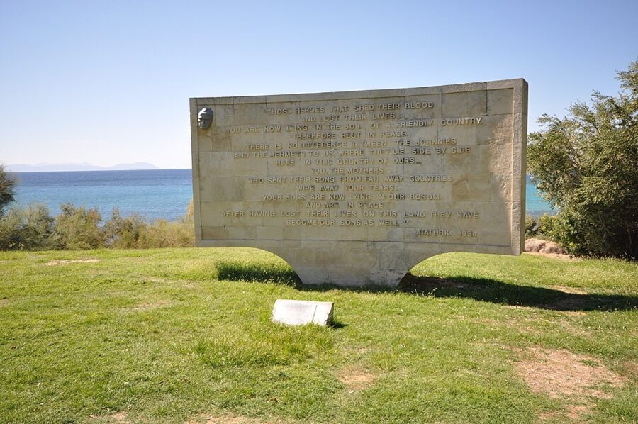

The stone tablet on the lawn carries the best-known words on the peninsula. They tell the mothers of the foreign dead to dry their tears: their sons lie in the soil of a friendly country, side by side with the Turkish soldiers, and have become Turkey’s sons too. The text was released in 1934 through the interior minister and is attributed to Atatürk; historians have questioned how much of the wording is his, while the directorate attributes it to him without qualification.
Ari Burnu Cemetery is beside it, on the point where the first boatloads came ashore. It holds 151 Australians, 35 New Zealanders, 27 British soldiers, three Indians and one Maltese, plus 37 men whose units are unknown. Read the ages and the one-line inscriptions families chose; they do more than any panel.
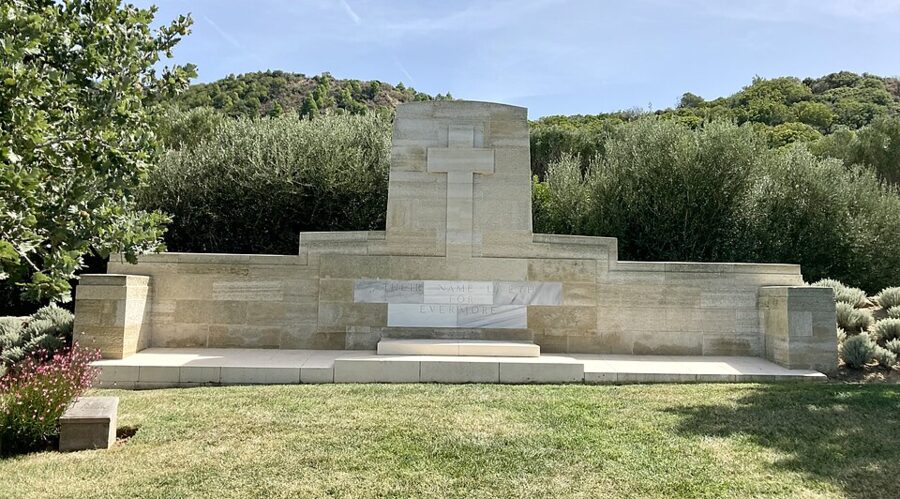

South along the coast road, Beach Cemetery sits above Hell Spit and was used from the first day almost to the evacuation; it holds 391 men, 285 of them Australian. Shrapnel Valley Cemetery is inland from the same point, in the gully Ottoman gunners shelled from Kabatepe, and holds 683. Both are quieter than the cove.
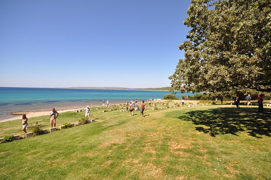

North Beach, the Sphinx and the commemorative site
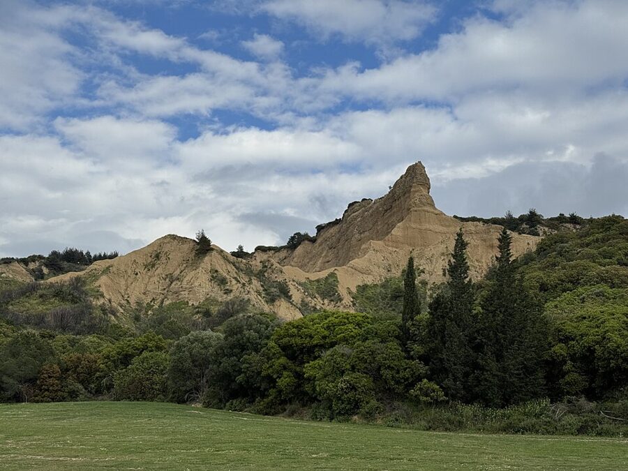
Just north of Ari Burnu the coast opens into North Beach, under the Sphinx. Here is the Anzac Commemorative Site, a lawn and stone amphitheater built for the Anzac Day dawn service and empty for the rest of the year. It is the best place on the coast to sit and look up at the ground the landing had to climb.
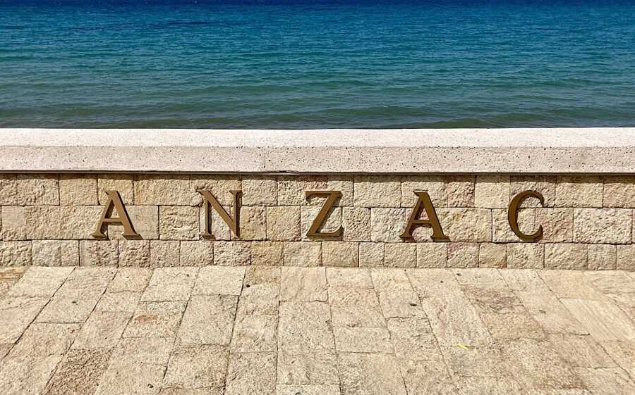

The newest monument in the Anzac area is the rebuilt Arıburnu Victory Monument. Ottoman soldiers made the original from shell cases in 1915, in ground the Anzacs had held, and Allied forces pulled it down after the war; the directorate calls it the only Ottoman victory monument documented as deliberately destroyed. Its site was found after a wildfire in August 2024, and the reconstruction opened on 10 August 2026 with the Australian ambassador among the guests.
The Arıburnu walking route
On foot, use the directorate’s Arıburnu walking route. It runs 7 km from Shrapnel Valley Cemetery up the middle of the old Turkish front line, by the Mehmet Çavuş memorial and the 57th Regiment cemetery, and over Kanlısırt to Lone Pine, built without pouring any concrete on the ridge. Commonwealth cemeteries and Turkish memorials come in turn, which is the point: both sides of the same few hundred meters.
The Respect to Mehmetçik statue
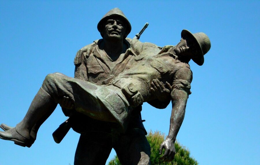
Driving up the ridge road from Kabatepe, the first stop is Albayrak ridge and the Mehmetçiğe Derin Saygı (Respect to Mehmetçik) statue of 1992. A Turkish soldier carries a wounded Australian officer toward his own lines, and the plaque quotes words attributed to Lord Casey, a former governor-general of Australia, in 1967, on the Anzacs’ admiration for the Turkish soldier.
Lone Pine (Kanlısırt)
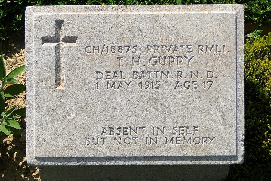
Lone Pine is the main Australian memorial on the peninsula and the site of the Australian service on Anzac Day. The ridge took its name from a single pine left standing when the scrub was cut for trench timber, and a pine has been replanted in the cemetery to stand for it.
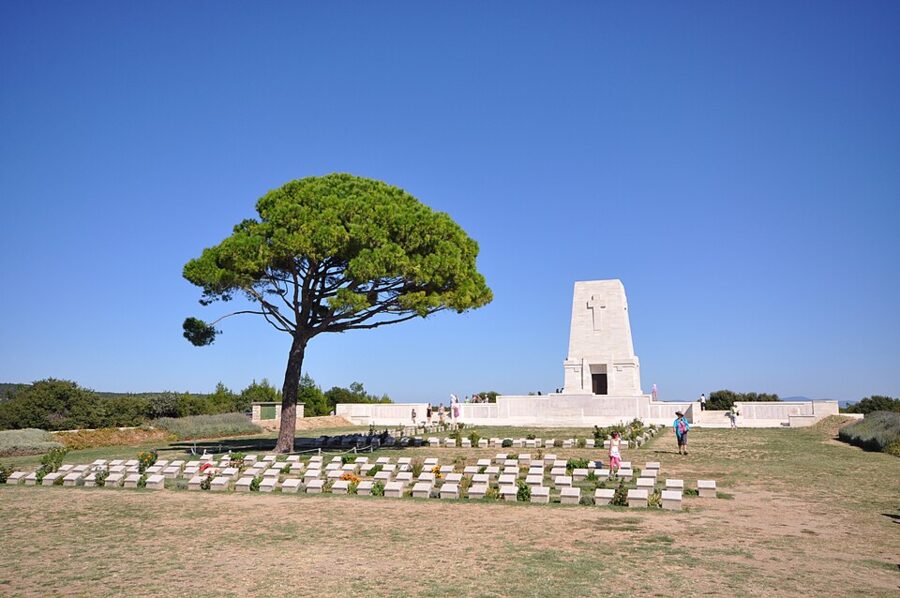

The attack of 6 August was a diversion for the push on Chunuk Bair. Australian infantry crossed open ground in the late afternoon, found the Ottoman trenches roofed with pine logs, broke in and fought underground for four days; seven Australians won the Victoria Cross. The Turkish name, Kanlısırt, means Bloody Ridge, and the Ottoman 16th Division lost 1,520 dead and 4,750 wounded holding it, by the directorate’s count.

Walk to the edge of the cemetery and look toward the road: the trench lines show as shallow dips in the scrub. The memorial stands where the 16th Division raised its own monument in 1916, demolished during the postwar occupation when the Australian one was built; a Turkish inscription stone by the road at the east end of Kanlısırt tells the August fighting from the other side.
Johnston’s Jolly and Quinn’s Post
From Lone Pine the road climbs north along what the Anzacs called Second Ridge, with the old front lines beside it. Johnston’s Jolly Cemetery, on the right, lies in the no man’s land of the ridge the Turks called Kırmızısırt (Red Ridge); it holds 181 men, 141 unidentified, with trenches from both sides around it.
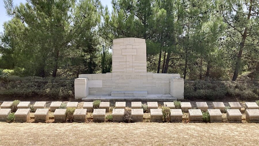

Further up are Courtney’s and Steel’s Post and Quinn’s Post, the most exposed points of the Anzac line, where the trenches were only meters apart. Quinn’s Post Cemetery holds more than 400 men, nearly three quarters unidentified. The Turkish name for the hill, Bomba Sırtı, Bomb Ridge, says how they died.
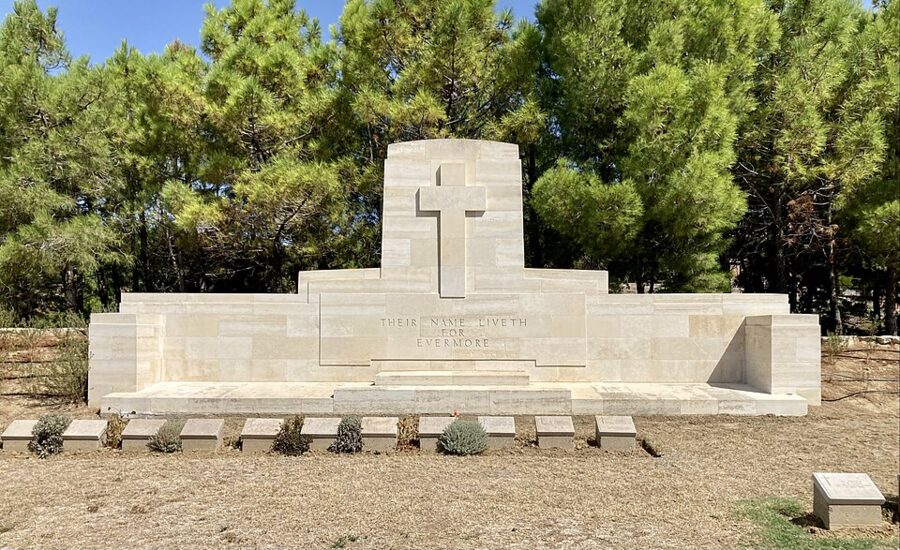

The 57th Regiment memorial
Just up the road is the most visited Turkish site in the north, the 57th Infantry Regiment cemetery and memorial. The 57th met the Australians on the morning of 25 April and threw them back from the high ground, and the order associated with that morning (“I do not order you to fight, I order you to die”) is quoted all over Turkey.
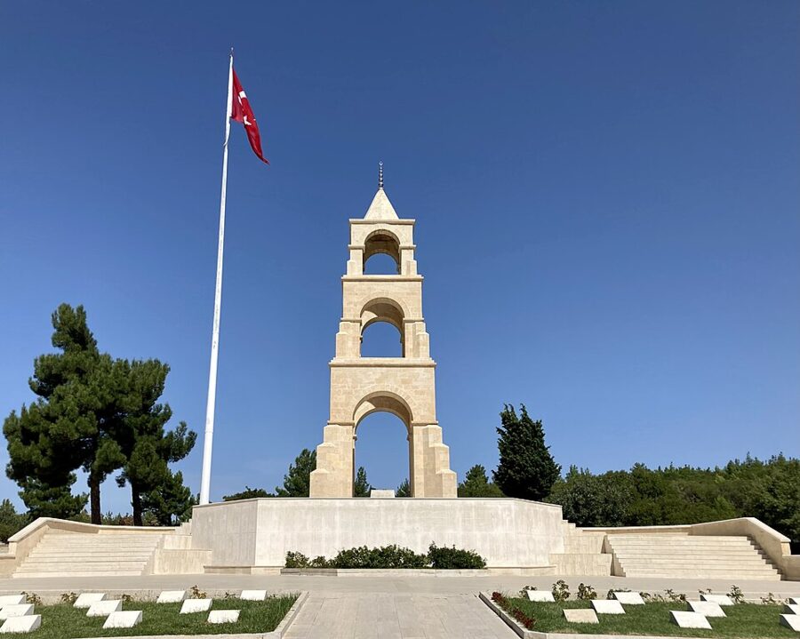

This cemetery is symbolic. The regiment’s real dead lie in the Çataldere valley below Bomba Sırtı, and the stones here stand for them. At the entrance is a bronze of Hüseyin Kaçmaz, Turkey’s oldest war veteran when he died in 1994 at 108, holding his grandchild’s hand; a 45 m² relief on the east wall shows the regiment’s counterattack.
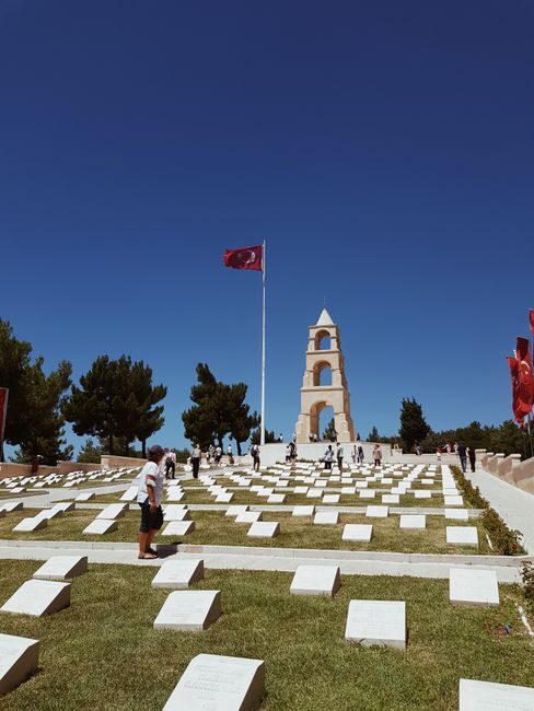
Kesikdere cemetery, in the valley to the right, is reached by granite steps and lists 1,115 identified men of four regiments. It is also symbolic: the trenches here were so close that men were buried where they fell, and the directorate treats the whole valley as a cemetery.
The Nek and Mehmet Çavuş
The Nek is a neck of ridge about 30 m wide. Early on 7 August four waves of the Australian 8th and 10th Light Horse charged across it on foot, timed to support the New Zealand attack on Chunuk Bair. The bombardment ended seven minutes early, the Ottoman trenches were full and ready, and the waves were cut down within meters.
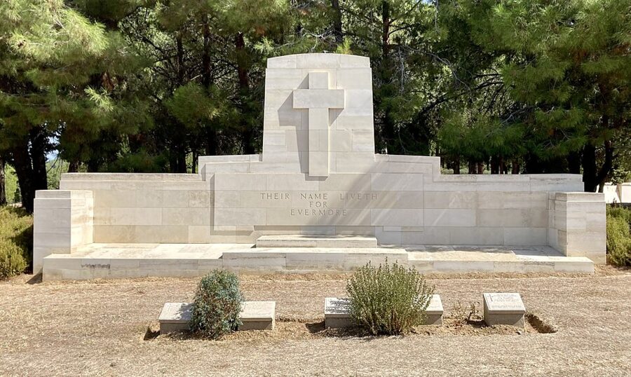

The Turkish name for the spot is Cesaret Tepe, Courage Hill, after Sergeant Mehmet Çavuş and his 25 men, who kept fighting here after their ammunition ran out. Their memorial of 1919 is the only one of three Ottoman victory monuments on this front that survived. From its terrace you see the Suvla plain to the north and the Sphinx to the southwest, which explains why both armies fought so hard for this ridge.
Chunuk Bair (Conkbayırı)
Chunuk Bair is the high point of the ridge, 3.3 km up from Lone Pine. New Zealanders of the Wellington Battalion under Lieutenant Colonel William Malone took the summit at dawn on 8 August and held it all day under heavy fire; Malone was killed that afternoon, and on 10 August an Ottoman counterattack led by Mustafa Kemal swept the survivors off. It was the closest the campaign came to its objective.
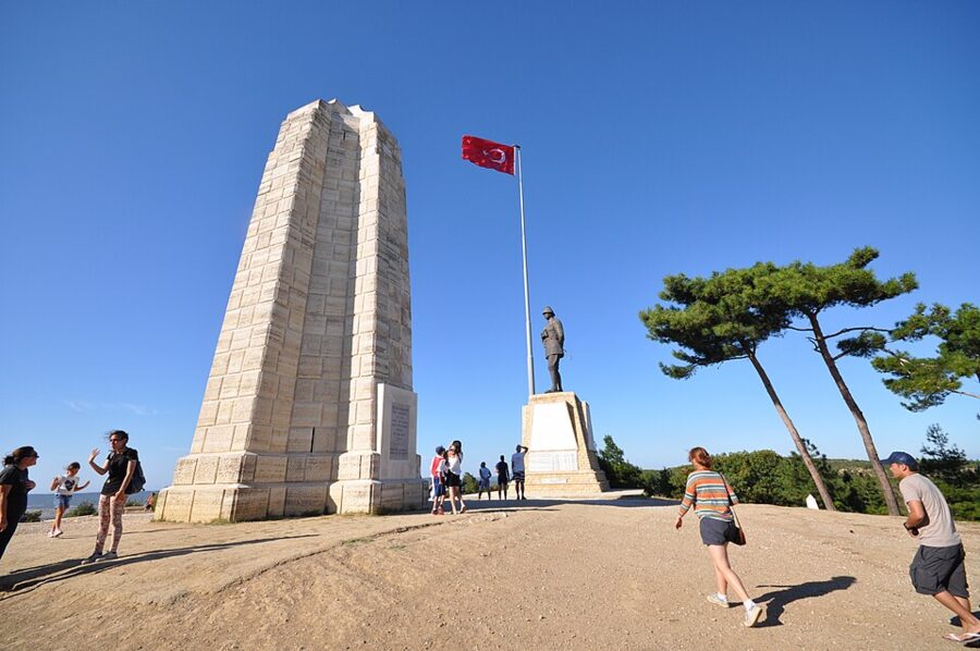

Both armies are remembered on the summit within a few meters of each other. The New Zealand memorial went up in 1925; a low wall nearby carries 856 names of New Zealanders with no known grave, and the cemetery holds 632 men, only ten identified. Ottoman soldiers buried many of them after the battle, and those graves became the cemetery.
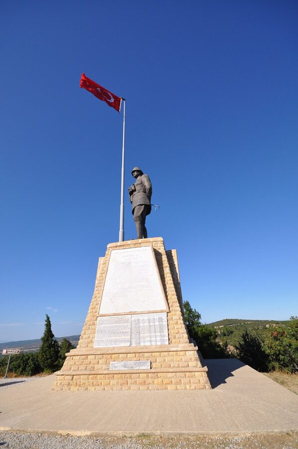

On a clear day the view takes in Anzac Cove, the Suvla plain and the Dardanelles on the far side, and shows in one turn of the head why whoever held this hill held the peninsula.
Suvla and Hill 60, if you have wheels
North of Chunuk Bair the road drops to the Suvla plain and its salt lake, where the British IX Corps landed on 6–7 August with the 10th (Irish) Division behind it; the Newfoundland Regiment served here from September. Green Hill Cemetery holds 2,971 men, mostly unidentified. This is the least visited part of the peninsula, and you need a car or bike.

The southern area: Kilitbahir to Cape Helles
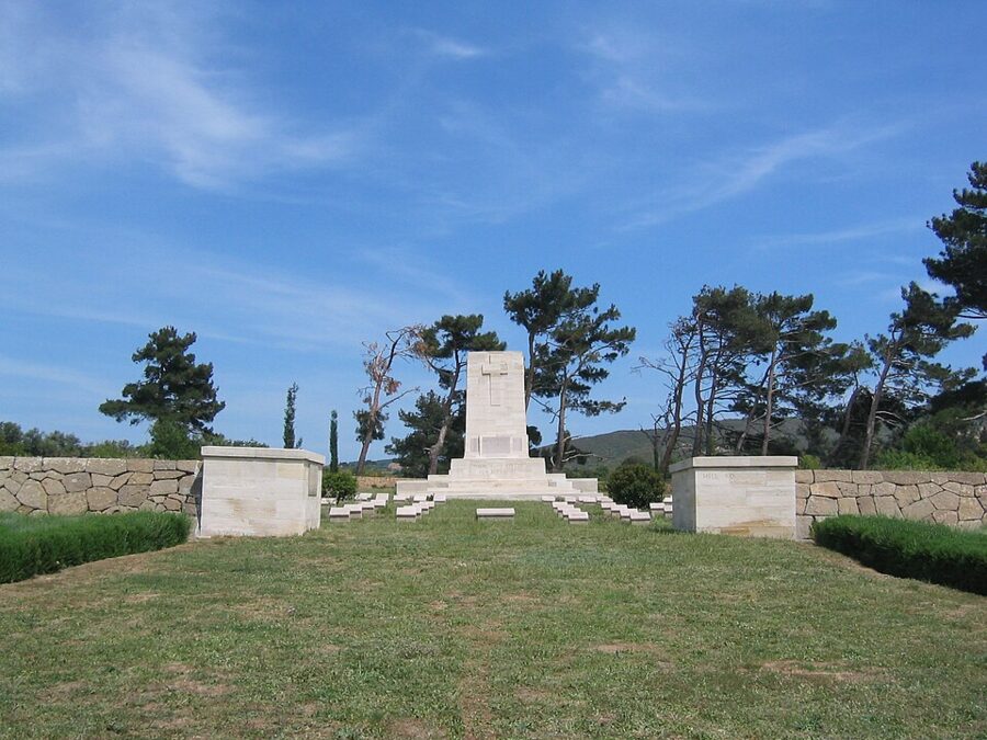
The south is a different trip. The road from Eceabat follows the strait past Kilitbahir, then crosses farmland to the Turkish memorial at Morto Bay and the British and French sites at the tip, 31 km from Eceabat to the Helles Memorial. Turkish visitors fill this end, and Anzac-focused tours often leave it out, so ask before you book.
Kilitbahir, the Dur Yolcu verse and Seyit Onbaşı
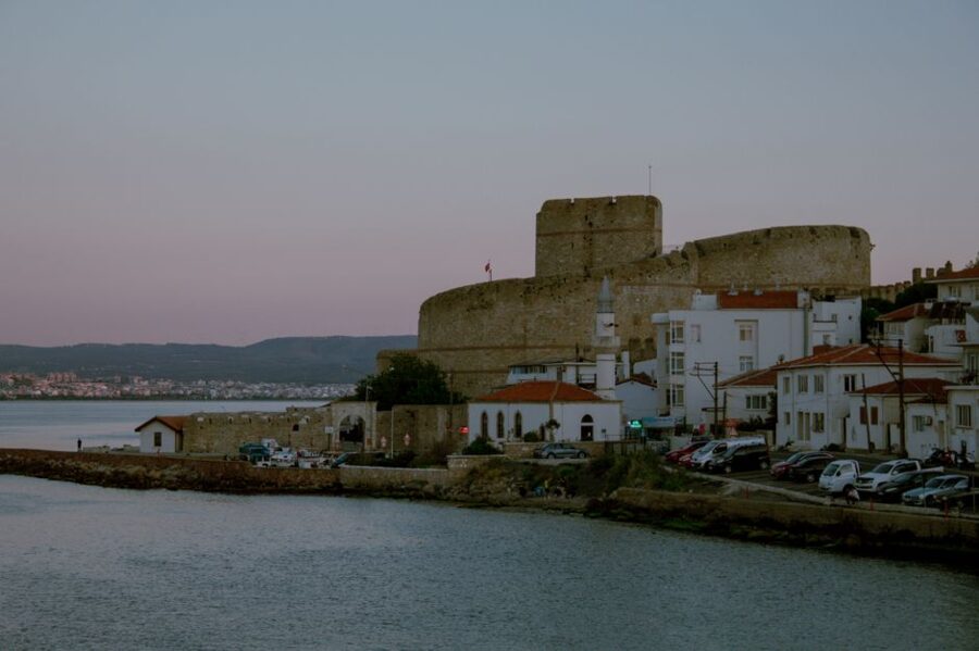
Kilitbahir, 5 km south of Eceabat, is a fishing village under one of the two castles Mehmed II built facing each other across the narrowest point of the strait in the 1460s. The other is in Çanakkale, and together they controlled every ship heading up the Dardanelles. The castle museum charges 200 TL and closes on Mondays.
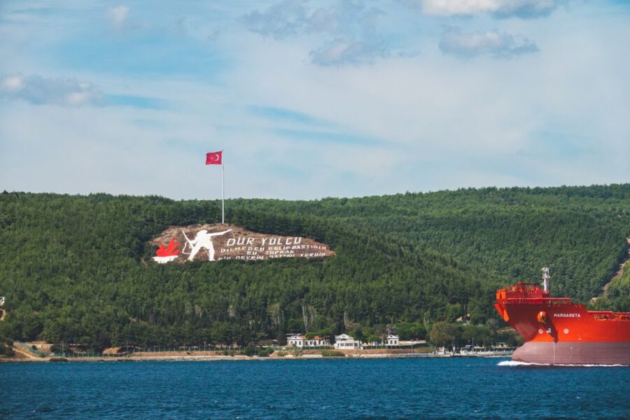
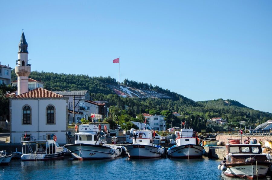
On the hillside behind the Değirmenburnu battery, huge letters spell out the opening of Necmettin Halil Onan’s poem “Bir Yolcuya” (To a Traveler) beside a soldier and a torch. A conscript, Seyran Çebi, laid them out in 1960 during his military service. The place was well chosen: this plateau and the strait below it were the whole object of the campaign.
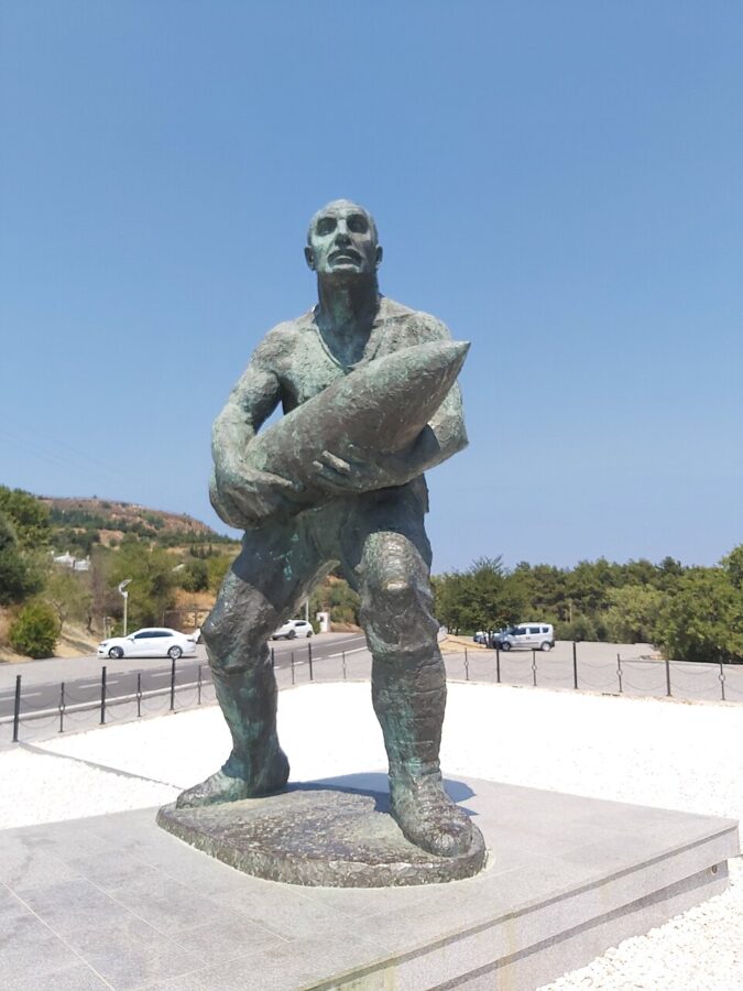
Just south of the village is the Rumeli Mecidiye Bastion, one of the batteries that fought the fleet on 18 March, and the statue of Seyit Onbaşı (Corporal Seyit). The story is that when his gun’s loading crane was knocked out, he carried a shell up on his back; the shell is usually given as 215 kg, though some accounts say 276. Which ship his shot hit is argued over, and the mines did most of that day’s damage, but it is the best-loved story of the naval battle in Turkey.
Alçıtepe (Krithia)
Alçıtepe is the village the British called Krithia, the objective of three failed attacks in 1915. Here the directorate has built a 1915 trench and Red Crescent hospital reenactment area, a reconstructed stretch of front-line trench and an Ottoman field hospital, for 150 TL. It shows what a front line looked like at ground level, which the grassed-over trenches elsewhere cannot.
The Çanakkale Martyrs’ Memorial
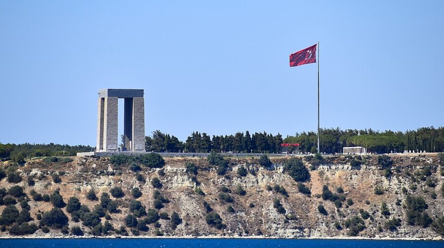
The Çanakkale Şehitler Abidesi stands on the Eskihisarlık headland above Morto Bay. It is the most visited place on the peninsula, and on spring weekends the car parks fill with coaches from all over Turkey. The design won a competition of 37 entries; building began in 1954 and it opened on 21 August 1960, its four legs meant to show the dead of every region rising together.
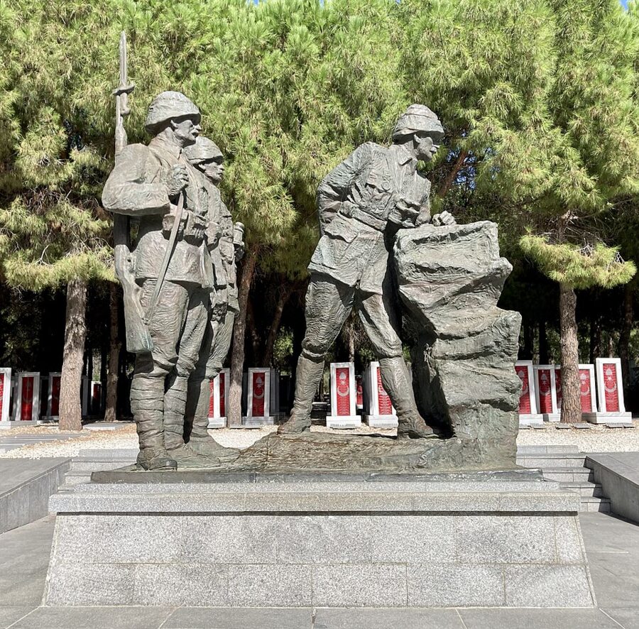

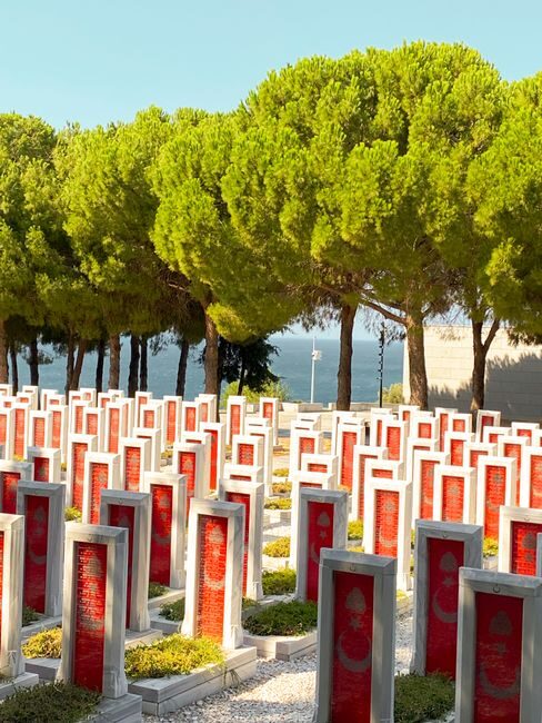
Behind it, the symbolic cemetery opened in 2007 carries the names of the 59,408 Ottoman soldiers identified so far. A 45 m relief runs in front of it, beginning at an unknown soldier’s tomb and a marble tablet of the same 1934 words that stand at Anzac Cove. Nearby is the grave of an Ottoman soldier’s skull, taken to Australia by an Anzac during the campaign, handed back in 2003 and buried here on 18 March that year.
The French war cemetery
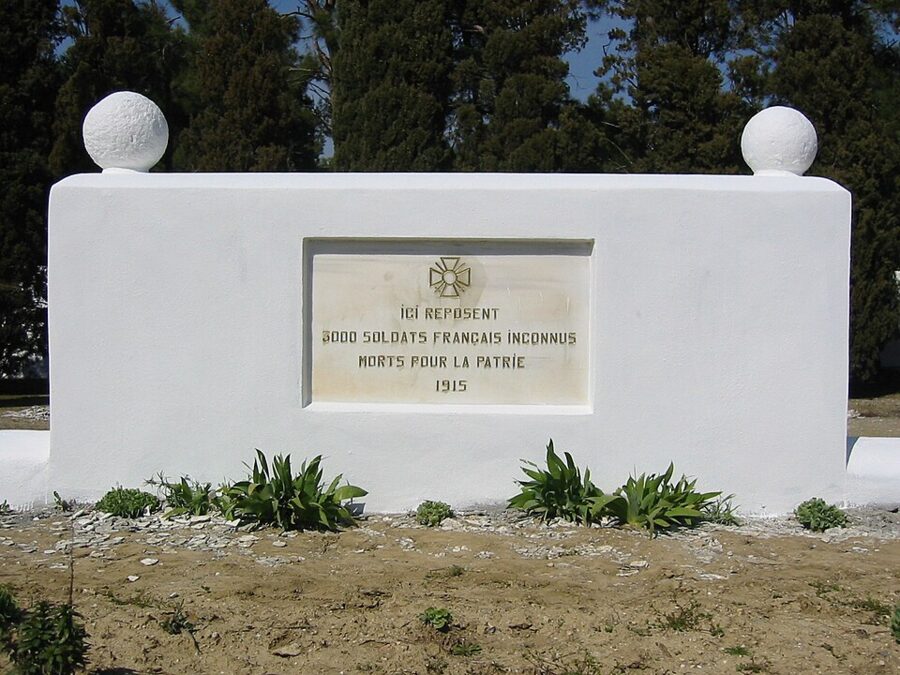
A short side road leads to the French cemetery on the slope above Morto Bay. It gathers the graves of four wartime French cemeteries and the dead of the French hospital on Lemnos, many of them colonial soldiers from Algeria, Morocco and Senegal. General Gouraud, who commanded the French force until he lost an arm here, opened it on 9 June 1930, and it is usually empty.

Seddülbahir, V Beach and the River Clyde
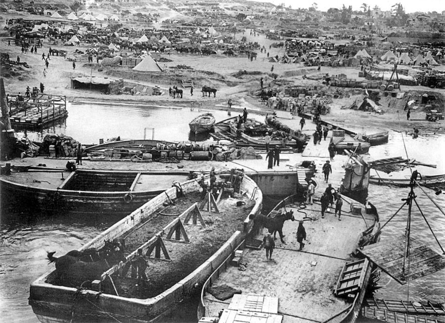
Seddülbahir village sits at the tip above its 17th-century castle, taken by the British on 26 April and now a free museum. Below it is V Beach, where the main Helles landing came ashore. The collier SS River Clyde was run aground here with doors cut in her sides so 2,000 men could pour out down gangways; machine guns caught them as they came out, and the boats alongside filled with dead and wounded.
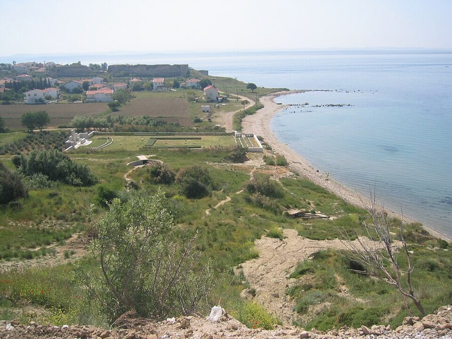

V Beach Cemetery, almost at sea level under the old Ertuğrul battery, holds 696 men. On the hill above is the grave of Lieutenant Colonel Charles Doughty-Wylie, shot on 26 April leading the attack up from the beach carrying only a cane, and awarded a posthumous Victoria Cross; it is the only individual Allied grave on the peninsula.
Opposite the Ertuğrul battery is the Yahya Çavuş memorial, to the Ottoman defenders of the same shore. One battalion of the 26th Regiment held about 5 km of beaches on 25 April; when a company commander fell, Sergeant Yahya from Ezine took charge, and the defense kept the British 29th Division off the high ground that day. The memorial lists 148 names and keeps a stretch of the Ottoman trench.
Cape Helles Memorial and Lancashire Landing
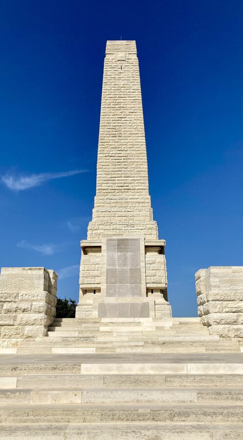
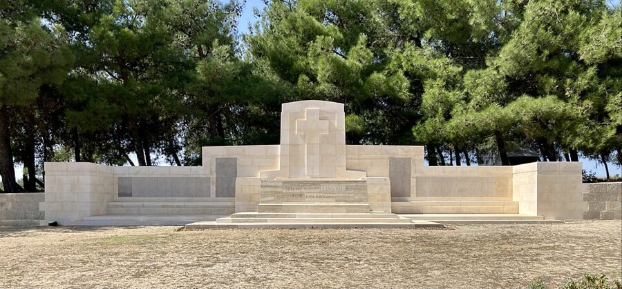
The Helles Memorial, a 32.9 m obelisk on the headland at the tip, is visible from every ship entering the strait. It is the memorial to the whole campaign and carries 20,763 names of British, Indian and other Commonwealth servicemen with no known grave, including those lost at sea. Australians who died at Helles in the Krithia attacks are named here too.

Lancashire Landing Cemetery is about 500 m inland from W Beach, where the 1st Lancashire Fusiliers came ashore on 25 April and lost about 600 of their 1,000 men. Six were awarded the Victoria Cross for that morning, the “six VCs before breakfast”; one, William Keneally, is buried among the cemetery’s 1,236 graves.
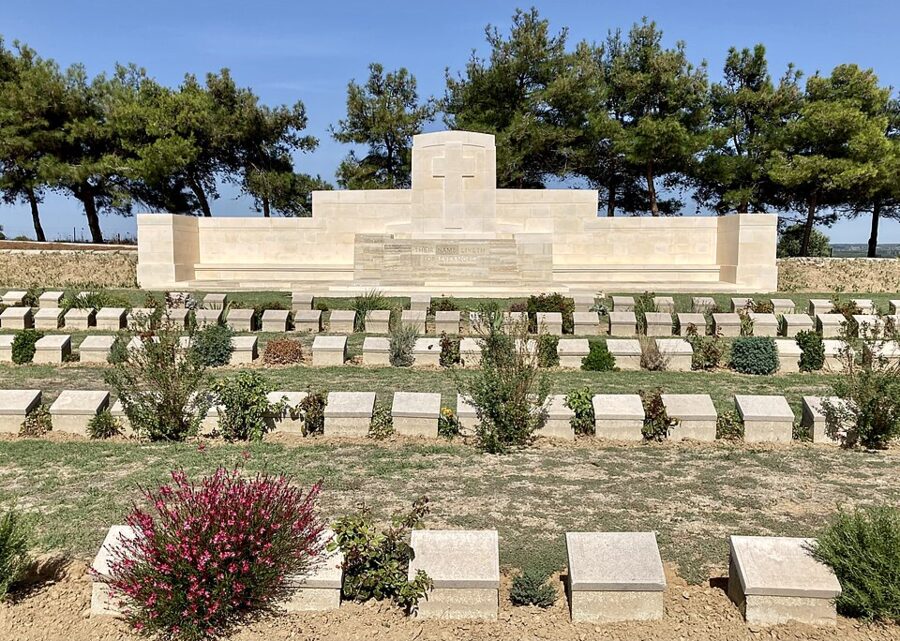

With time for one more stop, make it Twelve Tree Copse, inland toward Alçıtepe. It is the largest British cemetery on the peninsula, with more than 3,300 men from the Krithia battles, most unidentified.

Getting around: ferries, tours, cars and bikes
The practical problem in one line: there is no public transport from Eceabat or Çanakkale into the historic area, and the Australian government’s Anzac Day guidance says so in as many words. That leaves a tour, a hire car, a bike, or your feet plus a short taxi ride to the start.
The Dardanelles ferries
The wider ferry picture is in the guide to getting around Turkey. For Gallipoli you need two routes, both run by the Çanakkale ferry company Gestaş, both 40 TL for a foot passenger; the Eceabat crossing takes about 25 minutes and the Kilitbahir boat less.
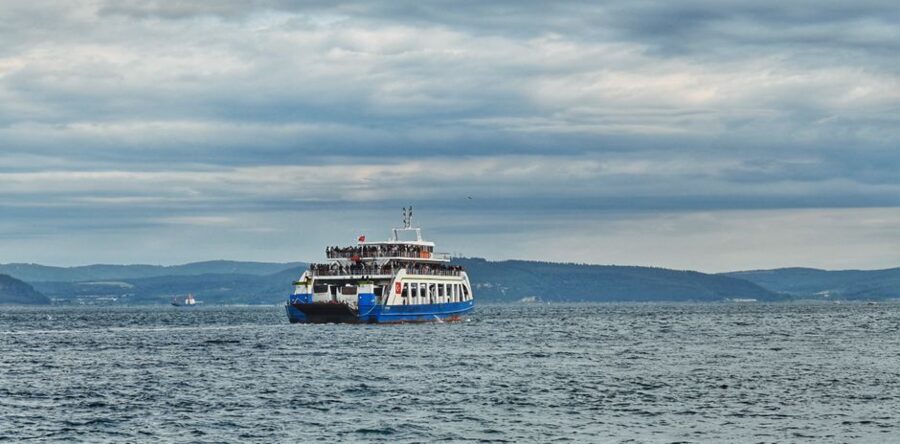
| Route | From Çanakkale | Back to Çanakkale | Fares (late 2026) |
|---|---|---|---|
| Çanakkale to Eceabat (car ferry) | hourly 07:00–23:00, then 01:00, 03:00, 05:00 | about hourly 07:15–22:00, then 00:00, 02:00, 04:00, 06:00 | foot 40 TL; car with up to 7 people 725 TL; same-day car return 1,090 TL |
| Çanakkale to Kilitbahir | every 30–60 minutes, 07:30–22:30, plus midnight | every 30–60 minutes, 07:30–23:00 | foot 40 TL; same-day car return 1,075 TL |
Boats leave off-timetable when the car queue is long, and stop in storms. Gestaş posts changes on its site and pushes live updates through its app and a WhatsApp channel, worth following if you have an early pickup on the other side.
Choosing a tour
Gallipoli is one of the few places in Turkey where I would pay for a tour; the question is which. Tours leave from Çanakkale (crossing on the ferry) and Eceabat, as half-day afternoon trips around the Anzac area or full days that include the south. Day trips from Istanbul exist, but they mean about 640 km of road for a few hours on the ground.
- A licensed field guide. Guiding inside the historic site is restricted to holders of the directorate’s field guide card (alan kılavuzu) with the current year’s sticker; ask to see it. The directorate’s floor fee for these guides in 2025 was 1,800 TL per tour for up to 13 people and 2,950 TL above that, a fair yardstick for a private guide before transport.
- Group size. A coach of 45 at Lone Pine is a different visit from a minibus of 12. Ask for the maximum, not the average.
- Whose story. Tours sold to Australians and New Zealanders often skip Helles and the Turkish memorial at Morto Bay; Turkish-language şehitlik turu trips focus on the Turkish memorials and give the Commonwealth cemeteries a passing stop. Know which you are buying.
- What is included. Ask in writing about the Martyrs’ Memorial, Helles and Kilitbahir, the hours on the ground, lunch, the Tanıtım Merkezi ticket and the ferry.
- Cancellation. Ferries stop in bad weather, and a tour that cannot cross should refund you.
Mixing works well: an Anzac-focused afternoon tour from Eceabat on day one, then the Kilitbahir ferry on your own the next morning for the castle and the Seyit Onbaşı bastion.
Hire car, bike or on foot
Split three or four ways, a hire car from Çanakkale is the cheapest way to see everything. Take it over on the Eceabat ferry (725 TL one way, 1,090 TL for a same-day return), do the Anzac area in the morning and the south in the afternoon, and park only in the marked bays on the ridge road.
| By road | Distance |
|---|---|
| Eceabat ferry to the Kabatepe visitor center | 8.5 km |
| Eceabat to Anzac Cove | 12 km |
| Anzac Cove to Lone Pine (3.2 km on foot up Artillery Road) | 5.7 km |
| Lone Pine to Chunuk Bair | 3.3 km |
| Eceabat to Kilitbahir | 5 km |
| Kabatepe to the Çanakkale Martyrs’ Memorial | 20.5 km |
| Eceabat to the Helles Memorial | 31 km |
| Martyrs’ Memorial to the Helles Memorial | 5 km |
By bike, the Anzac loop from Eceabat (Kabatepe, the coast, up the ridge to Chunuk Bair and back) is about 35–40 km and climbs from sea level to around 260 m, steeply in places: a good day in spring or autumn, a hard one in August. Thousands of riders join the directorate’s Şehitlere Saygı ride each spring (5 April in 2026), when roads in the south close, so check the date.
On foot, take a taxi or tour drop to Kabatepe or Anzac Cove, then the 7 km Arıburnu walking route to Lone Pine and on to Chunuk Bair. Carry water and lunch from Eceabat; I would not count on buying anything on the battlefield.
Anzac Day and 18 March
Two dates change the peninsula completely. On 25 April Australians and New Zealanders hold their dawn service near Anzac Cove; on 18 March Turkey marks the naval victory, and the south fills with officials, soldiers and Turkish visitors. Plan around both, whether you want to be there or not.
The Anzac Day dawn service, 25 April 2027
In 2027 Anzac Day falls on a Sunday. Everyone attending needs a free individual attendance pass, registered online through the Australian Department of Veterans’ Affairs system; a tour booking does not replace it, and your operator cannot register for you. Bring the pass and photo ID (passport or a copy, driving license or national ID card) for the checkpoints on the peninsula.
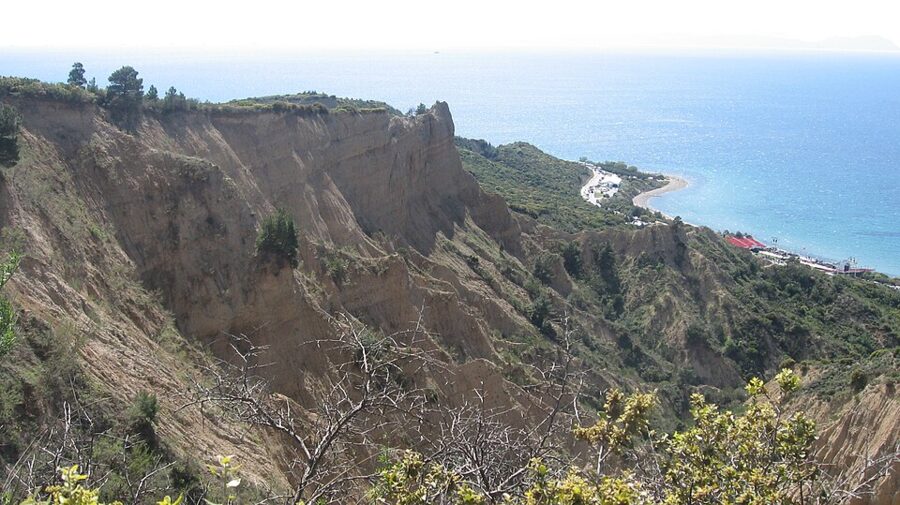

The published 2027 schedule: the site opens at 22:30 on 24 April, the pre-service program starts at 01:30, and the last entry is at 03:00, before the road closes. The dawn service is at 05:30, the Australian service at Lone Pine at 10:00 and the New Zealand service at Chunuk Bair at 11:30, so you can attend only one of the two. Coaches load at Hill 261 near Chunuk Bair from 13:00.
Private cars are not allowed near the site. The only private parking is at Kilye Cove, five minutes north of Eceabat, from about 22:00 on 24 April; shuttles run to Beach Cemetery until the car park closes at 02:45, and the advice is to arrive by 02:30. From there you walk about 1 km to the security screening, and you cannot return to the car until after the service. That is why most people go with a tour coach, booked months ahead.
Expect up to 8 km of walking: 3.2 km up the unpaved Artillery Road to Lone Pine, then 3.3 km uphill to Chunuk Bair. Accessibility shuttles must be requested when you register.
- Bring: warm layers, hat and gloves, a plastic sheet for the damp grass, non-perishable food, walking shoes, and a day pack no bigger than airline cabin size.
- Leave behind: alcohol, glass, cans, liquids over 100 ml, umbrellas (ponchos are handed out), folding chairs, large flags, selfie sticks, tripods and drones. Screening is airport-style and confiscated items are not returned.
- On site: no running water or power, free bottled water, a few Turkish food vendors, portable toilets, phone signal but nowhere to charge.
Turkey marks the same days. On 24 April there is a Turkish ceremony at the Çanakkale Martyrs’ Memorial and British and French ceremonies at Helles and the French cemetery, and around 25 April more than 10,000 young Turks walk the 57th Regiment Loyalty March (57. Alay Vefa Yürüyüşü) from Kocadere to Conkbayırı. Turkish officials attend the dawn, Lone Pine and Chunuk Bair services in turn.
18 March for Turkish visitors
18 March is the anniversary of the naval victory and Turkey’s day of remembrance for the Çanakkale dead, with the state ceremony at the Martyrs’ Memorial. In 2026 the vice president, several ministers and the chiefs of staff attended, warships paraded through the strait and the SOLOTÜRK aerobatic jet flew over. Worth seeing once from the edge of the crowd, if the rest of your day is planned around it.
The south is closed to ordinary traffic that morning. In 2026 the roads from Kilitbahir and Kabatepe to Alçıtepe were under controlled access until 14:00, while the north (the Tanıtım Merkezi road, Conkbayırı, Anzac Cove and the Bigalı Atatürk house) stayed open. Spend that morning in the Anzac area and the afternoon in the south. Smaller ceremonies fall on 10 August at Conkbayırı, for the Anafartalar victory, and on 3 November at Seddülbahir, for the first dead of the 1914 naval bombardment.
Çanakkale and Eceabat as bases
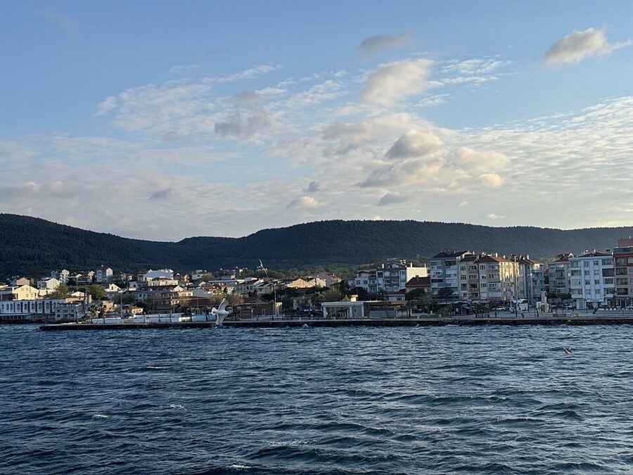
Both work. Çanakkale, on the Asian shore, is a lively university town with buses everywhere, cheap food and the ferries at the bottom of the main street. Eceabat, on the European side, is small and quiet, with far fewer beds and restaurants but a 12 km head start on the battlefield.
Çanakkale
On the classic loop, sleep in Çanakkale. Istanbul coaches arrive at the otogar about 5 km east of the ferry pier, with city buses and dolmuşes into the center, and the onward coaches south leave from the same otogar. The ferry, the tour offices, cheap hotels and the waterfront are all a few minutes’ walk from the pier.
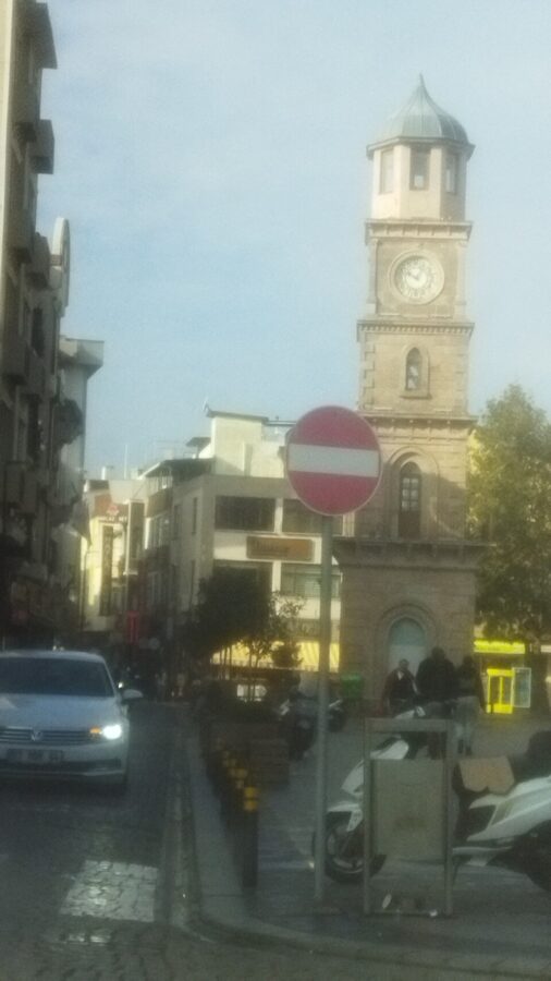
Dorm sleepers have a problem: the dorms have gone. In November 2026 the main hostel booking platform listed one property in Çanakkale, with no dorm beds and private rooms from about €30 a night. Treat that as the floor outside Anzac Day week, and split it if you can.
The Anzac Hotels group runs three hotels (Anzac Hotel, Grand Anzac Hotel and Comfort Anzac Hotel) within 50 m of each other and about 100 m from the ferry pier, and was taking guests through October 2026. Book weeks ahead for 18 March and months ahead for 25 April, when everything near the strait fills early.
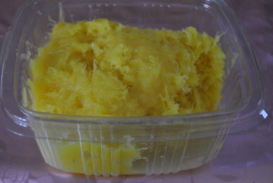
Eat on the Kordon, the waterfront either side of the pier, or in the lanes behind the clock tower. Try peynir helvası, the local cheese halva of unsalted fresh cheese, semolina or flour and sugar, baked until the top browns and served warm. Pide, köfte and fish sandwiches cover the budget meals, and prices drop a street or two back from the sea.

Eceabat
Eceabat is the better base if your tour starts there, you want an early start on the Anzac area, or you simply like a quiet town by the water. The ferry pier and the main square are in the middle, and some Istanbul coaches stop here before crossing, so you can go straight to the peninsula without going into Çanakkale first.
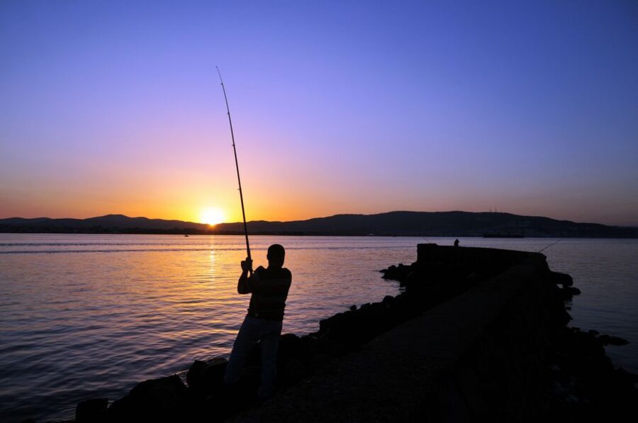
The catch is the choice of beds and food. Eceabat has only a handful of small hotels and pensions, and names from older guidebooks are not a safe bet, so book only where you can see recent guest reviews and live dates. Food is simple: a few lokantas and cafés around the square and along the water.
Troy and the next move
Most people pair Gallipoli with Troy, about 30 km south of Çanakkale on the Asian side and an easy half day by dolmuş. Do the battlefields first, while you have the legs for the walking, and Troy on the morning you leave; coaches run south toward İzmir and Selçuk through the day, so you can be on the road by mid-afternoon.
Whatever you do, buy nothing more than the 40 TL ferry ticket until you have decided how you are getting around on the other side. The cemeteries will not charge you; the distances will.