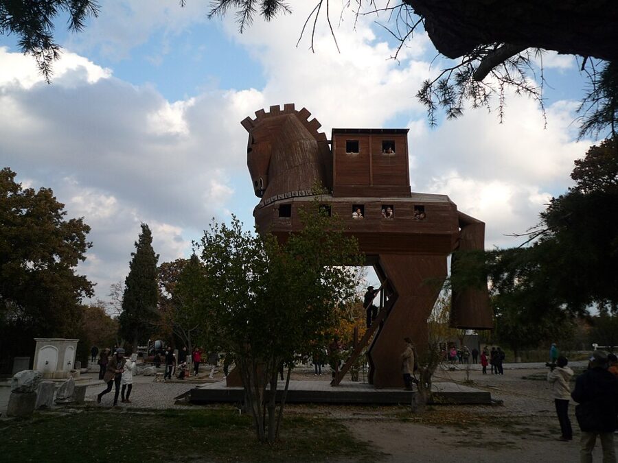
Twenty-seven euros buys you the most famous name in archaeology and, for a lot of people, the biggest letdown of a Turkey trip. The ticket covers the ruins of Troy and the Troy Museum beside them, a minibus from Çanakkale gets you there for 150 TL, and what waits at the end is a grassy hill cut through with trenches, walls from nine different cities, and a wooden horse built for tourists.

The letdown is avoidable. Troy disappoints people who arrive expecting a city and finds a soft spot in people who arrive knowing they are walking through a 3,000-year cross-section. The difference is about an hour and a half spent in the right order: the museum first, then the mound.

Done on your own, Troy costs the ticket and two minibus fares, and one more day buys you two quieter Greek cities down the coast, Alexandria Troas and Assos. Prices and hours here are the ones the Ministry of Culture and the operators listed in November 2026.


Contents
- Troy in numbers
- The problem with Troy, and how to read it
- The legend against the evidence
- Who dug Troy, and what they broke
- Go to the Troy Museum first
- Walking the site
- Getting to Troy from Çanakkale
- Çanakkale: where you sleep and eat
- Alexandria Troas: the city people mistook for Troy
- Assos: a temple above the sea
- Two days around Troy
- The road south
Troy in numbers
The site and the museum share one ticket and one set of hours, and the hours shrink in winter.
| What | Detail (November 2026) |
|---|---|
| Ticket | €27 at the foreigners’ rate, covering both the archaeological site and the Troy Museum |
| Hours from 1 October | 08:30–17:30 daily, ticket office closes 17:00; longer hours in the summer season |
| Closing day | None, open every day |
| Distance | About 30 km south of Çanakkale, at the village of Tevfikiye |
| Getting there | Village minibus from Çanakkale, 150 TL each way in 2026 |
| Last minibus back | 17:30 from Troy on the timetable in force from 1 November 2026 |
| Time needed | 1.5–2 hours in the museum, about 2 hours on the site |
| Audio guide | Available at both, per the ministry listing |
Both the museum and the site are run by the Ministry of Culture and Tourism, which prices foreigners in euros at the counter.
The problem with Troy, and how to read it
Troy is not a ruined city in the way Ephesus is. It is a tell, a hill made of settlements stacked one on another, and every layer was partly demolished by the one built on top. When people complain that “there’s nothing there”, what they mean is that there is too much there, all at once, and none of it complete.
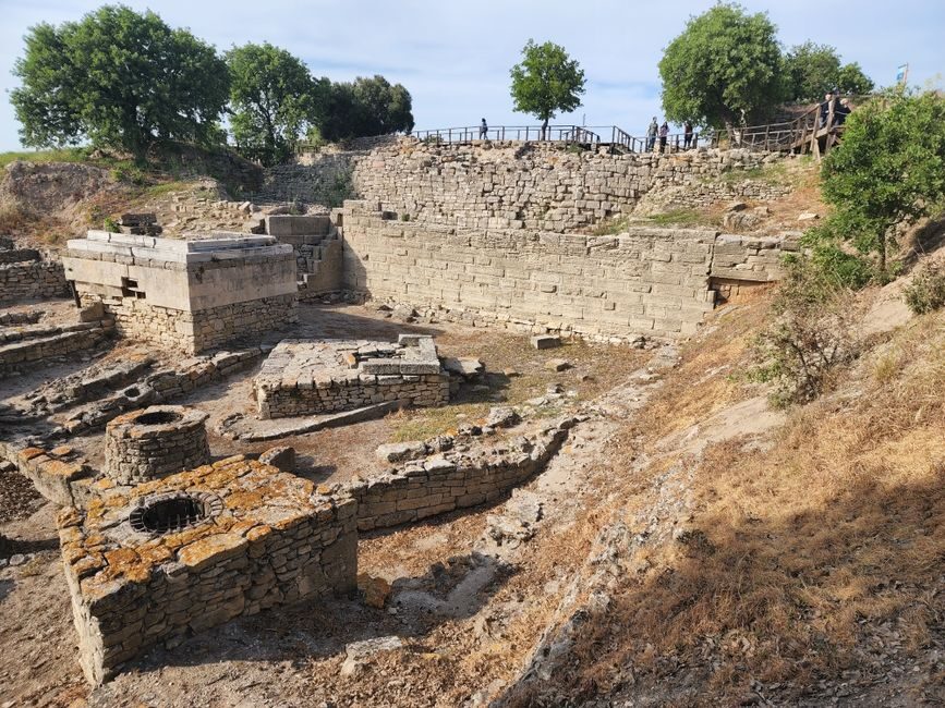
Archaeologists number the cities from the bottom up, Troy I to Troy IX, with letters for sub-phases. Learn the four that matter (II, VI, VIIa and IX) and the boards on the site start to make sense.
Nine cities in one hill
| Layer | Dates (approximate) | What it was | What you can see |
|---|---|---|---|
| Troy 0 | c. 3600–3500 BC | Traces claimed by the current Turkish dig | Nothing visible |
| Troy I | c. 3000–2550 BC | Small fortified village on a lagoon shore | Walls deep in Schliemann’s trench |
| Troy II | c. 2550–2300 BC | Rich citadel with big megaron halls; the “Priam’s Treasure” layer | The stone ramp, the roofed megaron |
| Troy III–V | c. 2300–1750 BC | Smaller, poorer settlements | Very little; Schliemann dug most of it away |
| Troy VI | c. 1750–1300 BC | Late Bronze Age citadel with a large lower town | The great sloping walls, towers, gates, houses |
| Troy VIIa | c. 1300–1180 BC | Rebuilt, crowded city, destroyed by fire | Small houses squeezed against the Troy VI walls |
| Troy VIIb | c. 1180–950 BC | Shrinking town after the Bronze Age collapse | Little beyond the reused walls |
| Troy VIII | c. 700–85 BC | Greek Ilion, a pilgrimage town around a temple of Athena | Temple foundations, the sanctuary |
| Troy IX | 85 BC–c. AD 500 | Roman Ilium, favored by emperors | The Odeon, the council house, columns |
Two things follow from the table. First, the Greek and Roman builders flattened the top of the hill to lay out their temple, so the highest point, where a Bronze Age palace would have stood, is gone. Second, the parts that look most “ancient Greek” to a modern eye, the columns and the theater seats, are the youngest things on the site.
Which Troy is Homer’s
If the Trojan War happened at all, it belongs to the end of Troy VI or to Troy VIIa, the city of roughly 1300 to 1180 BC. Troy VI ended around 1300 BC in collapsed masonry and subsidence that looks like an earthquake. Troy VIIa ended around 1180 BC in a fire, with scorch marks in the destruction layer. Both are candidates, and scholars still argue about which, if either, an epic poet some five centuries later was remembering.
The legend against the evidence
The story is simple enough. Paris, a son of King Priam of Troy, takes Helen from her husband Menelaus of Sparta; the Greeks sail over, besiege the city for ten years, and finally get in hidden inside a wooden horse. The Iliad, the epic poem attributed to Homer and usually dated to the 8th century BC, covers a few weeks in the tenth year of the siege. It ends with the funeral of Hector, before the city falls.
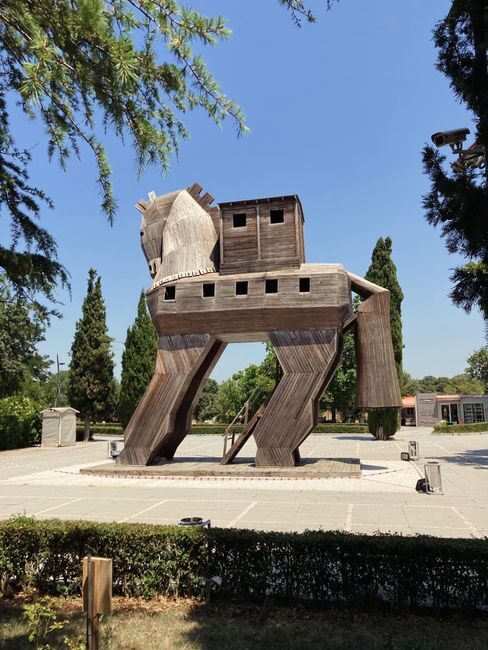
The most famous image of the war is barely Homer’s. The horse turns up in passing in the Odyssey, and the version everyone knows, with the priest Laocoön warning about Greeks bearing gifts, comes from the Roman poet Virgil in the 1st century BC.
What the Hittite archives add
The best outside evidence is not Greek at all. Clay tablets from Hattusa, the Hittite capital in central Anatolia, mention a kingdom called Wilusa and a place called Taruisa in the northwest. Since 1924 scholars have linked those names to the Greek Wilios (later Ilion) and Troia, and most now accept that Wilusa was Late Bronze Age Troy.
The tablets show Wilusa as a vassal of the Hittite king, with rulers named Kukkunni and Alaksandu (a name that sounds a lot like Alexandros, Paris’s other name in Homer). One treaty required Alaksandu to read its text aloud three times a year, so someone at Troy could read. Later letters mention a Wilusan king named Walmu being deposed, and trouble stirred up in the region by people the Hittites called Ahhiyawa, which most historians read as Mycenaean Greeks.
That is as close as the evidence gets. The Hittite texts never describe Greeks besieging Wilusa, and the historian of the Hittites Trevor Bryce has warned that the thinner the material, the easier it is to bend toward whatever conclusion you want. A fair summary: Troy was real, rich and fought over, and a war there is plausible; Achilles, Helen and the horse are poetry.
What Troy really was
The more interesting story is the one the dig has confirmed. Troy sat at the mouth of the Dardanelles, the narrow passage between the Aegean and the Black Sea, at a time when its harbor was a bay that has since silted into farmland. Troy VI traded with Mycenaean Greece, Cyprus and the Levant, and kept horses, the first on the site. It was a regional capital, not a village, and that is the reason anyone would have wanted to take it.
By Greek and Roman times the legend was already the main attraction. The Persian king Xerxes sacrificed a thousand cattle to Athena here on his way to invade Greece, according to Herodotus. Alexander the Great came in 334 BC, sacrificed at the tombs said to belong to Achilles and Patroclus, and declared the town free of taxes. The Romans, who claimed descent from the Trojan prince Aeneas, rebuilt it in style.
Who dug Troy, and what they broke
For most of the modern era nobody agreed where Troy was. Travelers in the 16th and 17th centuries took the ruins of Alexandria Troas, 20 km to the south, for Homer’s city. In the late 18th century the favorite candidate was a hill near Pınarbaşı, a few kilometers south of the real site. The Scottish journalist Charles Maclaren argued for Hisarlık in 1822, and in 1855 the British engineer John Brunton dug the first trenches.
Frank Calvert
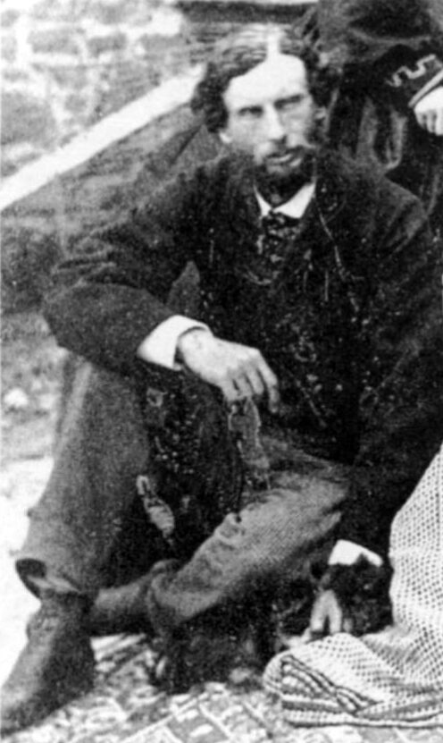
The man who actually found Troy is the least famous name in the story. Frank Calvert, an Englishman whose family lived in the Dardanelles and owned part of the hill, dug test trenches in 1865 and correctly identified Hisarlık with the classical city of Ilion. He suspected Homer’s Troy lay underneath. He did not have the money to prove it.
Heinrich Schliemann and his trench
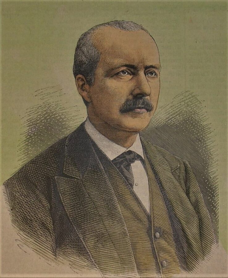
Heinrich Schliemann, a German businessman with a fortune from trade and a fixation on Homer, visited Calvert in 1868 and took over the project. In April 1870 he began cutting a great trench straight across the mound, convinced that Homer’s city must be the oldest and deepest. He dug again in 1871–1873, 1878–1879, 1882 and 1890, the last two seasons with the architect Wilhelm Dörpfeld.
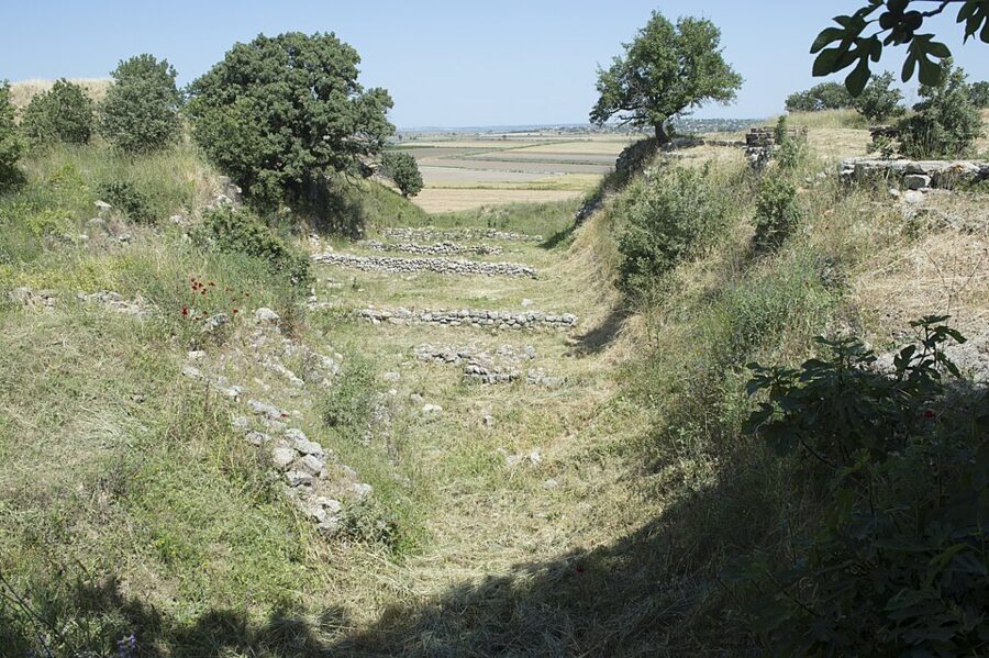

The trench is still there, and it is the best thing on the site for understanding both Troy and its excavator. Schliemann went straight through the layers he thought unimportant, removing walls without recording them. Most of Troy III to V, the settlements of about 2300 to 1750 BC, went onto his spoil heaps, which is why the table above has so little to say about them.
He was also wrong about the answer. Schliemann decided that Troy II, with its grand gate and its burned ruins, was Priam’s city. Later work showed Troy II was about a thousand years too early for any Trojan War. Dörpfeld, who kept digging after Schliemann’s death, argued for Troy VI instead, and Schliemann privately came round to the same view without ever publishing it.
Priam’s Treasure, and where its pieces are now
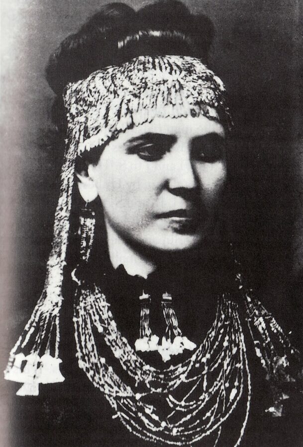
In late May 1873 Schliemann found a cache of gold and silver beside a wall of Troy II: diadems, thousands of tiny gold rings and beads, cups, a silver vase, copper weapons. He named it Priam’s Treasure and told a story of his wife Sophia carrying it away in her shawl. He later admitted Sophia was in Athens at the time, mourning her father, and scholars now think the “treasure” was probably assembled from several finds.
He smuggled it out of the Ottoman Empire. The government sued him, revoked his permit, and jailed the official who was supposed to be watching the dig. Schliemann later handed part of his finds to the Ottomans in exchange for a new permit, and those pieces went to the Istanbul Archaeology Museums. The rest went to Berlin in 1881.
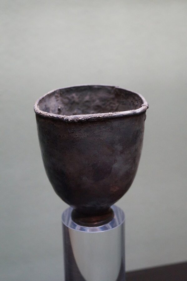

At the end of the Second World War the Red Army took the Berlin collection to Moscow. For half a century the Soviet Union denied knowing where it was; in 1994 the Pushkin Museum admitted it had the gold, and that is where most of it is shown today. One set of 24 gold jewelry pieces from Troy, bought by the University of Pennsylvania’s museum in 1966, was returned to Turkey in 2012 and now sits in the Troy Museum.
Dörpfeld, Blegen and the nine cities
Wilhelm Dörpfeld excavated again in 1893 and 1894 and concentrated on the walls of Troy VI, which Schliemann had cut through without noticing. The American archaeologist Carl Blegen of the University of Cincinnati dug from 1932 to 1938 with modern methods. He set out the nine main cities and divided them into 46 sub-phases, and his sequence is still the backbone of the table above.
Korfmann and the lower town
The biggest change in how Troy is understood came from 1988, when Manfred Korfmann of the University of Tübingen, working with the University of Cincinnati, reopened the dig. His teams surveyed the fields south of the hill and found a defensive ditch cut into the bedrock, with traces of a palisade behind it. Troy VI had a lower town of roughly 30 hectares around the citadel, which made it more than sixteen times bigger than earlier excavators had assumed.
The discovery turned Troy from a small fortified palace into a real city, and it caused a bitter public argument in Germany in 2001 and 2002, when the Tübingen historian Frank Kolb accused Korfmann of inflating the evidence. The ditch is real; how densely the lower town was built up is still debated, because erosion has stripped about 2 m of soil from the fields. Korfmann also found bronze arrowheads and burned human remains in the layers of the early 12th century BC.
Korfmann died in 2005, and his colleague Ernst Pernicka ran the dig until 2012. Since 2014 a team from Çanakkale Onsekiz Mart University under Rüstem Aslan has held the permit; it claims an even older layer, Troy 0, near the Troy II gate. In September 2025 the ministry announced an Early Bronze Age gold ring brooch and a piece of jade from the Troy II levels, both bound for the museum.
Go to the Troy Museum first
This is the single most useful piece of advice for Troy. The museum explains the layers with models, maps and the actual objects, and after it the mound reads like a book instead of a rubble field. The minibus stops nearer the museum than the gate in any case.
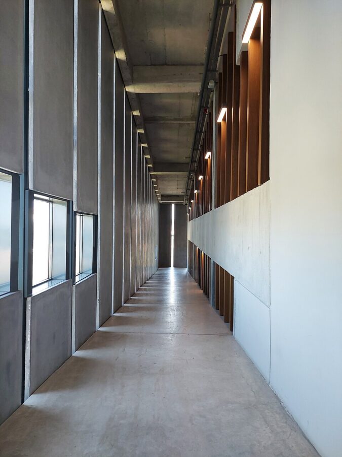

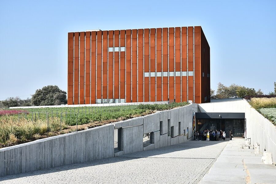
The building is a square block 32 m across, clad in rusting steel so that it looks like something dug out of the ground, and its height matches the depth of the excavation at Troy. It opened on 10 October 2018 and won a special commendation in the European Museum of the Year awards for 2020. Inside, a ramp about 480 m long replaces the stairs, starting with a descent past tombstones and statues; the roof has a viewing terrace.
What is on each floor
- Entrance level: a primer on archaeology, from dating methods to what a tell is. Skim it if you already know, but do not skip the timeline.
- Ground floor: the wider Troad, with finds from Assos, Alexandria Troas, Parion, Tenedos (Bozcaada) and other cities of the peninsula, most of it moved from the old Çanakkale Archaeological Museum. The Troy gold is in a separate darkened room on this floor.
- First floor: Bronze Age Troy, including a display case built in the shape of a ship to make the point about sea trade, and the end of the Late Bronze Age city told with projections.
- Second floor: Homer and the Trojan War, with the Polyxena sarcophagus, a statue of the emperor Hadrian found at Troy in 1993 and a Triton statue from Parion.
- Third floor: the Troad under Byzantine rule, and the “Lost Heritage” room, where you look through viewers at photographs of Troy finds now held abroad.
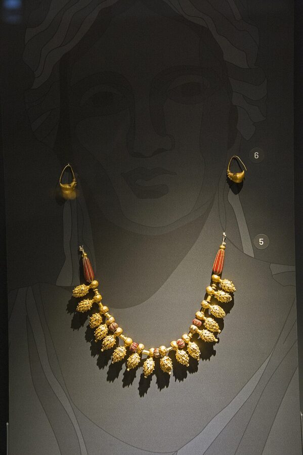

The museum holds tens of thousands of objects and shows a few thousand of them, and it carries no copies: everything is original. Its founding idea was to bring Troy’s finds back from the 44 museums and collections they had been scattered to, which so far has worked for pieces held inside Turkey and the Pennsylvania set, but not for Moscow.
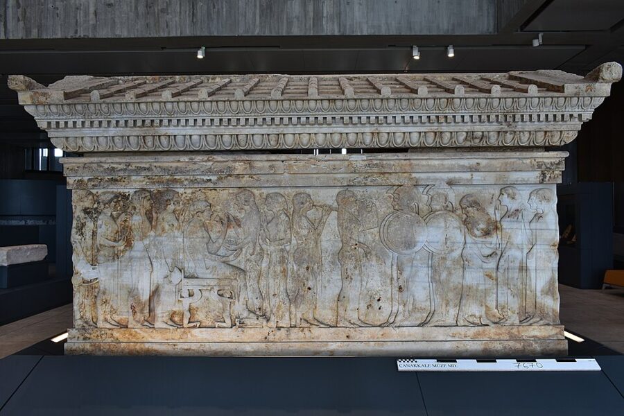

The marble Polyxena sarcophagus is the one object to make sure you see. It shows a scene the Iliad never reaches, the killing of Priam’s daughter at the tomb of Achilles, carved for a local grave some 2,500 years ago. It is a reminder that the legend was already old, and already local, when this coast was Greek.
Tickets, hours and how long to allow
The €27 ticket covers the museum and the site, and you can visit them in either order on the same day. From 1 October 2026 both opened 08:30–17:30, with the ticket office closing at 17:00; the summer schedule, which runs longer, returns in spring. Both are open every day of the year.
Give the museum an hour and a half if you read the panels, two if you like museums. Go up to the roof terrace before you leave for the site, and fill your water bottle: the mound has very little shade.
If you are doing a long loop of Turkey’s ancient sites, the Museum Pass Türkiye may save money; the arithmetic is in the Turkey itinerary. For Troy alone, the single ticket is the cheaper option.
Walking the site
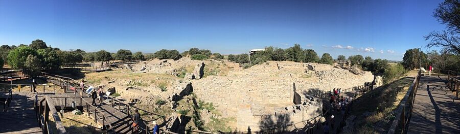
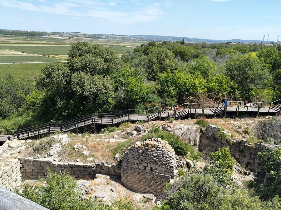
From the museum it is a walk of about 800 m to the site entrance. You go through the turnstiles in the square with the wooden horse, and a marked path loops around and across the mound, partly on dirt tracks and partly on railed boardwalks. Numbered information boards in several languages mark each stop.
The loop is about 2 hours at a reading pace. The order below follows the path from the entrance.
The east wall and the East Gate of Troy VI
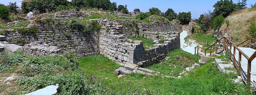

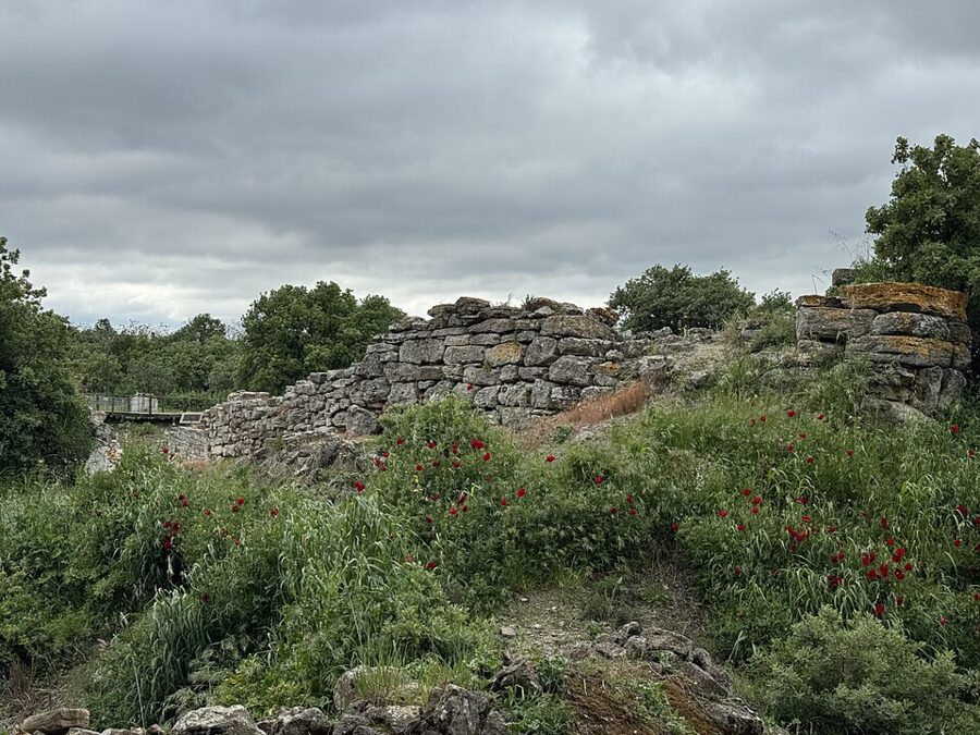
The first thing you meet is the best: the east wall of Troy VI, built of close-fitting limestone blocks on a deliberate slope. It was built in sections of 7–10 m that meet at shallow angles, which gives it a faintly sawtooth line. Around 1400 BC it was thickened to about 5 m, and with its mudbrick upper wall it stood more than 9 m high.
This is the wall people picture when they read Homer, and it is solid, careful masonry with no sculpture at all. Stand in the East Gate passage for a minute. It is about as close as you will get to the Late Bronze Age city.
The Northeast Bastion and the temple of Athena
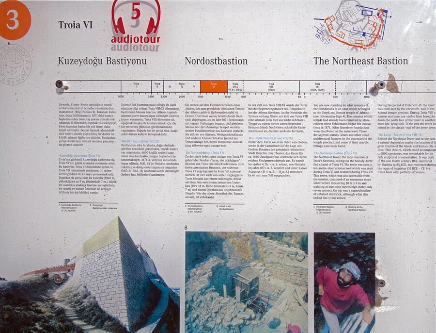

The path climbs along the walls to the Northeast Bastion, the biggest tower of Troy VI, built around a deep well. From here you are on the top of the hill, which the Greeks and Romans leveled for their sanctuary of Athena Ilias. Only scattered foundations and carved blocks remain of the temple that Xerxes and Alexander came to honor.
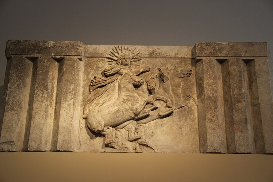
Look north from the edge here. The plain below was a shallow bay when Troy was founded, and on a clear day you can see the mouth of the Dardanelles and the ships heading into it. The view explains Troy’s wealth better than any panel: whoever held this hill watched the traffic between two seas.
Schliemann’s trench and Troy I
The path then drops toward Schliemann’s trench, where a board explains the destruction. Deep in the cut are the walls of Troy I, the first settlement, from around 3000 BC. Take a minute here to look at the trench walls, where the layers of later cities show in section.
The Troy II ramp and the megaron
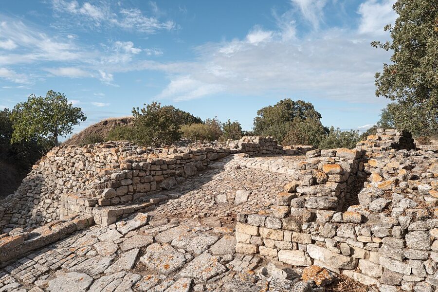

The paved stone ramp of Troy II is the most photographed spot on the site, and the most misleading. It led up to a gate of the citadel of around 2500 BC, and the treasure came from close by. Schliemann saw Homer’s Scaean Gate here; the dates say otherwise.
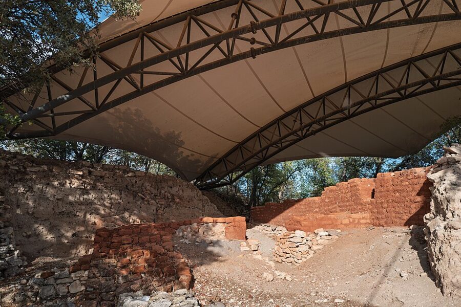

Beside it, under a large modern canopy, are the remains of an early megaron, the long hall with a porch that was the standard grand building of the Aegean Bronze Age. Troy II’s main megaron is the largest known building of its kind in the Aegean and Anatolian world. The roof protects mudbrick that would wash away in a few winters of rain.
The houses of Troy VI and the sanctuary
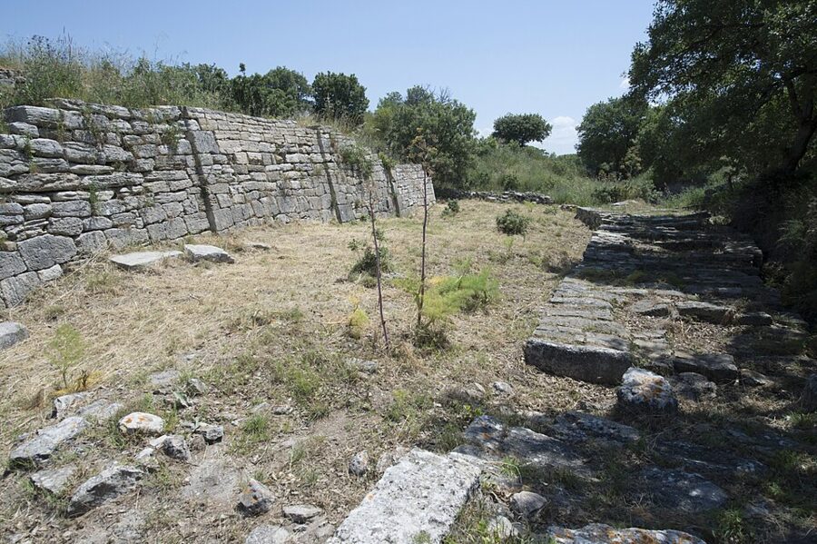

Coming down the west and south sides, you pass the big houses of Troy VI’s elite. The most striking is House VI M, with a stone retaining wall 27 m long that leans inward, a building that probably belonged to the palace complex.
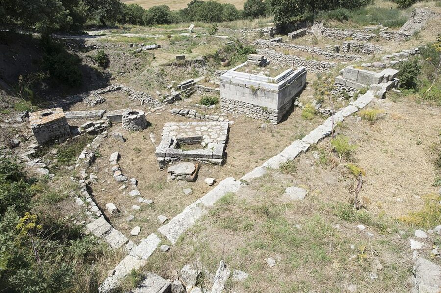

Just outside the walls lies the sanctuary, a walled area of altars and foundations dug into the ruins of the Bronze Age lower town. The earliest parts go back to around the early 7th century BC, when Greek settlers came, and it was rebuilt in Hellenistic and Roman times. The worship of the old walls themselves had already begun: the Troy VI ruins were used for cult feasts in the centuries after the city fell.
The Odeon and the council house
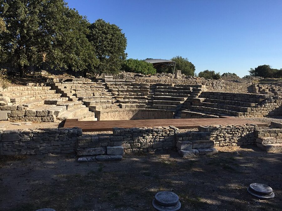

The last stretch is Roman. The Odeon, a small theater for music and recitals, sits near the south side of the mound; the emperor Augustus, who visited in 20 BC, paid for repairs to the theater and the sanctuary. Next to it is the bouleuterion, the council house, partly built over the Troy VI wall.
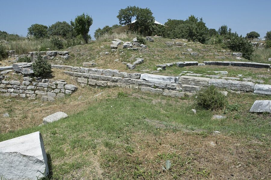

Roman Ilium was a showpiece. Julius Caesar, whose family claimed descent from Aeneas, granted the town favors, and it kept a bishop into the Byzantine era. Earthquakes around AD 500 finished it as a real town, and the hill slowly grassed over.
Practical notes for the walk
- Shade and water: almost none of either beyond the megaron canopy. In summer go at the 08:30 opening or in the last two hours.
- Footing: dirt paths and boardwalks with steps. The ruins are not suitable for wheelchairs; the museum is.
- Season: spring is the best time, when the mound is green and full of poppies. Winter is quiet and often wet.
- Tour groups: coach tours tend to arrive mid-morning, so an early start pays.

Getting to Troy from Çanakkale
You do not need a tour for Troy. The village minibuses that serve Tevfikiye, the village next to the site, run from central Çanakkale through the day, and the fare in 2026 is 150 TL each way, raised in March. Pay the driver in cash; small notes help.
Where the minibus leaves from
The village minibuses leave from the stands under the bridge over the Sarıçay, the small river that runs through the middle of Çanakkale, across from the Friday market. Ask for the Troya, Tevfikiye or Çıplak minibus; the 150 TL fare is the same on the routes to Tevfikiye, Kalafat and Çıplak. The drive is about 30 km, around half an hour by car, a little longer with village stops.
The minibus drops you by the museum, and from there it is about 800 m to the site gate. Buy your ticket at whichever you reach first.
Times, and the last bus back
In winter the gaps between buses are about two hours. The winter sheet of 2025 had departures from Çanakkale at 07:30, 09:30, 11:30, 13:30, 15:30 and 18:00. The timetable in force from 1 November 2026 has buses leaving Troy for Çanakkale at 07:00, 08:00, 09:00, 11:00, 13:00, 15:00 and 17:30.
The summer timetable, which starts in spring, is different again. Timetables change with the seasons and are posted at the stand, so photograph the current one when you arrive. Note the times of the last two buses back before you go into the museum; missing the 17:30 in winter means a taxi or a long walk to the main road.
| Option | Cost (2026) | Good for |
|---|---|---|
| Village minibus | 150 TL each way | Doing Troy alone, at your own pace |
| Taxi from Çanakkale | Metered; agree a price if the driver waits | Splitting between three or four people, or missing the last bus |
| Hire car | Varies; site has paid parking | Combining Troy, Alexandria Troas and Assos in one day |
| Organized tour | Varies by operator | Troy and Gallipoli on the same day |
If you do take a tour, check what is actually included: whether the €27 ticket is in the price, how long you get inside the museum (some tours skip it), group size, the guide’s license, and the cancellation terms.
Getting to Çanakkale in the first place
Çanakkale is on the main bus network, and the municipality publishes reference fares every month. For November 2026 they were 1,400 TL to Istanbul, 1,100 TL to İzmir, 800 TL to Bursa and 1,400 TL to Aydın, the province of Selçuk and Ephesus. Bus companies, terminals and the ferries across the Dardanelles are covered in the guide to getting around Turkey.
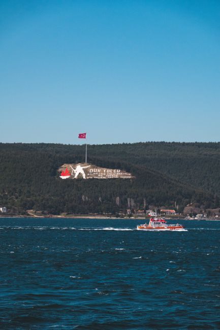
Troy and Gallipoli on one trip
Troy and the Gallipoli battlefields sit on opposite sides of the Dardanelles, and most people do both from Çanakkale. On public transport, give each its own day: Troy runs on the minibus timetable, and Gallipoli’s sites are spread over a peninsula with almost no buses. On a tight schedule, a tour or a hire car can do Troy in the morning and Gallipoli in the afternoon, though that leaves little time for the museum.
Çanakkale: where you sleep and eat
Çanakkale is a university and ferry town on the narrowest part of the Dardanelles, and an easy base: walkable, full of cheap cafés, and with sunset over the strait from the seafront. Two nights covers Troy and Gallipoli; three adds Assos.
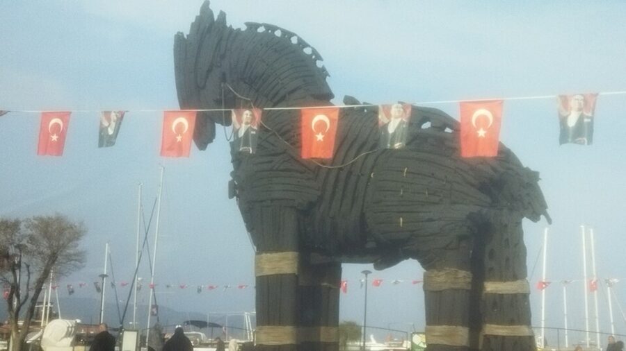
The Kordon and the horse from the film
The Kordon is the seafront promenade by the ferry pier, lined with cafés and fish restaurants looking across the strait. On it stands the wooden horse built for the 2004 Hollywood film Troy, given a permanent home here after filming. It makes a better photo than the one at the site.
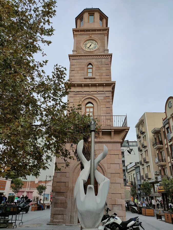

Behind the seafront, the streets around the 1897 clock tower are the old center, with bars, cafés and cheap hotels. The old archaeology museum’s collection has moved to the Troy Museum.
A cheap bed
Çanakkale has no real dorm scene, so the cheapest beds are in small hotels around the clock tower. The Anzac Hotels group runs three of them within about 50 m of each other: the Anzac Hotel on the clock tower square, the Grand Anzac and the Comfort Anzac. Private rooms at the Grand Anzac were advertised from about €30 a night for dates in November 2026, breakfast included.
Beds fill up around 25 April, when Anzac Day commemorations at Gallipoli bring crowds to town, and on summer weekends. Book ahead for those dates, and expect to pay more on the seafront.
What to eat
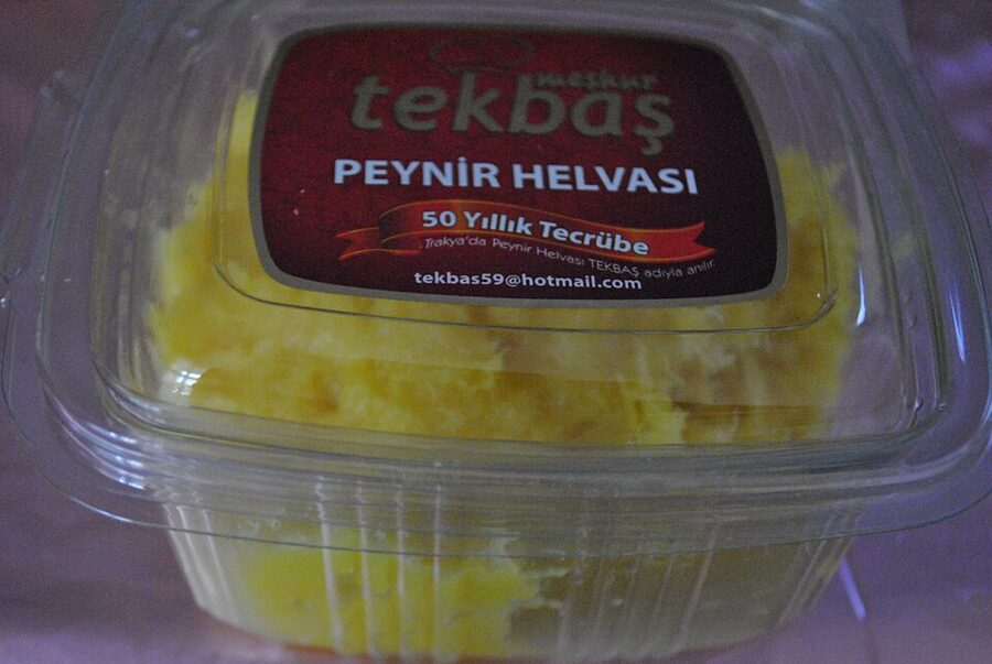
The town’s own sweet is peynir helvası, a halva made with fresh unsalted cheese, sugar and semolina, baked until golden. Pastry shops in the center sell it by weight; a small portion with tea is a cheap afternoon stop. Ezine, the market town on the road south of Troy, gives its name to the region’s white cheese, which turns up on every breakfast plate.

Fish is the thing to eat on the Kordon, but the seafront restaurants charge for the view. The cheaper meals are a street or two inland: köfte, pide, soup and grilled fish sandwiches in the backstreets of the old center, where students eat. A glass of tea is still the cheapest seat in town.
Alexandria Troas: the city people mistook for Troy
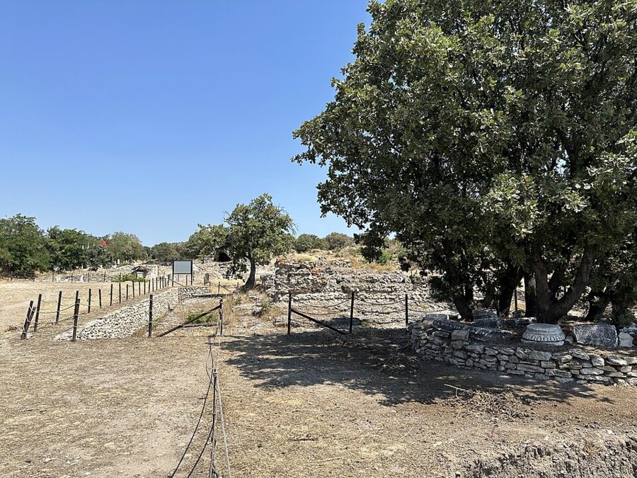
Alexandria Troas is the opposite of Troy: no famous name, no crowds, and a lot of ruin spread over a big area of oak scrub by the sea. In the 16th and 17th centuries European travelers took it for Homer’s city, and Turks called it Eski Stambul, “Old Istanbul”. It deserves a half-day if you like your ruins quiet.

Antigonus, one of Alexander’s generals, founded the city around 306 BC by moving the people of several smaller towns here, and his rival Lysimachus renamed it after Alexander in 301 BC. It became the main port of northwest Asia Minor and, under Augustus, a Roman colony. At its peak it may have had about 100,000 people.
The Apostle Paul sailed from here for Europe for the first time, according to the Acts of the Apostles, and on a later visit walked from Troas to Assos to meet his ship. Julius Caesar and later Constantine are said to have considered making it a capital. The Ottomans used it as a quarry: columns from here went into the Yeni Valide Mosque in Istanbul.
What you see
The circuit of the city walls, about 10 km round, can still be traced in places. The biggest standing ruin is the bath and gymnasium complex paid for by the wealthy Athenian Herodes Atticus in the 2nd century, known locally as Bal Saray, the “Honey Palace”. German archaeologists uncovered a stadium of about 100 BC in the early 2000s, and digs led by Ankara University have since been working on the odeon and a 2,200-year-old market building.

Getting to Alexandria Troas
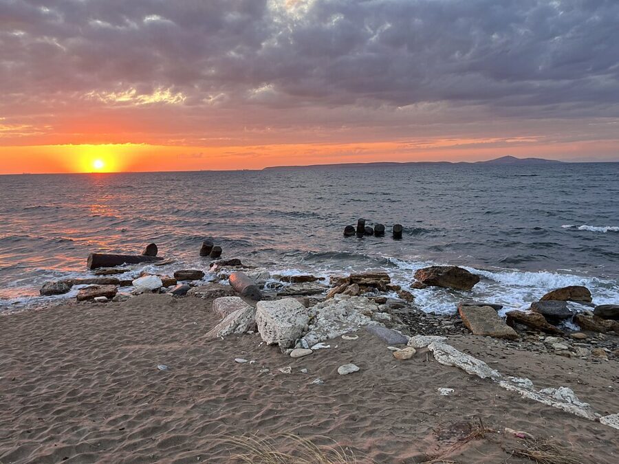
The site lies near the village of Dalyan in the Ezine district, on the coast south of Troy. From Çanakkale, minibuses run to Geyikli, the port for the Bozcaada ferry; the municipal reference fare to Geyikli was 280 TL in November 2026. From Geyikli or Dalyan, the last stretch is a short taxi ride, as no public transport goes to the ruins.
Alexandria Troas is one of the ministry’s Çanakkale sites and kept the same 08:30–17:30 winter hours as Troy from 1 October 2026. Bring water and food; the nearest shops are in the villages. With a car, it fits neatly between Troy and Assos on a single day.
Assos: a temple above the sea
Assos is the one to choose if you only have time for one extra site. A Greek city built on an extinct volcano above the Gulf of Edremit, it has a temple on the summit, a view across to Lesbos and a stone village, Behramkale, wrapped around the hill. The ministry charged €11 for the archaeological site in November 2026, with the same 08:30–17:30 winter hours as Troy and the ticket office closing at 17:00.
What to see
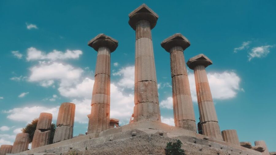
The Temple of Athena on the summit dates to around 530 BC and had 6 by 13 Doric columns. It was built of andesite, the hard gray volcanic stone of the hill, which is difficult to carve and almost indestructible. Some columns have been re-erected from their original pieces. Parts of its carved frieze are in the Louvre (taken in 1838), the Museum of Fine Arts in Boston (from the American dig of 1881–1883) and the Istanbul Archaeology Museums.
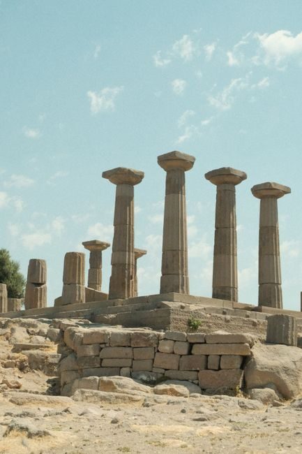
Assos had a philosopher in residence. Aristotle lived here for about three years from around 347 BC at the invitation of Hermias, the local ruler, married his niece and taught a circle of students. The city was also famous for its sarcophagi, carved from a stone the ancients believed consumed the bodies inside them; Roman writers tied the Greek word sarcophagus, “flesh-eater”, to this stone.
Below the summit, the lower city has a theater, an agora, a gymnasium and a long street of tombs, all in the same gray stone. Turkish teams have excavated here since 1981. Allow two hours for the temple and the lower city together.
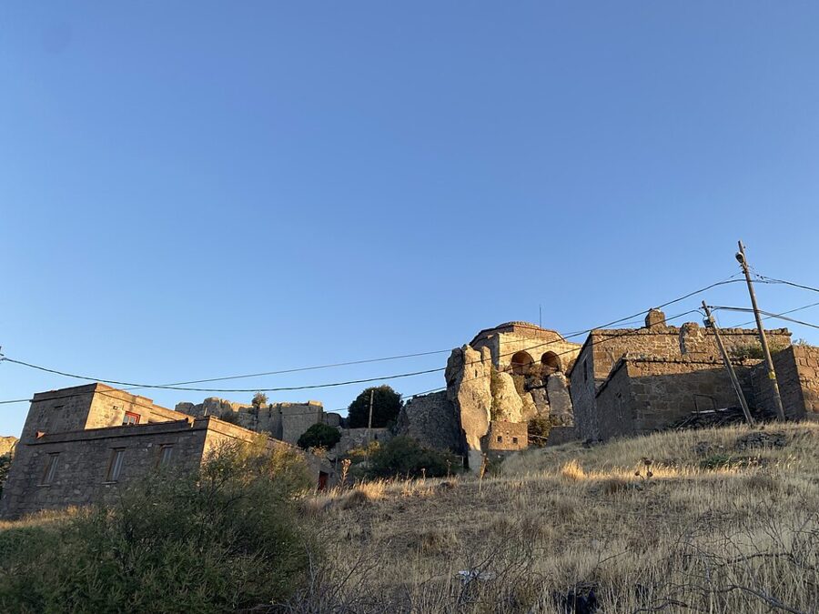

The harbor below
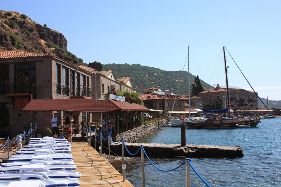
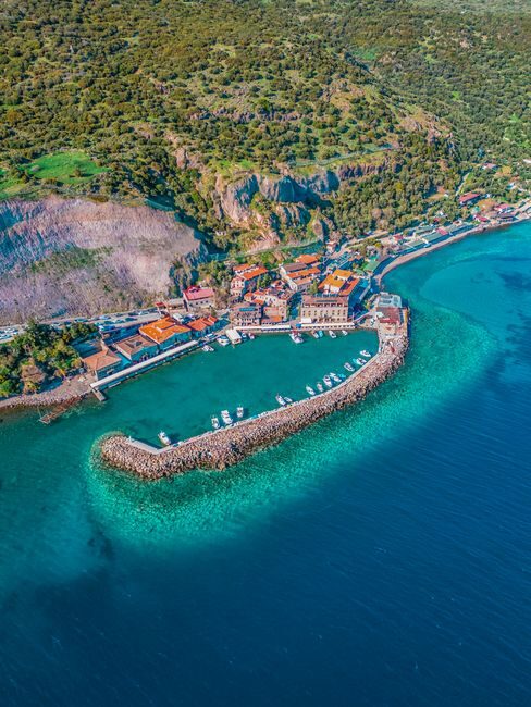
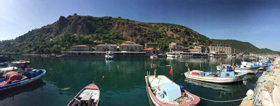
A steep, winding road drops from the village to the old harbor, a cluster of stone buildings, now mostly hotels and fish restaurants, on a tiny stone quay. It is lovely and it is not cheap. A tea on the quay is the budget way to enjoy it; dinner there is a splurge.
Getting to Assos
Take a bus from Çanakkale to Ayvacık, 74 km south; the municipal reference fare was 300 TL in November 2026. From Ayvacık, the Assos Birlik minibuses run on to Behramkale and the harbor, and there is a taxi rank at the Ayvacık garage. Minibuses also run on through the district to Küçükkuyu and Edremit on the coast, so Assos can work as a stop on the way south rather than a return trip.
Two days around Troy
With two full days from Çanakkale, this order wastes the least time on buses.
| Day | Plan | Main costs (2026) |
|---|---|---|
| 1 | Early minibus to Troy; museum at 08:30, then the site; back to Çanakkale for lunch; evening on the Kordon | €27 ticket; 300 TL minibus return |
| 2 (option A) | Gallipoli by ferry and tour, or a hire car | Ferry fare; tour price varies |
| 2 (option B) | Bus to Ayvacık, minibus to Assos; temple, lower city, harbor; continue south or return | €11 ticket; about 300 TL bus each way plus minibus |
With a hire car, all three ancient cities fit into one long day, ending at Assos for the sunset.
The road south
From Troy almost everyone heads south, down the Aegean side of the country. Buses from Çanakkale to İzmir and Selçuk take most of a day; from Selçuk you are walking distance from Ephesus, and the travertine terraces of Pamukkale are the stop after that. The whole loop, with days and costs, is in the two-week Turkey itinerary.
Whichever way you go, do Troy in the order that makes it work: the museum at 08:30, the walls when the coaches leave, and the 13:00 minibus back to Çanakkale. Then a plate of warm peynir helvası by the clock tower, and the morning bus south.