A Black Sea beach costs 80.60 TL from Taksim in 2026. That is one ride on the M2 metro to the end of the line at Hacıosman and a transfer onto the 151 bus, both tapped on the same Istanbulkart, and about an hour and a half later you are on the sand at Kilyos. Most of the best days out of Istanbul work the same way: a city card, a bus number and a timetable you can read before you leave the hostel.
None of these days needs a minibus tour or a hotel pickup. The Black Sea beaches at Kilyos, Şile and Ağva, the Ottoman dams of the Belgrade Forest, the Polish village of Polonezköy, the lighthouses and fishing harbors at the top of the Bosphorus, and Edirne, now on a new fast train line, are all within reach of a city bus, a ferry or a coach. The fares below are 2026 figures, and every city bus line named is one you can check on İETT’s own timetable before you go.
| Trip | Time each way | Return fare, 2026 | Best season | Suits |
|---|---|---|---|---|
| Kilyos (Black Sea beach) | 1–1.5 hours | 161.20 TL | Mid-June to early September | A cheap beach day without planning |
| Şile (beach, lighthouse, castle) | About 2 hours | About 475 TL | June to September; spring for walking | Beach plus a small town to wander |
| Ağva (two rivers, beach) | About 3 hours | About 657 TL | June to September | A slow day, or a night by the river |
| Belgrade Forest | 1–1.25 hours | 161.20 TL | April to June, October to November | Walkers, runners, Ottoman engineering |
| Polonezköy | 1.5–2 hours | From about 160 TL by bus; a taxi adds roughly 800 TL each way | May to June, October | Groups who can split a taxi |
| Rumeli Feneri and Rumeli Kavağı | About 1.5 hours | 161.20 TL | All year | Lighthouses, fish lunches, Bosphorus views |
| Anadolu Kavağı and Yoros Castle | 1.5–2 hours | From about 160 TL by bus and ferry | All year | Castle walk and the Black Sea mouth |
| Edirne | About 3 hours by bus; just over 3 by train | 800–1,200 TL by bus | All year; spring and autumn best | Ottoman architecture, a long day or one night |
Times are from central Istanbul and assume ordinary traffic. On a hot summer Saturday the beach roads slow to a crawl, and on public holidays the coast buses fill at the first stop. Leave early, and come back before the city does.
Contents
- Paying for it: the Istanbulkart and the 2026 fares
- The Black Sea beaches: Kilyos, Şile and Ağva
- Belgrade Forest: Ottoman dams and a day under the trees
- Polonezköy, the Polish village
- The far Bosphorus: Rumeli Feneri, Rumeli Kavağı and Anadolu Kavağı
- Edirne: Sinan’s masterpiece and the new fast train
- Water parks
- Further out: Bursa, the Princes’ Islands, Gallipoli and Troy
- What each day costs
Paying for it: the Istanbulkart and the 2026 fares
Every trip here except the Edirne bus and train runs on the Istanbulkart. On the tariff in force since 20 July 2026, a full fare costs 46.20 TL on buses, the metro and the tram. Change to a second vehicle within the transfer window and you pay 34.40 TL; a third ride costs 26.42 TL. That transfer discount is why the cheapest route to most of these places is metro first, bus second.
The long Şile and Ağva buses are priced differently. İETT treats the 139 and 139A as regional lines with distance bands, and the notice on its tariff page says they take no transfer discount when you board but give you one for the next ride. In practice you pay the full band fare on the coast bus, and your bus or ferry home from Üsküdar comes discounted.
Load more than you think you need before you leave the center, because an empty card on a 139A in the middle of the Ömerli forest is a long conversation with a driver. One anonymous card can pay for two or three people traveling together, one tap each.
The Black Sea beaches: Kilyos, Şile and Ağva
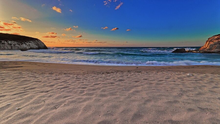
Istanbul’s own coast is the Marmara and the Bosphorus, and the city’s swimmers gave up on most of it in the 1970s as the water got dirtier. They moved north to the Black Sea, to Kilyos on the European side and Şile and Ağva on the Asian one. The sand is wide, the water is colder than the Aegean, and the waves are real.
Before you swim: currents, flags and the drowning record
Read this part even if you skip the rest. The Black Sea coast of Istanbul has strong rip currents: channels of water running straight out from the beach, hard to see from the sand and strongest on windy days with big surf. They pull good swimmers out past the break in seconds, and they are what the Şile authorities cite when they close the beaches.
On 5 July 2026 the Şile district governor’s office (the kaymakamlık) banned swimming on every beach in the district except Ayazma Beach and Ağva Merkez Beach, because of high waves and rip currents. Three people went into the sea anyway at other points along the coast. All three were swept away; by the next day two had been found dead, and the search for the third was still going on.
The rules that follow from that are short:
- Swim only on a beach with lifeguards, inside the marked area, during their hours. In 2026 the Istanbul Fire Brigade put 642 lifeguards, 235 watchtowers and 50 jet skis on 50 beaches across the city, with the season starting on 15 June.
- A red flag means nobody swims. On rough days the kaymakamlık can close a whole stretch of coast, and the ban applies to everyone. Ask the lifeguard if you are unsure; they would rather answer a question than go out for you.
- If a current takes you, swim parallel to the beach, not against the pull. Rip channels are narrow. Once you are out of one, swim back in at an angle, or float and wave.
- Lifeguard cover starts on 15 June and ends with the summer. A sunny day in October is a day for walking on the sand, not for swimming.
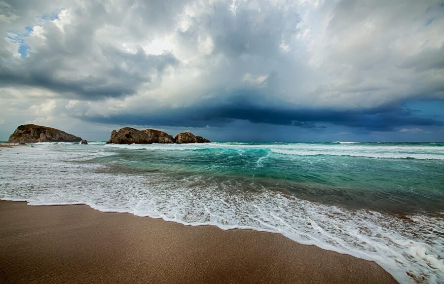
Kilyos and Demirciköy
Kilyos is the closest real beach to the city, officially renamed Kumköy (“sand village”) in the Republican era and still called Kilyos by everyone. It is a strip of hotels, beach clubs and a small village behind a long curve of sand, with Demirciköy further west at the end of the bus line. Expect city crowds on summer weekends and almost nobody on a Tuesday in June.
Most of the shoreline is divided between private beach clubs that charge entry at the gate, usually with a sunbed included. Prices change every season and climb at weekends, so check the board before you pay. Public stretches with no gate exist between the clubs; walk along the shore away from the bus stop and you will find them.
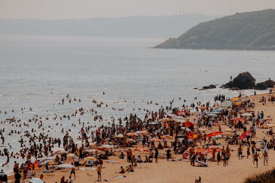
Getting there. Take the M2 metro to Hacıosman, the northern terminus, then the İETT 151 (Hacıosman Metro–Kilyos/Demirciköy). On weekdays it leaves Hacıosman from 05:45 until 22:40, roughly every 15 minutes in the middle of the day, and the last buses back leave Demirciköy around 22:00.
The ride takes 40–55 minutes depending on traffic. Departures marked S on the timetable detour via the Sinemköy housing estate.
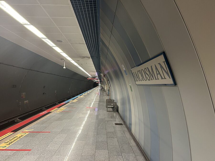
Cost. 46.20 TL for the metro plus 34.40 TL for the bus each way, 161.20 TL return. Add a beach club if you want a sunbed, or bring a towel and food and keep the day under 400 TL.
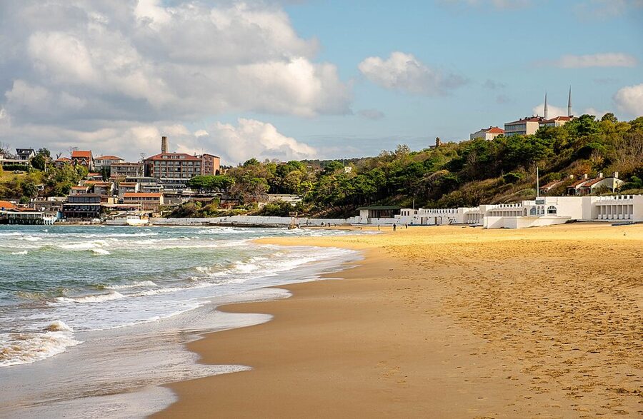

Şile: lighthouse, castle and cloth
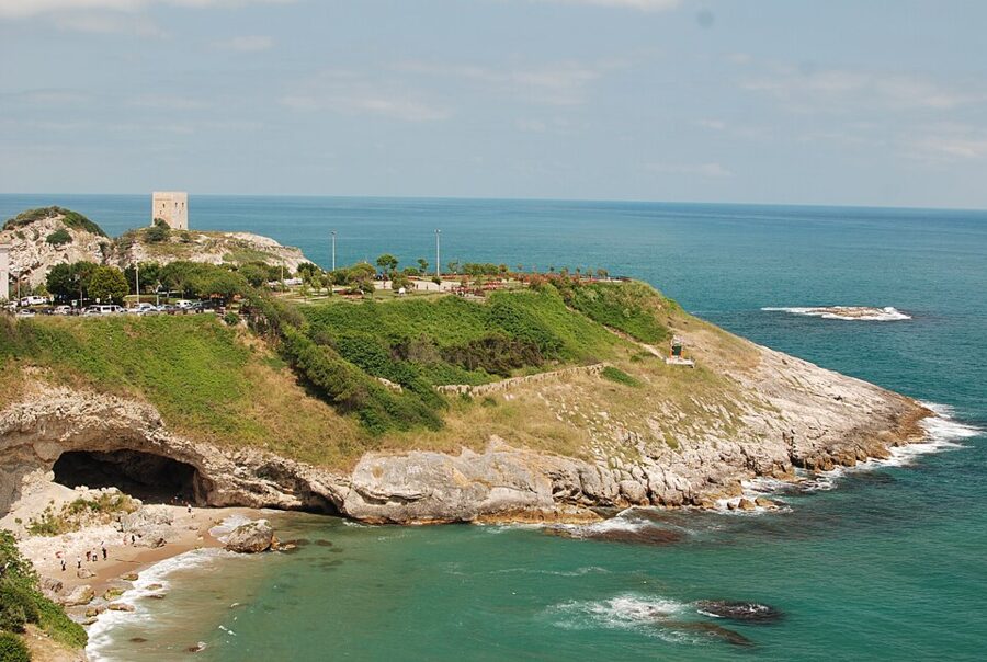
Şile is a proper town, not just a beach, which makes it the better day if the weather turns. It sits on cliffs above a bay on the Asian side of the Black Sea, with several beaches below the town, a small harbor and shops selling Şile cloth.
The lighthouse is the landmark. It was built in 1859 by the Ottoman lighthouse administration run by the Frenchman Michel Pasha, stands on rocks about 60 m above the sea, and burned a three-wick kerosene lamp until it was electrified in 1968. Walk up Fener Caddesi from the center for the view down onto the bay.
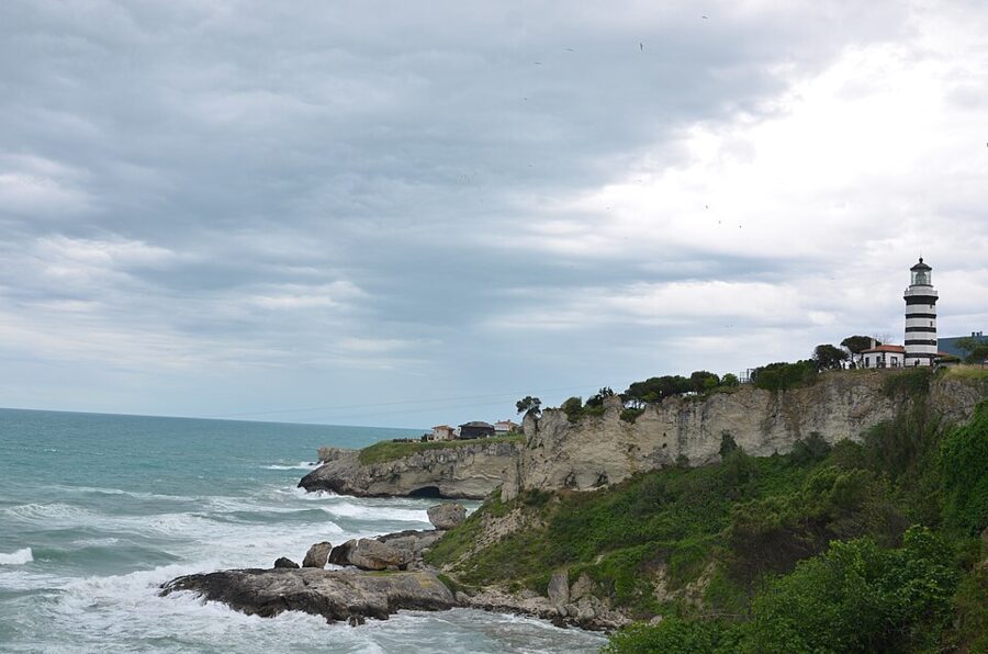

Below it, Şile Castle stands on Ocaklı Ada, a rocky islet in the bay. Sources disagree on who built it, with some crediting the Genoese and others the Byzantines; the Ottomans took it in 1396 under Bayezid I. A 2015 restoration left it so clean and square that it was widely mocked for looking like SpongeBob, and the joke has never quite gone away.

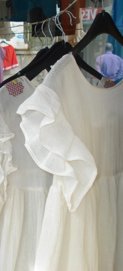
Şile cloth (Şile bezi) is the souvenir worth buying here. It is a light cotton woven from twisted yarn on the district’s own looms, which gives it a crinkled texture, then traditionally rinsed in seawater and hung to dry without wringing. It absorbs sweat and dries fast, which is why the shirts and scarves made from it are so useful in an Istanbul August. The cloth was once linen and hand-woven; today most of it is cotton and much is machine-woven, so ask which you are buying.

Ağva: the village between two rivers
Ağva is the far end of the line, about 100 km from Istanbul by road, and it is the trip with the most character. The village sits between two rivers, the Göksu and the Yeşilçay, which run parallel to each other into the Black Sea; its old Greek name, Dipotamos, simply means “two rivers”. Wooded hills come down to the water on both sides, and fishing boats tie up along the Göksu below the houses.
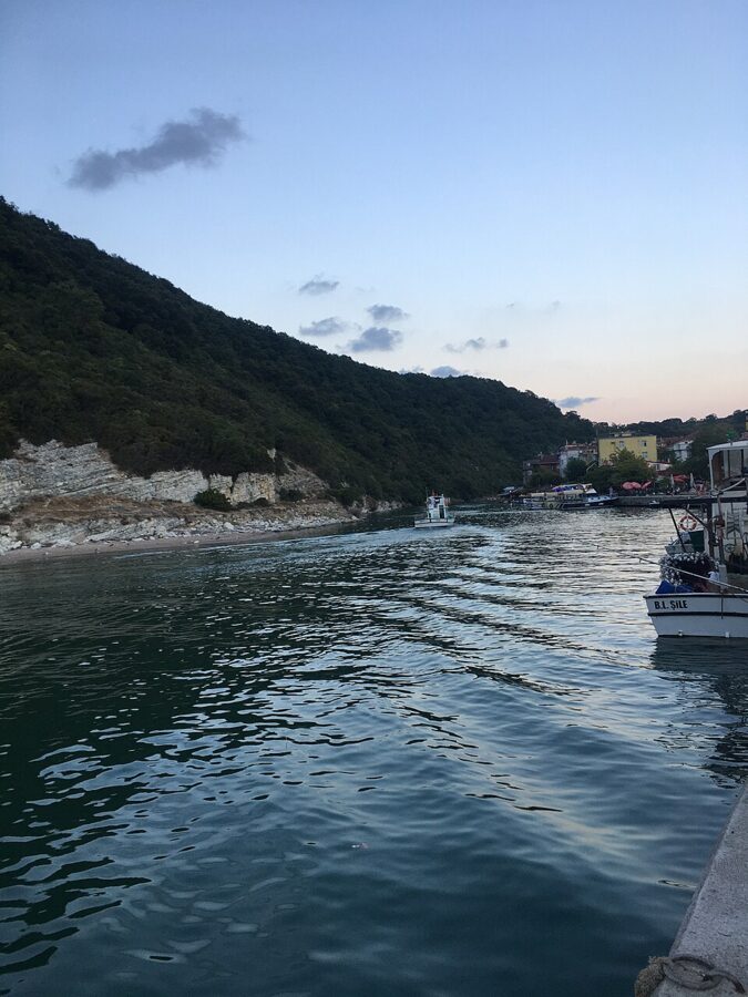

The day here is simple: walk the riverbanks, eat by the water, and swim off Ağva Merkez Beach when the lifeguards are on. That beach was one of the two the kaymakamlık kept open during the July 2026 ban, which tells you it is the managed, watched stretch. The village’s emblem is the sand lily, which flowers on the dunes in late summer.
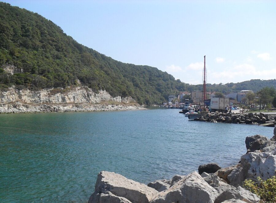

Ağva is the one beach trip where I would think about staying the night. Three hours each way on a bus is a lot for four hours by the river. If you do it as a day trip, take the first or second bus out.
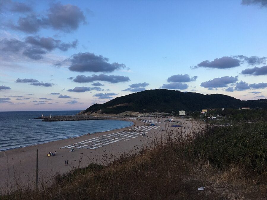

Getting to Şile and Ağva: the 139 and 139A from Üsküdar
Both towns are on İETT’s regional lines, which start at the Şemsipaşa stop on the Üsküdar waterfront, a short walk along the shore from the ferry piers and the Marmaray station. The 139A (Üsküdar–Şile/Ağva) is the one to know: it runs through Ümraniye and Çekmeköy, across the Ömerli forest to Şile, then along the coast to Ağva. The 139 runs only as far as Şile and only a few times a day.
On the 2026 timetable the 139A leaves Şemsipaşa at 06:30, 07:30, 09:00, 10:00, 11:00, 13:00, 15:15, 16:30, 17:30, 19:30 and 20:30, and the same times run on Saturdays and Sundays. Back from Ağva Merkez it leaves at 06:15, 07:00, 08:00, 09:00, 10:30, 12:30, 13:45, 15:30, 17:00, 18:30 and 20:00, passing Şile a little later. Letters beside some times on the board mean the bus takes a different road between villages (the coast road, the Ovacık road or via Yeniköy), which changes the journey time but not the endpoints.
The 139 adds a few Şile-only runs: from Şemsipaşa at 12:00, 14:00, 18:30 and 22:15, and from the Şile terminal at 06:00, 11:00 and 16:00, with the 06:00 and 16:00 running express on the motorway back to Üsküdar. Neither line publishes a journey time. Ağva is about 100 km from Üsküdar and the bus calls at village after village, so budget around two hours to Şile and close to three to Ağva, more on summer weekends.
| Fare band on the 139 and 139A (July 2026, full fare) | Istanbulkart |
|---|---|
| Within Ağva or Şile (to İmrenli or Teke) | 46.20 TL |
| Ağva to Şile | 86.39 TL |
| Şile to Ömerli | 100.99 TL |
| Şile to Çekmeköy (the longest band listed for Şile) | 191.31 TL |
| Ağva to Ömerli | 191.31 TL |
| Ağva to Üsküdar | 282.35 TL |
The tariff notice lists no separate Şile–Üsküdar band, so plan on 191.31 TL each way for Şile and 282.35 TL for Ağva. Add 46.20 TL each way to reach Üsküdar from the European side by ferry or Marmaray, and a Şile day comes to about 475 TL return and an Ağva day to about 657 TL. Both towns together work too: Üsküdar to Ağva in the morning, the 86.39 TL hop back to Şile in the afternoon, and the 191.31 TL band home.
Belgrade Forest: Ottoman dams and a day under the trees
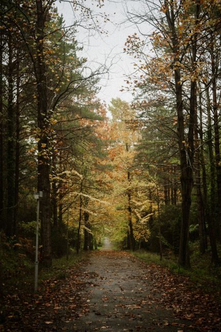
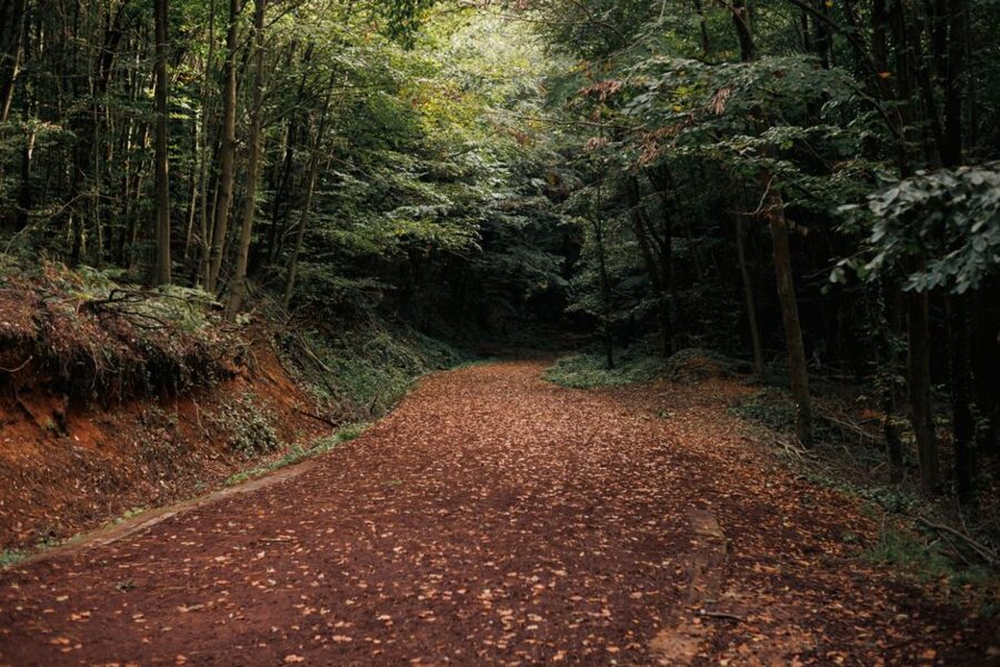
The Belgrade Forest (Belgrad Ormanı) is the green block on the map north of the city, between Sarıyer and the Black Sea, and it is the closest place to Istanbul where you can walk for hours without hearing traffic. It is mostly sessile oak and other broadleaf trees, with streams, picnic meadows and a set of Ottoman reservoirs that kept the city alive for three centuries.
The name comes from a village. After his Belgrade campaign of 1521, Süleyman the Magnificent settled Serbian captives in an old Byzantine village inside the forest, which became known as Belgrad. The villagers were later moved out to protect the water, and under Abdülhamid II the last of them were cleared after experts traced an outbreak of disease to laundry from the Pera hotels being washed in the Büyük Bent reservoir.
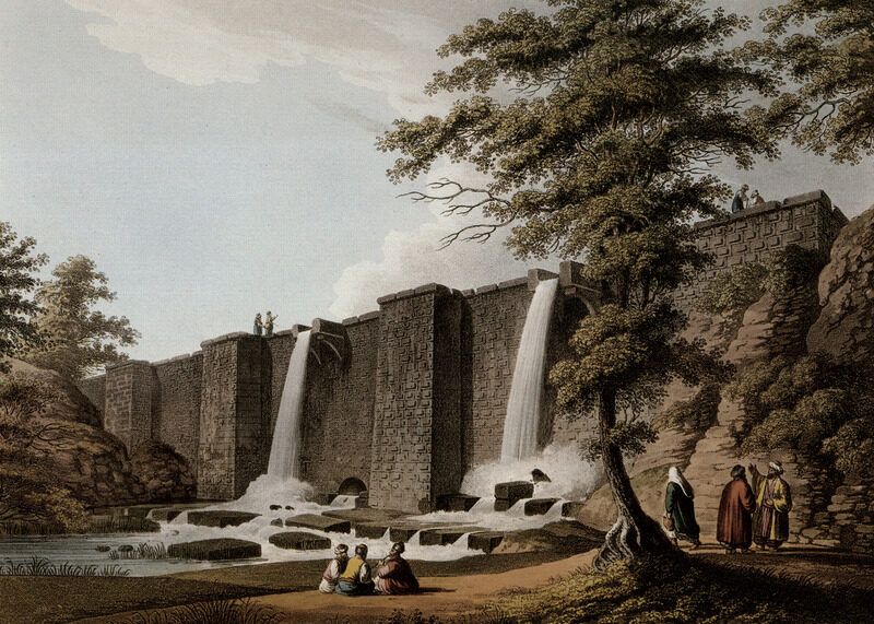
Those reservoirs are the reason to come. The forest holds seven historic dams (bent), built over two centuries to feed the Kırkçeşme water system: Kömürcü Bendi (1620), Büyük Bent (1724), Topuzlu Bent (1750), Ayvat Bendi (1765), Valide Bendi (1796), Kirazlı Bent (1818) and Yeni Bent (1839). Mimar Sinan, the great Ottoman architect, was put in charge of repairing and extending the forest’s waterworks from 1554. Walking between two or three dams on the forest roads is the classic day here.
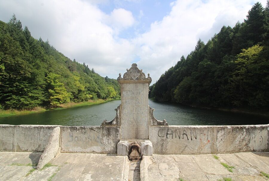

The forest’s history is less peaceful than its paths. In 1826, when Mahmud II abolished the Janissary corps, surviving Janissaries fled into the Belgrade Forest; when three months of pursuit failed to flush them out, the forest was ringed with fire and a large part of it burned with them.
Since December 2024 the nature parks inside the forest, among them Neşetsuyu, Bentler and Kömürcübent, have been run by the national parks directorate (DKMP), and vehicles pay electronically at HGS gates. Neşetsuyu, with its spring, ponds and shaded walking paths, is the busiest part, and it fills with families and runners at weekends. Come on a weekday and you can walk the forest roads for an hour and meet a handful of people.
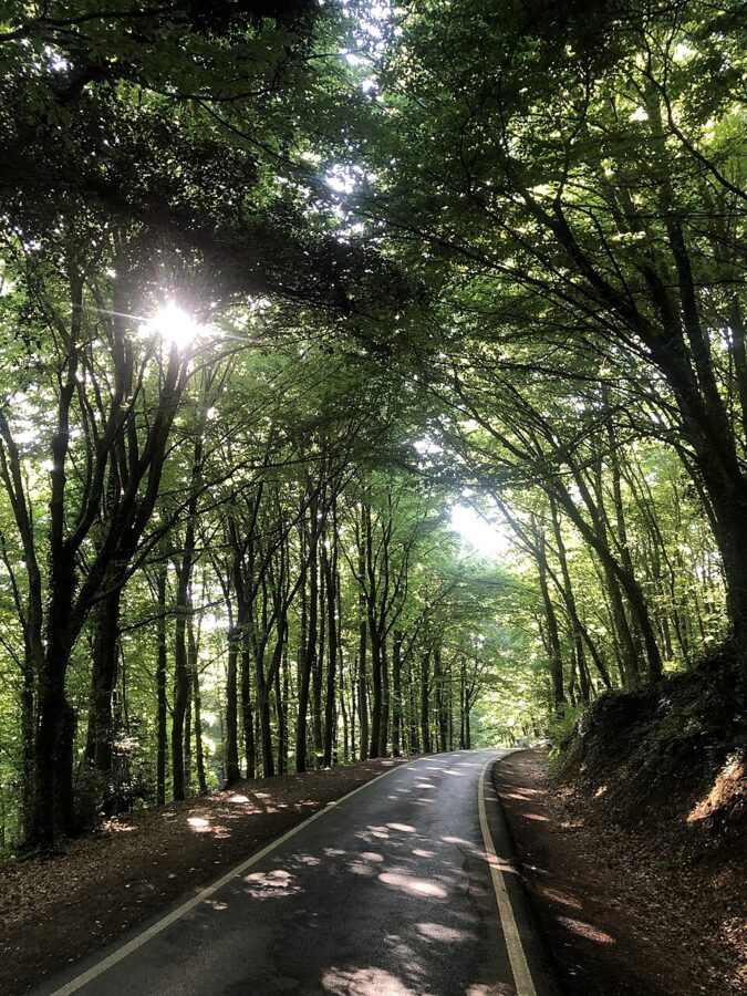

One Sinan aqueduct deserves a mention even though it is hard to reach without a car. The Mağlova Kemeri (1555–1562), near Cebeci in Sultangazi, is 35 m high and 257 m long, two tiers of arches across the Alibey valley, and it still carries water. The art historian Semavi Eyice ranked it beside the Süleymaniye and the Selimiye, and called leaving it half-drowned in the Alibeyköy dam lake a crime.
Getting there. M2 metro to Hacıosman, then the İETT 42HM (Bahçeköy–Hacıosman Metro) to the end of the line at Bahçeköy, and walk into the forest on the signposted roads. On weekdays the 42HM leaves Hacıosman from 06:10 to just after midnight, every 10–20 minutes. The 153 (Bahçeköy–Sarıyer) runs roughly every 45 minutes and links a forest day to the Bosphorus ferry at Sarıyer.
Cost. 161.20 TL return on the Istanbulkart, the same as Kilyos. Bring a picnic: this is the one trip where a bag of bread, cheese and fruit from a corner shop (bakkal) near the metro beats anything you could buy in the forest.
Polonezköy, the Polish village
Polonezköy is a village of wooden houses, orchards and a Catholic church in the forests of Beykoz, about 15 km inland from the Bosphorus, and it was founded by Polish exiles. In 1842 Prince Adam Czartoryski, the leader of the Polish emigration after the failed uprising of 1830, sent his agent Michał Czajkowski to Istanbul to build a second political base inside the Ottoman Empire. Czajkowski bought forest land from Lazarist priests, and the settlement took its founder’s name: Adampol, Adam’s village.
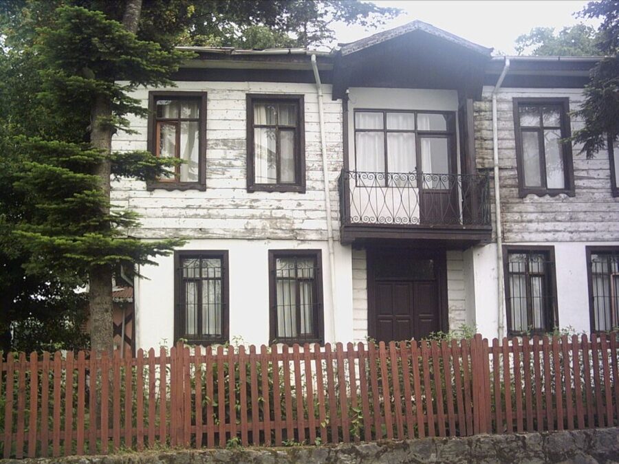

The village started with 12 people and peaked at around 220, swelled by veterans of the 1830 uprising and the Crimean War and by Poles who had escaped Siberian exile. Its residents became Turkish citizens in 1938 and only received title deeds to the land they farmed in 1968. About 1,000 people live here now, of whom only a few dozen still speak good Polish; the opera singer Leyla Gencer was born here.
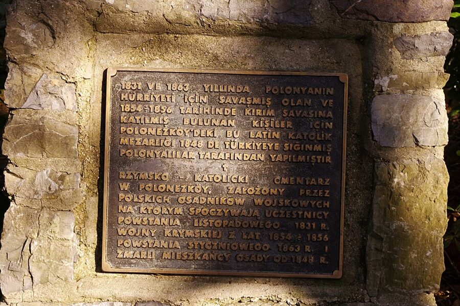
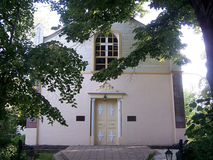
What to see is small and quiet: the Church of Our Lady of Częstochowa, the Zofia Ryży memorial house with the family’s photographs and papers, and the village cemetery, where Ludwika Śniadecka, the woman the Polish poet Juliusz Słowacki loved, is buried among 92 restored historic graves. Around the village, the Polonezköy Nature Park has marked forest walks and picnic areas.


Getting there. This is the trip where public transport lets you down. The only İETT line through the village is the 137 (Cumhuriyet Köyü/Riva–Beykoz/Sultaniye), and only a few weekday runs, marked “-2” on its timetable, go via Polonezköy to Kavacık, early in the morning and in mid-afternoon; check them on İETT’s site the day before. The practical route is a bus to Kavacık Aktarma, the transfer hub at the Asian end of the Fatih Sultan Mehmet Bridge, then a taxi for the last stretch.
Cost. The bus to Kavacık is one fare and a transfer, about 80 TL each way. On the July 2026 meter a taxi starts at 71.94 TL and charges 47.92 TL per km, so the 15 km or so from Kavacık comes to roughly 800 TL each way. Split four ways, that is fine; alone, it makes Polonezköy dearer than Edirne by bus.
The far Bosphorus: Rumeli Feneri, Rumeli Kavağı and Anadolu Kavağı
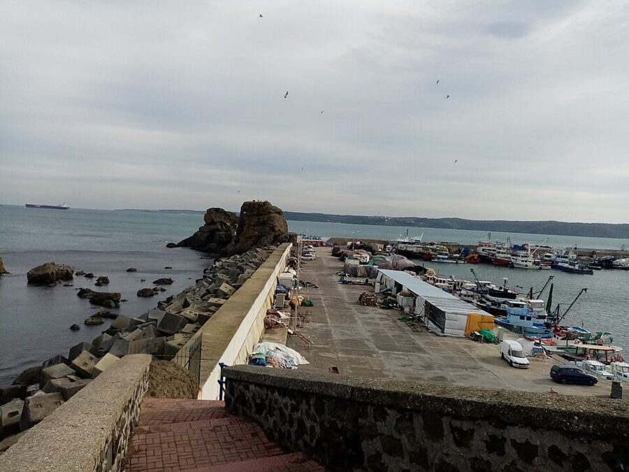
The top of the Bosphorus, where the strait opens into the Black Sea, has three villages worth a day: Rumeli Feneri and Rumeli Kavağı on the European shore, and Anadolu Kavağı under Yoros Castle on the Asian one. They are fishing places first, with harbors full of working boats, and restaurant strips second.
Rumeli Feneri
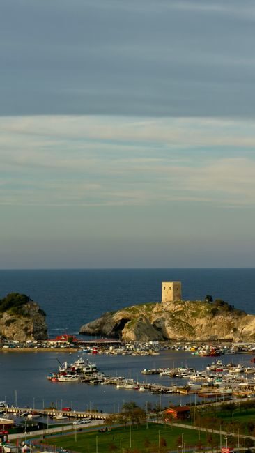
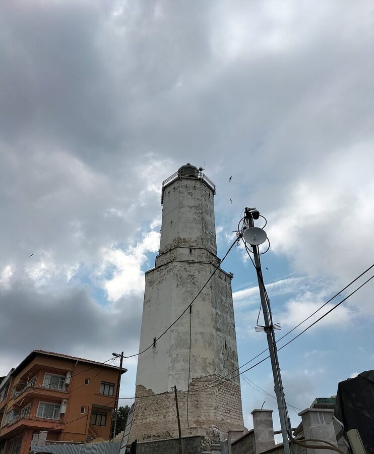
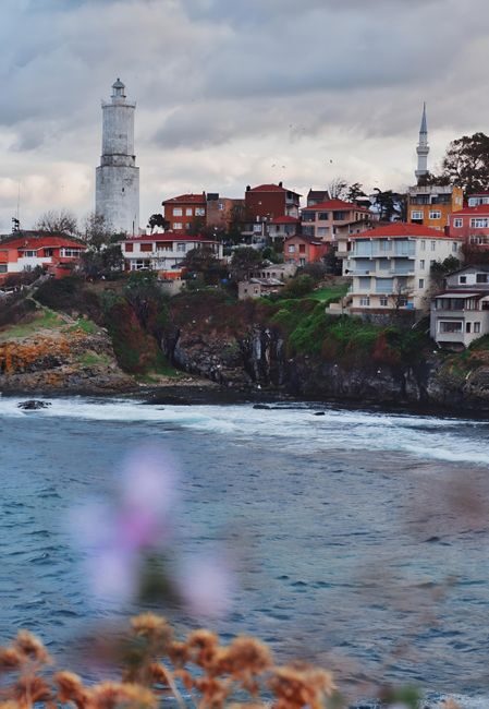
Rumeli Feneri is the last village on the European side, a cluster of houses around a fishing harbor on rocky cliffs, and it takes its name from the lighthouse. The tower went into service on 15 May 1856, during the Crimean War, so that British and French ships could find the mouth of the strait; it was built under the same Michel Pasha who built the Şile lighthouse. The tower is 30 m tall and stands 58 m above the sea, and inside it is the tomb of Sarı Saltuk, a 13th-century Turkish dervish.

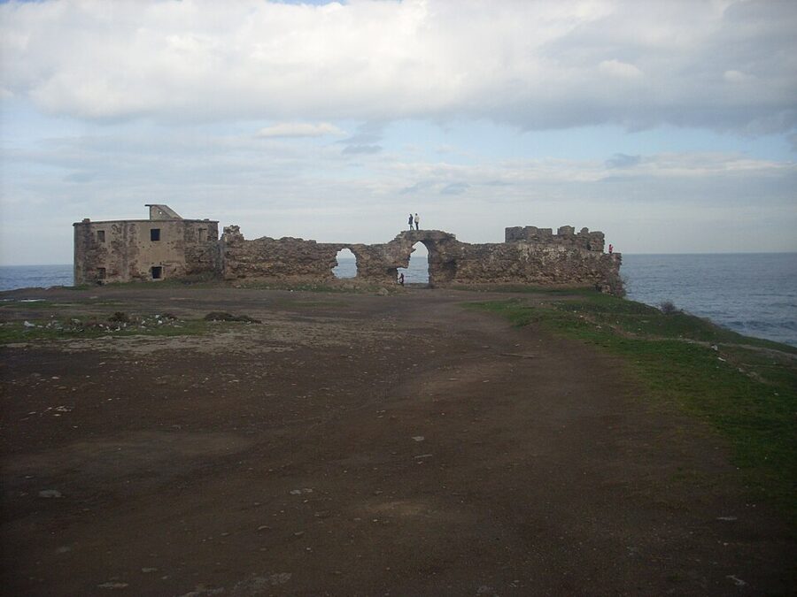
Below the village, the islets off the harbor are the Öreke rocks, identified since antiquity with the Symplegades, the Clashing Rocks that the Argonauts had to sail between on their way to the Black Sea. Just outside the village is Rumeli Feneri Castle, begun in 1769 and redesigned by French military engineers in the 1780s and 1790s, when the Ottomans were fortifying the Bosphorus mouth against Russia. Its walls stand open on the headland.

Greeks lived here until the First World War; the village church of Aya Yorgi became the Rumeli Feneri Yeni Camii in 1971. Almost everyone in the village today descends from families from Rize, on the eastern Black Sea coast, who settled after the Russo-Turkish War of 1877–78, and that shows in the fish on the restaurant menus.
Getting there. The İETT 150 (Hacıosman Metro–Rumelifeneri) is the only public transport to the village. On weekdays it leaves Hacıosman from 05:40 to 23:50, every 20–30 minutes, and the last buses back from the Kale Caddesi terminus leave around 22:30–23:00. M2 plus the bus costs 80.60 TL each way, 161.20 TL return.
Rumeli Kavağı
Rumeli Kavağı is the next village south, a small harbor between Rumeli Feneri and Sarıyer known in Istanbul for its fish, mussels and figs. Some sailings of the Bosphorus commuter ferry from Eminönü end here, and the small cross-strait ferry to Anadolu Kavağı calls too, which makes it the hinge of a two-shore day.
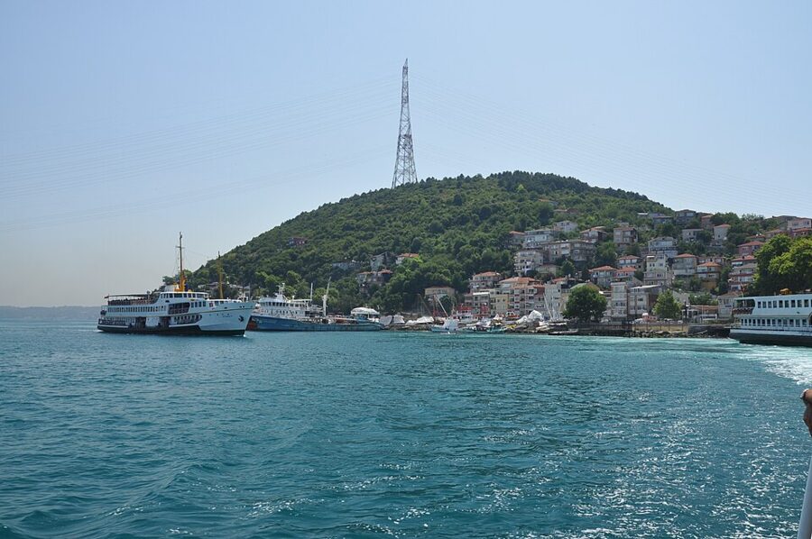

Getting there. The İETT 25A (Rumelikavağı–Hacıosman Metro) runs from the M2 terminus every 30–40 minutes on weekdays, with the last bus from Rumeli Kavağı at about 22:00. Some runs, marked N, start or end at Namazgah instead of Hacıosman. Rumeli Feneri and Rumeli Kavağı are on different bus lines, so a day linking both means two separate trips from Hacıosman or a taxi between them.
Anadolu Kavağı and Yoros Castle
Anadolu Kavağı, on the Asian shore, is the last village before the Black Sea: a row of fish restaurants around a pier, with the ruined Byzantine walls of Yoros Castle on the hill above. It is the turnaround point of the long city ferry tour from Eminönü, the cheapest Bosphorus cruise, which waits here for about two and a half hours before heading back. The castle climb takes about a quarter of an hour on signposted lanes.
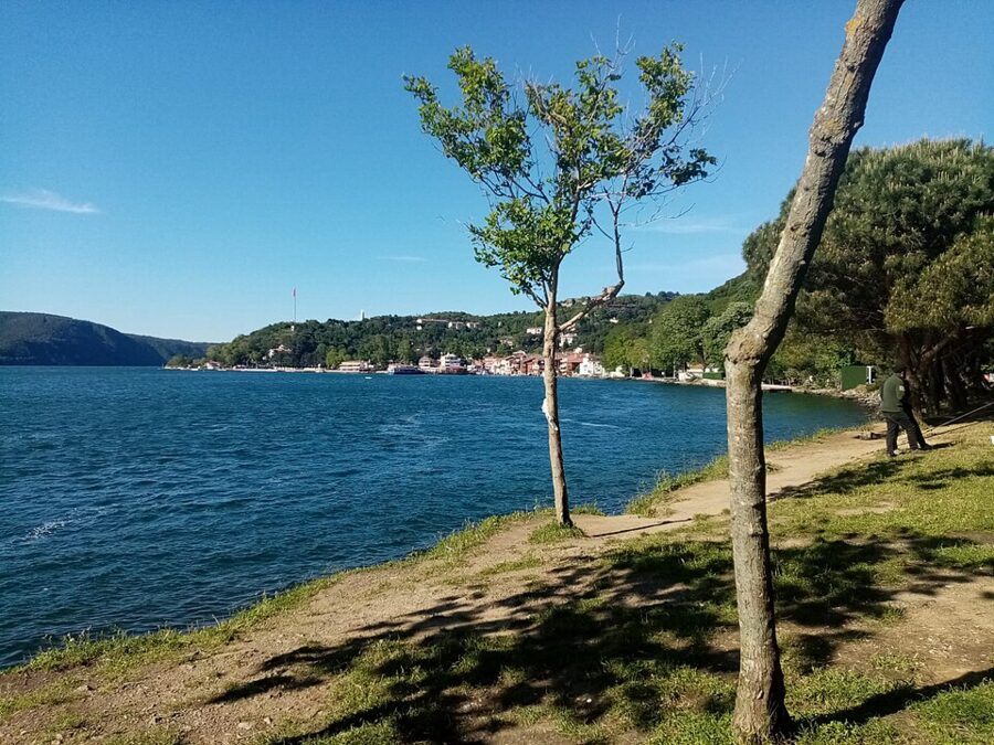

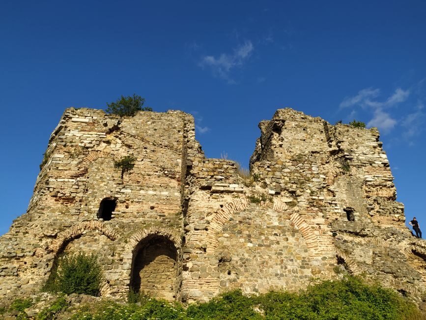
You do not have to come on the tour boat. The İETT 15A (Anadolukavağı–Kavacık) runs along the Asian shore through Beykoz, with weekday departures from Anadolu Kavağı between 05:50 and 22:20; some runs go only as far as Sultaniye and a few continue to Üsküdar. The small Şehir Hatları ferry across the strait to Rumeli Kavağı and Sarıyer runs through the day, so you can arrive on one shore and leave from the other.
Edirne: Sinan’s masterpiece and the new fast train
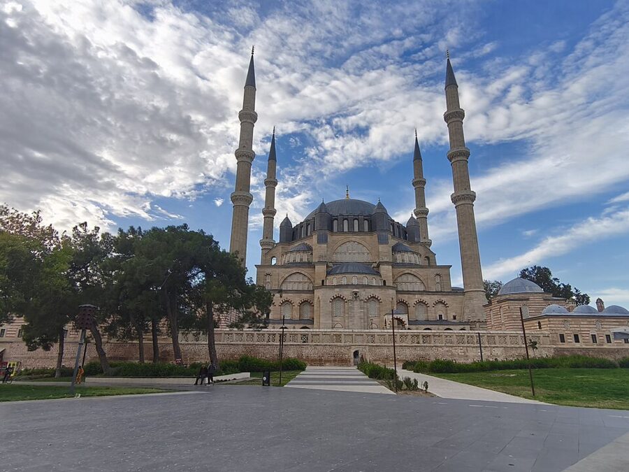
Edirne is the big one. It was the Ottoman capital before Istanbul, sits by the Bulgarian and Greek borders in the far northwest of Turkey, and holds the finest building the Ottomans ever made: the Selimiye Mosque, which Mimar Sinan himself called his masterpiece. It is also three hours away, which makes it a long day trip, and the only one here that costs real money to reach.

Getting there: bus or the new train
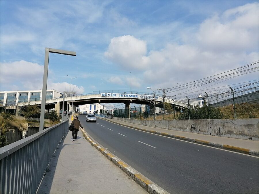
By bus. Intercity coaches leave from the Esenler otogar (Büyük İstanbul Otogarı) and the Alibeyköy terminal all day; in November 2026 the main ticket sites listed more than 200 departures a day, with fares from 400 TL to about 600 TL one way and an average ride of just over three hours. Pamukkale Turizm runs the most departures, and Metro Turizm also sells the route on its own site. Coaches arrive at the Edirne otogar outside the center, a city bus or taxi ride from the Selimiye.

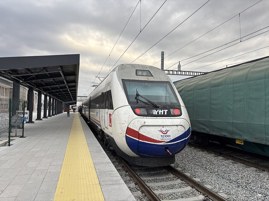
By train. On 9 October 2026 the 153 km Çerkezköy–Kapıkule section of the new Halkalı–Kapıkule high-speed line opened, and from 10 October fast trains have covered Çerkezköy to Edirne in 54 minutes, three times a day each way. The Istanbul end of the line (Halkalı to Çerkezköy) is still being built, so for now you reach Çerkezköy on the old line and change. TCDD Taşımacılık runs two regional trains a day each way between Halkalı and Uzunköprü, timed to connect with the fast trains.

| Edirne by train, autumn 2026 | Departs | Arrives |
|---|---|---|
| Regional train Halkalı–Uzunköprü, change at Çerkezköy | Halkalı 08:25 | Çerkezköy, in time for the 10:45 |
| Fast train Çerkezköy–Edirne | Çerkezköy 10:45 | Edirne 11:38 |
| Fast train Edirne–Çerkezköy | Edirne 17:45 | Çerkezköy 18:39 |
| Regional train from Uzunköprü, change at Çerkezköy | Çerkezköy, connecting | Halkalı around 21:00 |
That gives you about six hours in Edirne. The other fast trains leave Çerkezköy at 15:00 and 19:30 and Edirne at 09:00 and 13:00, and stop at Büyükkarıştıran, Lüleburgaz and Babaeski. The fast-train leg launched at 310 TL one way; buy the through ticket on TCDD’s e-bilet site or app, or at a station counter, and check the connecting time there, because the regional timetable is the part most likely to shift. Reach Halkalı on the Marmaray, and allow for it: the regional train will not wait.
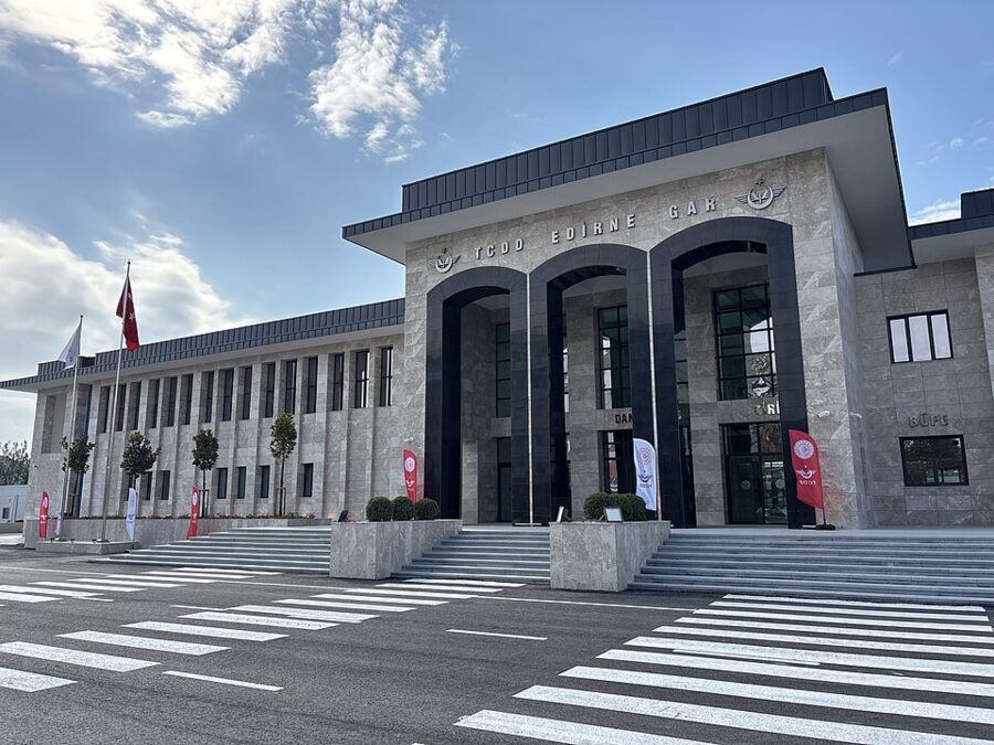
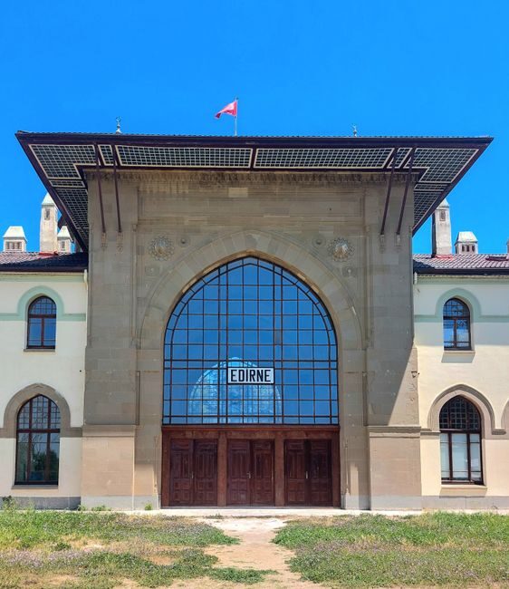
Edirne station is on the southeastern side of the city, rebuilt for the new line. From there a city bus or taxi takes you to the center; the Selimiye is the dome you can see from everywhere.

The Selimiye Mosque
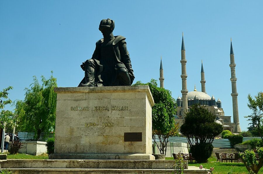
Selim II, son of Süleyman the Magnificent, chose Edirne rather than Istanbul for his imperial mosque, and Sinan built it between 1568 and 1575, paid for in part with the sultan’s share of the spoils of the conquest of Cyprus. Selim died in December 1574 and never saw it finished. Sinan regarded it as his best work, and the Selimiye and its complex were added to UNESCO’s World Heritage List in 2011.
The point of the building is the dome. Sinan set it on eight pillars so that almost the whole prayer hall sits under one open space, and his biographers praised it for matching the diameter of the Hagia Sophia’s dome while rising slightly higher, the first time an Ottoman architect had managed it. Stand in the middle of the carpet and look up before you look at anything else.

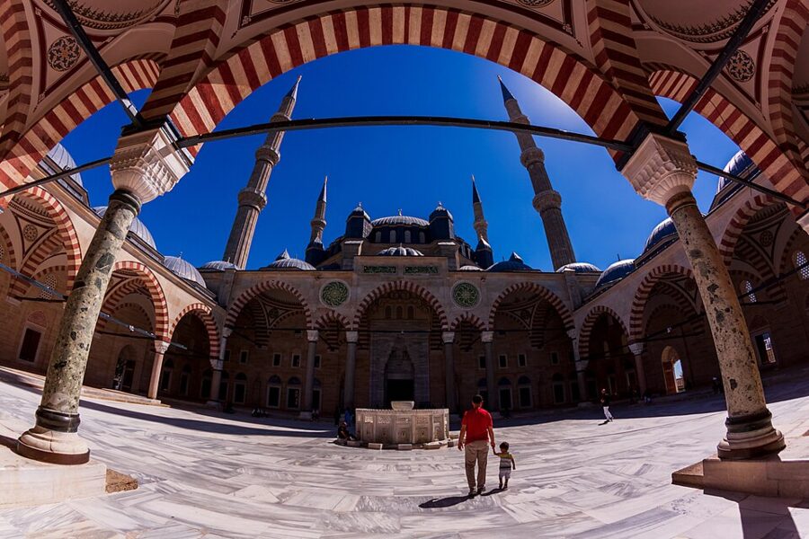

The mosque spent four years under a full restoration by the Directorate of Foundations (Vakıflar), described at the reopening as the most extensive in its 450 years, and it reopened for worship and visitors in 2026, with the official ceremony on 12 June. Entry is free. Like every working mosque, it closes to visitors during the five daily prayers and for longer around the Friday noon prayer, so check the day’s prayer times and arrive between them. Dress for a mosque: shoulders and knees covered, hair covered for women, shoes off at the entrance.
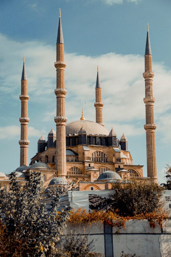
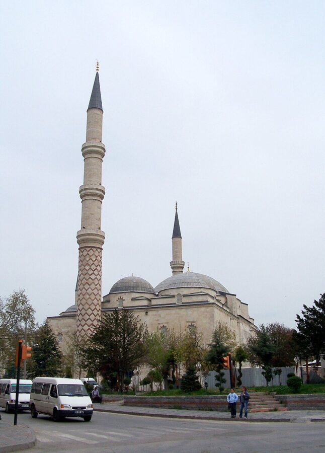
The Old Mosque and Üç Şerefeli
Two earlier mosques stand a few minutes’ walk downhill, and together they show you the century of experiments that led to the Selimiye. The Eski Cami (Old Mosque) was begun by Emir Süleyman and finished in the early 15th century under his brother, Mehmed I. It is a square hall under nine domes on four piers, with enormous calligraphy painted across its walls; the taller of its two minarets was added later by Murad II.
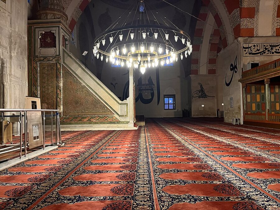

The Üç Şerefeli Mosque was built for Murad II between 1438 and 1447 and was first called the New Mosque, to set it apart from the Old one. Its name means “three balconies”, after the tallest of its four minarets, and its plan, a courtyard with a domed arcade in front of a prayer hall under a wide central dome, is the first step toward Istanbul’s great imperial mosques. A fire in 1732 and an earthquake in 1752 damaged it badly, and much of what you see was rebuilt under Mahmud I.
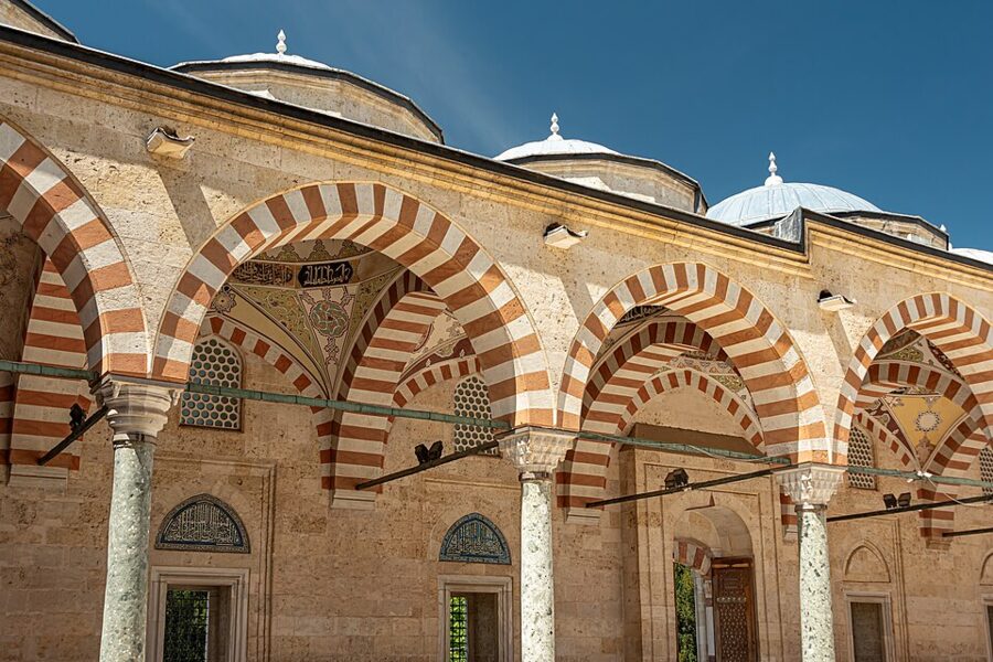


The Bayezid II complex and its Health Museum
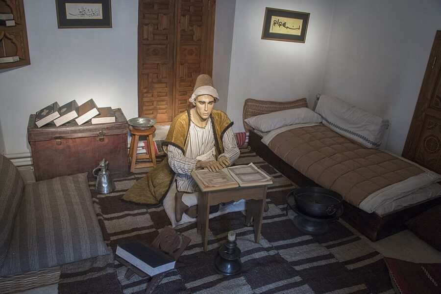
Across the Tunca river, northwest of the center, stands the complex of Sultan Bayezid II, built in 1488 by the architect Hayreddin: a mosque, a medical school, a soup kitchen and a hospital (darüşşifa). The hospital ran for four centuries, until the Russo-Turkish War of 1877–78, and became known for treating mental illness with music, the sound of running water and scents. Since 1997 Trakya University has run it as the Sultan Bayezid II Complex Health Museum, and the complex is on Turkey’s tentative list for UNESCO.
It drew 180,242 visitors between January and October 2026, and the tableaux of students, doctors and patients in the old rooms are better than they sound. The museum is open every day and charges its own admission as a university museum, so check the price at the desk; in summer 2026 it also opened late on Thursday, Friday and Saturday nights. The walk from the Selimiye takes 20–30 minutes, across the Tunca.

Karaağaç, the Great Synagogue and the bridges
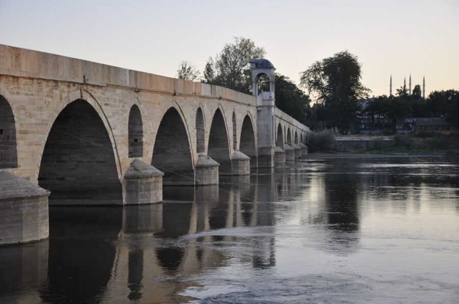
Karaağaç is a neighborhood about 4 km southwest of the center, across the Meriç (Maritsa) river and right on the Greek border. Greece held it from 1920 to 1923, and when the Treaty of Lausanne drew the new border along the river, this small piece on the far bank stayed Turkish. Its grand old railway station, abandoned in 1971 when a new station was built on the other side of the river, now belongs to Trakya University, and the Treaty of Lausanne Monument and Museum opened beside it in 1998.
The walk out to Karaağaç is the best part. You cross the Tunca and then the long stone bridge over the Meriç, and in late afternoon the light on the water is worth timing your day around. Allow about an hour each way on foot, or take a city bus or taxi out and walk back.
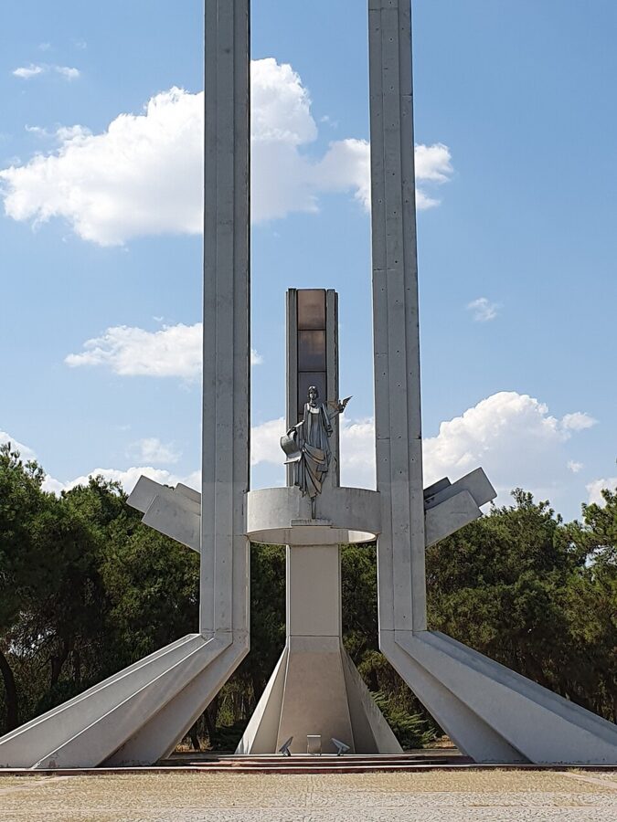
Back in the center, the restored Great Synagogue of Edirne is worth fitting in between the mosques if it is open on your day.
Eating, and staying the night
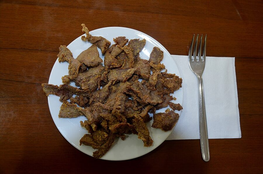
Edirne’s dish is ciğer tava: liver sliced thin, coated and deep-fried until crisp, served with fried dried chili peppers and onion. The ciğerci restaurants around the center serve little else, and a plate with bread and ayran makes a full lunch. Budget around what an Istanbul lokanta charges, roughly 250–400 TL in late 2026.

If you can spare the night, take it. Edirne after the day buses leave is a different town, the evening walk to the Meriç bridges is the best hour of the trip, and the morning gives you time for the Health Museum without watching the clock. On the train, the 09:00 fast train from Edirne connects for an easy return; on the bus, any morning coach does.
Water parks
Istanbul’s water parks are a family outing rather than a backpacker one: tickets are priced for parents with children, and a day of slides costs more than a day on the Black Sea. For water and waves on a budget, take the 151 to Kilyos.
Further out: Bursa, the Princes’ Islands, Gallipoli and Troy
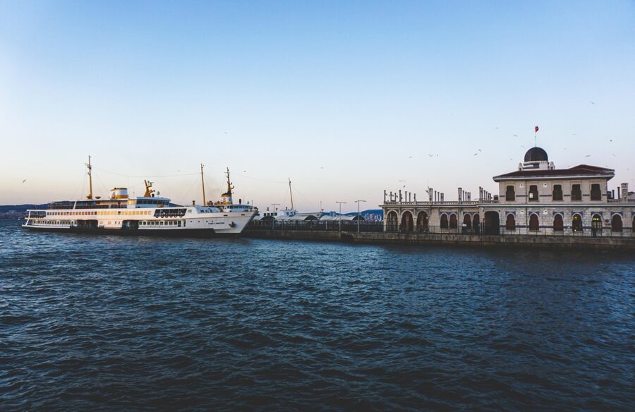
The Princes’ Islands. The car-free islands in the Sea of Marmara are the easiest escape of all, a city ferry ride away from Kabataş or Bostancı. The Bostancı–Adalar boat costs 171.89 TL on the Istanbulkart on the July 2026 tariff.
Bursa. The first Ottoman capital, with its green-tiled tombs, silk market and the cable car up Uludağ, can be done in a long day from Istanbul, but it rewards a night far more than Edirne does.
Gallipoli and Troy. Both sit on the Dardanelles near Çanakkale, a long bus ride southwest of Istanbul, and day tours that try to do them from Istanbul spend most of the day on the road. Treat them as an overnight trip based in Çanakkale, with a night either side if you want both.
What each day costs
These totals assume a full Istanbulkart fare from central Istanbul, a packed breakfast and one cheap meal out. Food is the variable: a simit, the cheapest breakfast in Istanbul street food, cost 30 TL from a city cart after the September 2026 increase, and a lokanta lunch with a stew and bread runs about 250–400 TL. Bring a refillable bottle and buy bread and fruit before you leave.
| Day trip | Transport, return (2026) | With a cheap lunch |
|---|---|---|
| Kilyos | 161.20 TL | About 450–550 TL, plus beach club entry if you want a sunbed |
| Belgrade Forest | 161.20 TL | About 300 TL with a picnic |
| Rumeli Feneri | 161.20 TL | About 450–550 TL with a lokanta lunch; a fish restaurant costs far more |
| Anadolu Kavağı by bus and ferry | From about 161 TL by bus via Kavacık | About 450–600 TL with a snack lunch on the quay |
| Şile | About 475 TL | About 750–900 TL |
| Ağva | About 657 TL | About 900–1,100 TL |
| Polonezköy | About 160 TL plus a taxi of roughly 800 TL each way | About 2,000 TL alone, about 850 TL each in a group of four |
| Edirne by bus | 800–1,200 TL plus the metro to the otogar | About 1,300–1,700 TL |
For the long trips, the cheapest saving is not a cheaper bus but an earlier one. An early 139A from Üsküdar, the 07:30 or the 09:00, puts you in Şile with the beach still empty; the 08:25 regional train from Halkalı gets you to the Selimiye before the noon prayer. Load the card the night before, check İETT’s timetable for your line, and be at the stop ten minutes early, because the coast buses leave on time and the next one is often an hour away.